Click to visit the main New York Public Library Homepage
The New York Public Library
Digital Collections
About Digital Collections
Browse
Search only public domain materials
Items
Collections
Divisions
Home
Search
Browse
About
Search only public domain materials
Items
Collections
Divisions
Digital Collections
Using Images
Using Data
Search
Filtered keyword search
Show filters
Hide filters
Show Only Public Domain
topic
x
Administrative and political divisions
Railroads
244
Real property
103
Landowners
96
Roads
56
More
Less
name
United States. General Land Office
52
G.W. & C.B. Colton & Co
43
Rand McNally and Company
41
Roeser, C. (Charles)
26
Bien, Julius, 1826-1909
25
More
Less
collection
Maps of North America
561
Maps of New York City and State
334
Lawrence H. Slaughter Collection of English maps, charts, globes, books and atlases
6
Maps of Asia
4
I. N. Phelps Stokes Collection of American Historical Prints
1
More
Less
place
New York (State)
294
New York (N.Y.)
119
Manhattan (New York, N.Y.)
88
Massachusetts
81
New York
68
More
Less
genre
Maps
907
Cadastral maps
72
Road maps
17
Topographic maps
7
Manuscript maps
6
More
Less
publisher
publisher not identified
51
G.W. & C.B. Colton & Co
26
General Land Office
24
Department of the Interior, General Land Office
20
S. Augustus Mitchell
19
More
Less
division
Map Division
905
Manuscripts and Archives Division
1
Wallach Division: Print Collection
1
type
cartographic
906
still image
16
text
16
Date Range
to
907 results found for:
x
New York Maps
Filtering on:
x
Topic
: Administrative and political divisions
Sort by:
Relevance
Title
Date created
Date digitized
Sequence
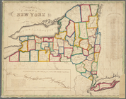
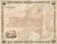
Map
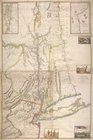
of the province of
New
York
as divided
use:
… partner (e.g.,
New
York
City of
New
-
York
use:
… partner (e.g.,
New
York
Map
of the city of
New
York
use:
… partner (e.g.,
New
York
Map
of the city of
New
York
use:
… partner (e.g.,
New
York
City of
New
York
use:
… partner (e.g.,
New
York
Map
of the city of
New
York
use:
… partner (e.g.,
New
York
New
map
of the city of
New
York
with part
use:
… partner (e.g.,
New
York
Map
of the state of
New
York
: compiled
use:
… partner (e.g.,
New
York
New
map
of the city of
New
York
: with part
use:
… partner (e.g.,
New
York
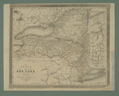
The state of
New
York
from the most
use:
… partner (e.g.,
New
York
Distance
map
of the state of
New
York
use:
… partner (e.g.,
New
York
Map
of the state of
New
York
: compiled
use:
… partner (e.g.,
New
York
Map
of the state of
New
York
use:
… partner (e.g.,
New
York
New
-
York
use:
… partner (e.g.,
New
York
New
York
use:
… partner (e.g.,
New
York
Province de
New
-
York
: en 4 feuilles
use:
… partner (e.g.,
New
York
Map
of the state of
New
York
: showing
use:
… partner (e.g.,
New
York
New
-
York
use:
… partner (e.g.,
New
York
… of the provinces of
New
-
York
and
New
Jersey
use:
… partner (e.g.,
New
York
m
… of the city of
New
York
…
use:
… partner (e.g.,
New
York
Plan of the city of
New
-
York
use:
… partner (e.g.,
New
York
Map
of the state of
New
York
: showing
use:
… partner (e.g.,
New
York
Map
of the state of
New
York
: compiled
use:
… partner (e.g.,
New
York
Map
of the State of
New
York
use:
… partner (e.g.,
New
York
Hayward's
map
use:
… partner (e.g.,
New
York
Map
of the State of
New
York
use:
… partner (e.g.,
New
York
Neueste Karte von
New
York
: mit seinen
use:
… partner (e.g.,
New
York
Map
of the State of
New
York
use:
… partner (e.g.,
New
York
Map
of the State of
New
York
use:
… partner (e.g.,
New
York
… of the city of
New
York
…
use:
… partner (e.g.,
New
York
Map
of Connecticut
use:
… partner (e.g.,
New
York
State of
New
York
use:
… partner (e.g.,
New
York
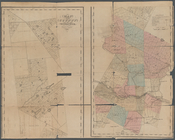
Map
of the county of Herkimer
use:
… partner (e.g.,
New
York
New
Jersey
use:
… partner (e.g.,
New
York
Map
of the state of
New
York
: showing
use:
… partner (e.g.,
New
York
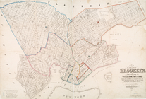
Map
of the city of Brooklyn, and village
use:
… partner (e.g.,
New
York
m
Map
of the state of
New
-
York
: with parts
use:
… partner (e.g.,
New
York
The provinces of
New
York
, and
New
use:
… partner (e.g.,
New
York
A mapp of ye improved part of…
use:
… partner (e.g.,
New
York
State of
New
York
divided into senatorial
use:
… partner (e.g.,
New
York
Map
of Berkshire County
use:
… partner (e.g.,
New
York
Map
of the state of
New
York
: showing
use:
… partner (e.g.,
New
York
Hooker's
new
pocket plan of the city of
New
use:
… partner (e.g.,
New
York
Map
of the state of
New
York
use:
… partner (e.g.,
New
York
A
map
of the State of
New
York
use:
… partner (e.g.,
New
York
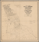
Map
of the city of Yonkers, First Ward
use:
… partner (e.g.,
New
York
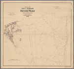
Map
of the city of Yonkers, Second Ward
use:
… partner (e.g.,
New
York
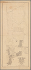
Map
of the city of Yonkers, Third Ward
use:
… partner (e.g.,
New
York
Nell's topographical
map
of the state
use:
… partner (e.g.,
New
York
Plan showing land owned by th…
use:
… partner (e.g.,
New
York
1
2
3
4
Previous
Next
1
2
3
4
Previous
Next