Click to visit the main New York Public Library Homepage
The New York Public Library
Digital Collections
About Digital Collections
Browse
Search only public domain materials
Items
Collections
Divisions
Home
Search
Browse
About
Search only public domain materials
Items
Collections
Divisions
Digital Collections
Using Images
Using Data
Search
Filtered keyword search
Show filters
Hide filters
Show Only Public Domain
topic
x
Boundaries
History
7
Territorial questions
2
New York (State)
1
name
Barclay, Anthony, 1792-1877
7
Porter, Peter B. (Peter Buell), 1773-1844
7
United States. Light-House Board
7
Bird, William A., 1796-1878
5
Thompson, David, 1770-1857
5
More
Less
collection
Maps of North America
6
Maps of New York City and State
2
Lawrence H. Slaughter Collection of English maps, charts, globes, books and atlases
1
place
United States
8
Canada
7
Niagara River (N.Y. and Ont.)
2
Detroit River (Mich. and Ont.)
1
Grand Island (N.Y. : Island)
1
More
Less
genre
Maps
9
Charts
1
Diagrams
1
publisher
U.S. Light-House Board
7
U.S. Army Corps of Topographical Engineers
1
division
Map Division
9
type
cartographic
9
still image
1
Date Range
to
9 results found for:
x
Charts
Filtering on:
x
Topic
: Boundaries
Sort by:
Relevance
Title
Date created
Date digitized
Sequence
The State of New Jersey.
collection:
Charts
and maps
m
Niagara 1819
note:
…"Photolithographed from original
charts
The second section of the sur…
note:
…"Photolithographed from original
charts
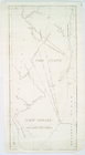
Lake St. Clair
note:
…"Photolithographed from original
charts
Barometric profile of the rou…
abstract:
Subject: Profile
chart
showing the height
Detroit 1820
note:
…"Photolithographed from original
charts
m
Map of the St. Clair River : …
note:
…"Photolithographed from original
charts
No. 3, map of Isle Royale in …
note:
…"Photolithographed from original
charts
m
Map of the river Sainte Mary …
abstract:
…
charts
by permission