Click to visit the main New York Public Library Homepage
The New York Public Library
Digital Collections
About Digital Collections
Browse
Search only public domain materials
Items
Collections
Divisions
Home
Search
Browse
About
Search only public domain materials
Items
Collections
Divisions
Digital Collections
Using Images
Using Data
Search
Filtered search
Show filters
Hide filters
Show Only Public Domain
topic
x
Landowners
Real property
21
Cities and towns
7
Administrative and political divisions
5
Buildings
5
More
Less
name
Walling, Henry Francis, 1825-1888
5
H.F. Walling's Map Establishment
4
Lee & Marsh
3
Smith, Robert Pearsall, 1827-1898
3
Beers, D. G. (Daniel G.)
2
More
Less
collection
Maps of North America
19
Maps of New York City and State
5
place
New York (State)
5
Ohio
5
Maine
4
Clinton County
2
Iowa
2
More
Less
genre
Maps
24
Cadastral maps
18
Illustrations
11
Pictorial works
4
Aerial views
2
More
Less
publisher
Lee & Marsh
3
publisher not identified
2
A. Pomeroy
1
A.R.Z. Dawson
1
Benj. R. Boggs
1
More
Less
division
Map Division
24
type
x
cartographic
still image
24
Date Range
to
24 results found
Filtering on:
x
Topic
: Landowners
x
Type
: cartographic
x
Type
: still image
Sort by:
Title
Date created
Date digitized
Sequence
m
Topographical map of the coun…
m
Map of Clinton Co., New York:…
A map of Philadelphia and par…
m
City of Toledo, Lucas Co., Oh…
Hyde Park : [Chicago, Illinoi…
m
Map of Dutchess Co., New York…
m
Map of Multnomah County, Oreg…
m
Map number sixteen : [Berkele…
Map of Clinton County, Ohio
m
Map of Columbiana County, Ohi…
m
Map of Trumbull County, Ohio
Map of Perry County, Ohio
Map of the city of Davenport …
Allen's outline map of Ottumw…
m
Map of Clearfield Co., Pennsy…
Map of the State of Georgia
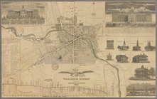
Map of the village of Auburn
Map of Bennington County, Ver…
Map of Waldo County, Maine: f…
m
A topographical map of Lincol…
m
Map of the county of Berkshir…
Town & village of Ovid, Senec…
m
A topographical map of Lincol…
m
Map of Ontario County, New Yo…
End of results
|
Top