Click to visit the main New York Public Library Homepage
The New York Public Library
Digital Collections
About Digital Collections
Browse
Search only public domain materials
Items
Collections
Divisions
Home
Search
Browse
About
Search only public domain materials
Items
Collections
Divisions
Digital Collections
Using Images
Using Data
Search
Filtered keyword search
Show filters
Hide filters
Show Only Public Domain
topic
x
Nautical charts
Harbors
30
Coasts
25
Navigation
25
Rivers
7
More
Less
name
Bache, A. D. (Alexander Dallas), 1806-1867
170
United States Coast Survey
167
Mathiot, G
44
Maffitt, John Newland, 1819-1886
24
Boutelle, C. O. (Charles Otis)
21
More
Less
collection
Maps of North America
161
Maps of New York City and State
9
place
Massachusetts
22
Virginia
20
Florida
19
California
17
Atlantic Ocean
16
More
Less
genre
Maps
170
Nautical charts
146
Bathymetric maps
73
Illustrations
2
Pictorial works
1
More
Less
publisher
U.S. Coast Survey
75
U.S. Coast Survey Office
47
United States Coast Survey
17
Coast Survey Office
5
The Survey
5
More
Less
division
Map Division
170
type
cartographic
170
still image
4
text
1
Date Range
to
170 results found for:
x
Bache, A. D. (Alexander Dallas)
Filtering on:
x
Topic
: Nautical charts
Sort by:
Relevance
Title
Date created
Date digitized
Sequence
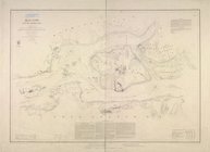
Hell Gate and its approaches
parent:
0716ab20-c5ab-012f-5229-58
d
385
a
7bc34
Preliminary chart of Hampton …
parent:
6de804b0-6e42-0135-9363-03359af58
a
86
Approximate cotidal lines of …
parent:
7fd9ef50-8bcf-0133-cd18-00505686
d
14e
Atlantic Coast, Chesapeake en…
parent:
52
a
622
d
0-b144-0132-78c9-58
d
385
a
7bbd0
Reconnaissance of the entranc…
parent:
3b2ec720-b143-0132-959c-58
d
385
a
7bbd0
Preliminary chart of the sea …
parent:
0b61aca0-
d
632-0132-f6cd-58
d
385
a
7b928
Sketch F, no. 6, showing the …
parent:
32958040-b143-0132-2eae-58
d
385
a
7bbd0
Reconnaissance of Hatteras In…
parent:
52
a
622
d
0-b144-0132-78c9-58
d
385
a
7bbd0
Ocilla River, Florida
parent:
32958040-b143-0132-2eae-58
d
385
a
7bbd0
Preliminary chart of Kennebec…
parent:
1de59
d
40-
a
2c8-0134-478f-00505686
a
51c
Sketch of Ocracoke Inlet, Nor…
parent:
52
a
622
d
0-b144-0132-78c9-58
d
385
a
7bbd0
Preliminary chart of Frying P…
parent:
52
a
622
d
0-b144-0132-78c9-58
d
385
a
7bbd0
Reconnaissance of Doboy Bar a…
parent:
3b2ec720-b143-0132-959c-58
d
385
a
7bbd0
Harbor of Pass Christian, Mis…
parent:
5fbc9c00-2e99-0135-9
a
59-0
d
9c07195736
Reconnoissance of Cape Canave…
parent:
32958040-b143-0132-2eae-58
d
385
a
7bbd0
Reconnoissance of the entranc…
parent:
5ee37b20-68b6-0135-
a
6bc-55653da6e8c6
Hydrographic reconnaissance o…
parent:
bbd95190-68ac-0135-720c-29
a
548262744
Reconnaissance of the bar and…
parent:
32958040-b143-0132-2eae-58
d
385
a
7bbd0
Preliminary chart of Plymouth…
parent:
13180400-6bc6-0134-
d
489-00505686
a
51c
Reconnaissance of Coffin's Pa…
parent:
32958040-b143-0132-2eae-58
d
385
a
7bbd0
Preliminary reconnaissance of…
parent:
b67948e0-22dd-0135-81ef-1b6
d
98e6e891
Map of comparison of Maffitt'…
parent:
b5897740-b144-0132-f312-58
d
385
a
7bbd0
Preliminary chart of Hatteras…
parent:
52
a
622
d
0-b144-0132-78c9-58
d
385
a
7bbd0
Reconnaissance of the eastern…
parent:
acea7850-b143-0132-c36f-58
d
385
a
7bbd0
Preliminary chart of the sea …
parent:
a
9e10440-7c69-0135-322
d
-275c13
d
6
a
8ee
Sketch of Frying-Pan Shoals a…
parent:
52
a
622
d
0-b144-0132-78c9-58
d
385
a
7bbd0
Preliminary sketch of Cherrys…
parent:
ed6e6b40-68
a
7-0135-1277-69f43
d
42b3b1
Preliminary reconnaissance of…
parent:
5cb68050-2382-0135-c40c-0ebf6
d
199390
Preliminary survey of Turtle …
parent:
32958040-b143-0132-2eae-58
d
385
a
7bbd0
St. Helena Sound, South Carol…
parent:
b5897740-b144-0132-f312-58
d
385
a
7bbd0
Horn Island Pass, Mississippi…
parent:
db28
d
080-b143-0132-f52
a
-58
d
385
a
7bbd0
Reconnaissance of Tampa Bay, …
parent:
32958040-b143-0132-2eae-58
d
385
a
7bbd0
Savannah River, reconnaissanc…
parent:
3b2ec720-b143-0132-959c-58
d
385
a
7bbd0
Preliminary chart of St. Mark…
parent:
32958040-b143-0132-2eae-58
d
385
a
7bbd0
York River and Cape Neddick h…
parent:
39e9
d
6b0-
a
2c5-0134-43
a
4-00505686
a
51c
Preliminary chart of St. John…
parent:
047e6220-16ed-0135-265
d
-4bd3799b649
a
Lynn Harbor, Massachusetts 18…
parent:
bac116
a
0-b143-0132-83cb-58
d
385
a
7bbd0
Preliminary chart of Calibogu…
parent:
b5897740-b144-0132-f312-58
d
385
a
7bbd0
Preliminary chart of Mount Ho…
parent:
90c6
a
5c0-b144-0132-
d
3e3-58
d
385
a
7bbd0
Preliminary sketch of Galvest…
parent:
69f704b0-e818-0135-2efe-39fb3
d
86bc8
a
Metomkin Inlet, Virginia : fr…
parent:
87229fd0-c52b-012f-390
d
-3c075448cc4b
Preliminary chart of Stellwag…
parent:
bac116
a
0-b143-0132-83cb-58
d
385
a
7bbd0
Norfolk harbor, Virginia : fr…
parent:
87229fd0-c52b-012f-390
d
-3c075448cc4b
Stono Inlet, South Carolina
parent:
b5897740-b144-0132-f312-58
d
385
a
7bbd0
m
Preliminary chart of Port Roy…
parent:
b5897740-b144-0132-f312-58
d
385
a
7bbd0
Preliminary Chart of entrance…
parent:
8517b870-b144-0132-5074-58
d
385
a
7bbd0
Preliminary chart of Bull's B…
parent:
b5897740-b144-0132-f312-58
d
385
a
7bbd0
Reconnaissance of Doboy Bar a…
parent:
3dc01150-01e2-0135-7707-01
d
46
a
94db77
Reconnaissance of Romerly Mar…
parent:
3b2ec720-b143-0132-959c-58
d
385
a
7bbd0
Reconnaissance of entrance & …
parent:
8517b870-b144-0132-5074-58
d
385
a
7bbd0