Click to visit the main New York Public Library Homepage
The New York Public Library
Digital Collections
About Digital Collections
Browse
Search only public domain materials
Items
Collections
Divisions
Home
Search
Browse
About
Search only public domain materials
Items
Collections
Divisions
Digital Collections
Using Images
Using Data
Search
Filtered keyword search
Show filters
Hide filters
Show Only Public Domain
topic
x
Real property
Business enterprises
190
Landowners
16
Administrative and political divisions
5
Buildings
4
More
Less
name
Beers, S. N
116
Beers, D. G. (Daniel G.)
111
Stone & Stewart
102
Wm. Stewart, Publisher
47
Stone, C. K
46
More
Less
collection
Atlases of the United States
285
Maps of North America
16
Maps of New York City and State
13
Atlases of New York City
1
Collection of property maps of parts of Westchester County, N.Y. : covering mostly Eastchester, Mount Vernon, and Yonkers
1
place
New York (State)
299
Chautauqua County
47
Chautauqua County (N.Y.)
47
Saint Lawrence County
47
Saint Lawrence County (N.Y.)
47
More
Less
genre
Atlases
285
Maps
267
Cadastral maps
17
Prints
15
Topographic maps
8
More
Less
publisher
Stone & Stewart
69
C. K. Stone
46
C.K. Stone
42
Lee & Marsh
3
M. Dripps
3
More
Less
division
Map Division
316
type
cartographic
282
text
37
still image
4
Date Range
to
316 results found for:
x
Topographic maps
Filtering on:
x
Topic
: Real property
Sort by:
Relevance
Title
Date created
Date digitized
Sequence
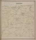
Topographical
map
of Seneca County, N.Y.
note:
Mapping
the Nation (NEH grant, 2015-2018)…
Topographical
map
of the District of Columbia
note:
Partial cadastral
map
showing landowners
General plan for the town of …
note:
Topographical
map
by Geo. R. Mackenzie
m
Topographical
map
of the District of Columbia
note:
Mapping
the Nation (NEH grant, 2015-2018)…
A
topographical
map
of Lewis Co., New York
note:
Cadastral
map
showing property owners
Topographical
map
of the coal and iron ore lands
note:
… catalog of the
Map
Lloyd's
map
of the Great Oil Region
note:
Specially surveyed for this
map
by B.M. Hanks, A.M
Lloyd's
map
of the Great Oil Region
note:
Specially surveyed for this
map
by our own
Map
of the Marine Hospital ground, Staten
note:
… to Early
Maps
of the Middle
Topographical
map
of the northern section
note:
… to Early
Maps
of the Middle
Rye Park: [New York]
note:
B.S. Olmstead,
topographical
engineer, Rye, N.Y
m
Castle Ridge, Tarrytown, West…
note:
Egbert L. Viele, civil and
topographical
m
Property identification
map
of Inwood Hill
note:
Blueprint of
map
, indicating property owners
m
Topographical
map
of New York City, County
note:
Cadastral
map
. Covers the area south
Harbor of Manitowoc, Wis. : t…
note:
Differ from similar
map
in the in location
m
Map
of the Cedar Knolls, at Bronxville
note:
Topographical
map
of Cedar Knolls. Shows
m
A
topographical
map
of Lincoln Co. Maine
note:
NYPL
Map
Div. dissected and incomplete: 2
Flushing
note:
… catalog of the
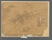
Map
Jamaica
note:
NYPL
Map
Div. copy has accession no
m
A
topographical
map
of Lincoln Co. Maine
note:
NYPL
Map
Div. copy
m
Topographical
map
of the County of Winnebago
note:
… at H.F. Walling's
Map
Harbor of Manitowoc, Wis. : t…
note:
… and carto-bibliography of
maps
, entry 748
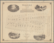
Shonnard Park at Yonkers, est…
note:
Designed from a
topographical
survey by Egbert L
A
topographical
map
of Steuben Co., New York
note:
Mapping
the Nation (NEH grant, 2015-2018)…
m
Topographical
map
of New York City, county
note:
Cadastral
map
covering area south of 155
Map
of the city of Washington, District
note:
… and
topographical
engineer
Mayville [Village]; Mayville …
collection:
New
topographical
atlas of Chautauqua
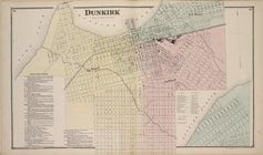
Dunkirk [Village]; Dunkirk Bu…
collection:
New
topographical
atlas of Chautauqua
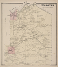
Hanover [Township]
collection:
New
topographical
atlas of Chautauqua
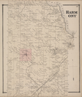
Harmony [Township]
collection:
New
topographical
atlas of Chautauqua
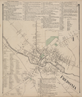
Fredonia business Directory; …
collection:
New
topographical
atlas of Chautauqua
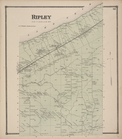
Ripley [Township]
collection:
New
topographical
atlas of Chautauqua
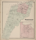
Westfield [Township]; Barcelo…
collection:
New
topographical
atlas of Chautauqua
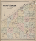
Map
of Chautauqua County
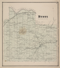
Busti [Township]
collection:
New
topographical
atlas of Chautauqua
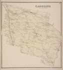
Caroline [Township]
collection:
New
topographical
atlas of Tompkins County
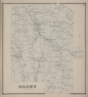
Danby [Township]
collection:
New
topographical
atlas of Tompkins County
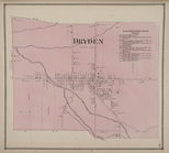
Dryden Township Business Dire…
collection:
New
topographical
atlas of Tompkins County
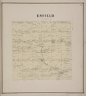
Enfield [Township]
collection:
New
topographical
atlas of Tompkins County
La Fayette Business Directory…
collection:
New
topographical
atlas of Tompkins County
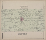
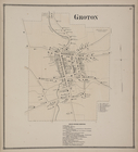
Groton [Village]; Groton Busi…
collection:
New
topographical
atlas of Tompkins County
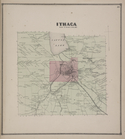
Ithaca [Township]
collection:
New
topographical
atlas of Tompkins County
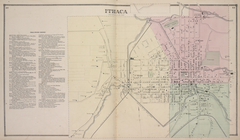
Ithaca Business Directory; It…
collection:
New
topographical
atlas of Tompkins County
Newfield [Township]
collection:
New
topographical
atlas of Tompkins County
Ulysses [Township]
collection:
New
topographical
atlas of Tompkins County
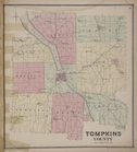
Tompkins County
collection:
New
topographical
atlas of Tompkins County
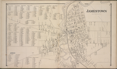
Jamestown Business Directory …
collection:
New
topographical
atlas of Chautauqua
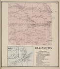
Delanti [Village]; Ellington …
collection:
New
topographical
atlas of Chautauqua
Ashville [Village]; Ashville …
collection:
New
topographical
atlas of Chautauqua
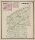
Sheridan [Village]; Sheridan …
collection:
New
topographical
atlas of Chautauqua
1
2
Previous
Next
1
2
Previous
Next