Click to visit the main New York Public Library Homepage
The New York Public Library
Digital Collections
About Digital Collections
Browse
Search only public domain materials
Items
Collections
Divisions
Home
Search
Browse
About
Search only public domain materials
Items
Collections
Divisions
Digital Collections
Using Images
Using Data
Search
Filtered keyword search
Show filters
Hide filters
Show Only Public Domain
topic
x
Real property
Landowners
7
Cities and towns
4
Administrative and political divisions
1
Canals
1
More
Less
name
H.F. Walling's Map Establishment
2
Walling, Henry Francis, 1825-1888
2
Browne, P. J
1
Canfield, J. W
1
Carhart, Mead & Co
1
More
Less
collection
Maps of North America
16
Atlases of the United States
1
place
Ohio
10
Cleveland
2
Cleveland (Ohio)
2
Toledo
2
Toledo (Ohio)
2
More
Less
genre
Maps
17
Cadastral maps
12
Illustrations
6
Atlases
1
publisher
publisher not identified
5
Ahaz Merchant
1
Carhart, Mead, & Co
1
For the Potomac Manufacturing Company?
1
G.M. Hopkins
1
More
Less
division
Map Division
17
type
cartographic
17
still image
6
Date Range
to
17 results found for:
x
ohio map
Filtering on:
x
Topic
: Real property
Sort by:
Relevance
Title
Date created
Date digitized
Sequence
m
Map
of Mahoning County,
Ohio
…
note:
…
maps
, 651
Map
of Port-Lawrence & Vistula, which
note:
… catalog of the
Map
m
Map
of Columbiana County,
Ohio
, 1860 …
note:
… along center of
map
Map
of Perry County,
Ohio
…
note:
…. Walling's
Map
m
Map
of Trumbull County,
Ohio
…
note:
Library of Congress. Land ownership
maps
m
City of Toledo, Lucas Co.,
Ohio
…
note:
… catalog of the
Map
Plan des achats des compagnies de l'
Ohio
et du
note:
NYPL
Map
Div. copy has accession no
The only correct
map
of the city
note:
NYPL
Map
Div. copy imperfect: lacking a piece
Map
of Clinton County,
Ohio
…
note:
NYPL
Map
Div. copy imperfect: brittle
Plan of
Ohio
City
note:
… catalog of the
Map
Map
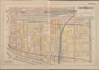
of Cleveland and its environs …
note:
… catalog of the
Map
… Page Plate No. 3 [
Map
City of Covington
note:
Mapping
the Nation (NEH grant, 2015-2018)…
Township no. 74 N. range no.…
note:
… of the printed
maps
of Michigan
Plan of part of Weverton
note:
… to Early
Maps
of the Middle
Trans-Flat-Top Land Association's
map
of Wyoming
note:
Mapping
the Nation (NEH grant, 2015-2018)…
m
The Wyoming Coal Field and it…
note:
… and eastern
Ohio
, and southern
End of results
|
Top