Click to visit the main New York Public Library Homepage
The New York Public Library
Digital Collections
About Digital Collections
Browse
Search only public domain materials
Items
Collections
Divisions
Home
Search
Browse
About
Search only public domain materials
Items
Collections
Divisions
Digital Collections
Using Images
Using Data
Search
Filtered keyword search
Show filters
Hide filters
Show Only Public Domain
topic
x
Real property
Landowners
44
Villages
12
Cities and towns
11
Cities & towns
9
More
Less
name
Smith, Robert Pearsall, 1827-1898
12
Sanborn Map Company
9
Worley & Bracher
6
Bourquin, F. (Frederick), 1808-
5
Chace, J
3
More
Less
collection
Maps of North America
36
Maps of New York City and State
17
Atlases of New York City
12
Atlases of the United States
1
place
Pennsylvania
33
New York (State)
28
Venango County
5
New York (N.Y.)
4
Venango County (Pa.)
4
More
Less
genre
Maps
66
Cadastral maps
39
Topographic maps
4
Charts
2
Manuscript maps
2
More
Less
publisher
Sanborn Map Company
9
publisher not identified
6
A. Pomeroy
2
E. Robinson Co
2
producer not identified
2
More
Less
division
Map Division
66
type
cartographic
66
still image
3
text
1
Date Range
to
66 results found for:
x
pennsylvania map
Filtering on:
x
Topic
: Real property
Sort by:
Relevance
Title
Date created
Date digitized
Sequence
… of Holmes'
map
of the province of
Pennsylvania
note:
NYPL
Map
Div. copy is 1 sheet (2 sheets
Map
of the first and second anthracite coal
note:
… to Early
Maps
of the Middle
Map
of Warren County,
Pennsylvania
note:
Mapping
the Nation (NEH grant, 2015-2018)…
m
Map
of Cambria Co.,
Pennsylvania
…
note:
NYPL
Map
Div. copy in 4 sheets, 71 x 63 cm
m
Map
of the first and second anthracite coal
note:
… to Early
Maps
of the Middle
Topographical
map
of the coal and iron ore lands
note:
… catalog of the
Map
Map
of the oil region, Venango Co., Pa.
note:
Mapping
the Nation (NEH grant, 2015-2018)…
Map
of Venango County,
Pennsylvania
…
note:
NYPL
Map
Div. copy mounted on sheet 71 x 96
m
Map
of Lebanon County,
Pennsylvania
…
note:
Mapping
the Nation (NEH grant, 2015-2018)…
Lloyd's
map
of the Great Oil Region
note:
Specially surveyed for this
map
by our own
…,
Pennsylvania
, January 24, 1865
note:
Mapping
the Nation (NEH grant, 2015-2018)…
m
Map
of Clearfield Co.,
Pennsylvania
…
note:
NYPL
Map
Div. copy in 2 sheets, 67 x 135
Lloyd's
map
of the Great Oil Region
note:
Specially surveyed for this
map
by B.M. Hanks, A.M
Oil lands, Prentice Angell & …
note:
Mapping
the Nation (NEH grant, 2015-2018)…
m
Map
of Fulton Co.,
Pennsylvania
…
note:
Mapping
the Nation (NEH grant, 2015-2018)…
A mapp of ye improved part of…
note:
… to Early
Maps
of the Middle
m
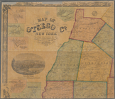
Map
of Otsego Co., New York
note:
County
map
showing cities and townships
m
Map
of Bedford County, Pa. …
note:
Mapping
the Nation (NEH grant, 2015-2018)…
Map
of the Valley Furnace Estate and other
note:
Mapping
the Nation (NEH grant, 2015-2018)…
A plan of the land belonging …
note:
Mapping
the Nation (NEH grant, 2015-2018)…
Map
note:
Mapping
the Nation (NEH grant, 2015-2018
Plan of President Township
note:
… of
Pennsylvania
from actual
Map
of West Hickory Creek, Venango & Warren
note:
Mapping
the Nation (NEH grant, 2015-2018)…
m
The Wyoming Coal Field and it…
note:
NYPL
Map
Div. copy
Map
of revolutionary camp ground
note:
… the Legislature."--Lower margin. [NYPL
Map
Map
of Pittsburgh and its environs …
note:
… catalog of the
Map
Plan of a mineral estate situ…
note:
… on northeastern sheet of
map
m
… of the Freemen of
Pennsylvania
, this
map
of the city
note:
Wheat, J.C.
Maps
and charts published
General plan for the town of …
note:
Topographical
map
by Geo. R. Mackenzie
m
Map
of Somerset County, Pa. …
note:
NYPL
Map
Div. copy in 4 sheets 57 x 59 cm
Lands of the Ogden Mining & M…
note:
Mapping
the Nation (NEH grant, 2015-2018)…
Map
of property of the Blooming-Grove Park
note:
Mapping
the Nation (NEH grant, 2015-2018)…
Map
of the city of Erie …
note:
… catalog of the
Map
Map
of a portion of Point Keweenaw, L.S. …
note:
NYPL
Map
Div. copy
The Cornplanters Reserve, Ven…
note:
… catalog of the
Map
…, Plate No. 9 [
Map
bounded by Fulton St.,
Pennsylvania
…, Plate No. 10 [
Map
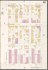
…, Plate No. 41 [
Map
…, Plate No. 42 [
Map
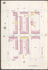
…, Plate No. 59 [
Map
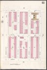
…, Plate No. 60 [
Map
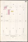
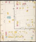
…, Plate No. 68 [
Map
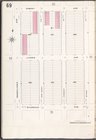
…, Plate No. 69 [
Map
…. 82 [
Map
bounded by
Pennsylvania
Ave., Abbott, bay
Plate 13, Part of Ward 4: [Ma…
… and
Pennsylvania
Avenue. …
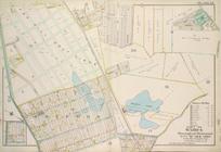
Map
of Chenango County, New York
note:
… of
Pennsylvania
."…
Plate 33, Part of Wards 2 & 3…
m
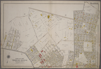
Map
of Washington County, New York
note:
… District of
Pennsylvania
."…
A chorographical
map
of the province
note:
Historical
map