Click to visit the main New York Public Library Homepage
The New York Public Library
Digital Collections
About Digital Collections
Browse
Search only public domain materials
Items
Collections
Divisions
Home
Search
Browse
About
Search only public domain materials
Items
Collections
Divisions
Digital Collections
Using Images
Using Data
Search
Filtered search
Show filters
Hide filters
Show Only Public Domain
topic
x
Nautical charts
Harbors
70
Coasts
60
Navigation
31
Rivers
8
More
Less
name
United States Coast Survey
198
Bache, A. D. (Alexander Dallas), 1806-1867
170
Mathiot, G
47
Alden, James, 1810-1877
31
Maffitt, John Newland, 1819-1886
24
More
Less
collection
Maps of North America
252
Lawrence H. Slaughter Collection of English maps, charts, globes, books and atlases
68
Maps of New York City and State
30
Maps of the Oceans
12
I. N. Phelps Stokes Collection of American Historical Prints
7
More
Less
place
Atlantic Ocean
39
New Jersey
33
New York (N.Y.)
32
Massachusetts
31
Virginia
31
More
Less
genre
Maps
381
Nautical charts
218
Bathymetric maps
100
Prints
10
Illustrations
4
More
Less
publisher
U.S. Coast Survey
95
U.S. Coast Survey Office
51
United States Coast Survey
21
publisher not identified
9
The Survey
6
More
Less
division
Map Division
375
Wallach Division: Print Collection
7
type
cartographic
381
still image
11
text
2
Date Range
to
382 results found
Filtering on:
x
Topic
: Nautical charts
Sort by:
Title
Date created
Date digitized
Sequence
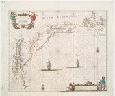
A draught of New York from th…
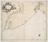
Carte réduite des côtes orien…
Carte particuliere de Virgini…
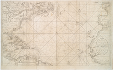
Carte reduite de l'Ocean occi…
Pacific Ocean showing part of…
A new chart of the vast Atlan…
A chart of the English Channe…
Pascaerte van't Eylant St. Ju…
The Atlantic or Western Ocean
The West-India atlas..., [Fro…
m
Sable Island
Nieuwe Werelt kaert
Carta general del Oceano Atla…
Carte réduite de l'Ocean occi…
West-Indische paskaert: waer …
Mar del nort
A new chart of the vast Atlan…
A chart of the Atlantic or We…
Tableau des courants observés…
m
A chart of the Atlantic or We…
Chart of the Atlantic Ocean :…
Carte reduite des mers compri…
A new chart of the vast Atlan…
Carte réduite de l'Ocean occi…
Chart and plan of the harbour…
Pas-kaart vande zee kusten va…
Part of New England New York …
Pascaarte van Nieu Nederlandt…
Americae septentrionalis pars.
Pas caerte van Nieu Nederland…
Paskaerte van de zuydt en Noo…
Nieuwe wassende Graade Zee ka…
The harbor of Annapolis
A chart of the sea coast of N…
Chart of the mouth of Susqueh…
A sketch of the operations of…
A map and chart of those part…
A chart of Delaware Bay and R…
An actual survey of the sea c…
m
A new chart of the coast of A…
Pas caarte van Nieu Nederlandt
Mouth of Chester River : (Har…
m
A new and accurate chart of t…
A new chart of the coast of N…
m
The north eastern coast of No…
Carte réduite des côtes orien…
Little Egg Harbor
Nautical chart of Little Egg …
Chart of the entrance to Ches…
A new and accurate chart (fro…
1
2
Previous
Next
1
2
Previous
Next