Click to visit the main New York Public Library Homepage
The New York Public Library
Digital Collections
About Digital Collections
Browse
Search only public domain materials
Items
Collections
Divisions
Home
Search
Browse
About
Search only public domain materials
Items
Collections
Divisions
Digital Collections
Using Images
Using Data
Search
Filtered search
Show filters
Hide filters
Show Only Public Domain
topic
x
Nautical charts
Harbors
70
Coasts
60
Navigation
31
Rivers
8
More
Less
name
United States Coast Survey
198
Bache, A. D. (Alexander Dallas), 1806-1867
170
Mathiot, G
47
Alden, James, 1810-1877
31
Maffitt, John Newland, 1819-1886
24
More
Less
collection
Maps of North America
252
Lawrence H. Slaughter Collection of English maps, charts, globes, books and atlases
68
Maps of New York City and State
30
Maps of the Oceans
12
I. N. Phelps Stokes Collection of American Historical Prints
7
More
Less
place
Atlantic Ocean
39
New Jersey
33
New York (N.Y.)
32
Massachusetts
31
Virginia
31
More
Less
genre
Maps
381
Nautical charts
218
Bathymetric maps
100
Prints
10
Illustrations
4
More
Less
publisher
U.S. Coast Survey
95
U.S. Coast Survey Office
51
United States Coast Survey
21
publisher not identified
9
The Survey
6
More
Less
division
Map Division
375
Wallach Division: Print Collection
7
type
cartographic
381
still image
11
text
2
Date Range
to
382 results found
Filtering on:
x
Topic
: Nautical charts
Sort by:
Title
Date created
Date digitized
Sequence
Alaska Peninsula and Aleutian…
Coast chart, no. 118, Napeagu…
m
1896 Connecticut River, Conn.…
m
Map of the portion of the Con…
Alaska Peninsula and Aleutian…
General chart of Alaska : com…
Hawaiian or Sandwich Islands
Beaufort River, S.C. : from B…
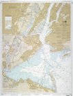
Bay and harbor of New York
1889, Larchmont Harbor, N.Y.:…
Alaska Peninsula and adjacent…
Océan Atlantique nord, côtes …
Coast Chart no. 9, Boston Bay…
Coast chart no. 10 Cape Cod B…
Charleston harbour, S. Ca. : …
Preliminary chart of Calibogu…
Sketch showing the progress o…
Nantucket Sound: western part
m
United States--east coast, Ne…
Reconnaissance of the western…
Map of the coast of Massachus…
The harbor of New Bedford
City and harbor of Portland, …
Plan of Boston and its vicini…
Reconnaissance of the western…
Plan of Boston and its vicini…
Boston Harbor, Massachusetts:…
Erie Harbor, Pa.
America, N.W. Coast, Strait o…
Reconnaissance of Doboy Bar a…
Lynn Harbor, Massachusetts 18…
Reconnaissance of the western…
Preliminary chart of entrance…
Preliminary chart of Hampton …
Atlantic Coast, Chesapeake en…
Coast chart no. 48, Cape Fear…
St. Mary's River and Fernandi…
Preliminary chart of Hatteras…
Stono Inlet, South Carolina
Metomkin Inlet, Virginia : fr…
m
Preliminary chart of Savannah…
Harbor of Refuge, Dutch Islan…
Tybee Bay and Calibogue Sound…
Preliminary sketch of Galvest…
Preliminary chart of Gray's H…
Preliminary chart of Port Roy…
Preliminary chart of Calibogu…
Reconnaissance of entrance & …
Preliminary chart of Kennebec…
Rappahannock River, Virginia …
1
2
Previous
Next
1
2
Previous
Next