Click to visit the main New York Public Library Homepage
The New York Public Library
Digital Collections
About Digital Collections
Browse
Search only public domain materials
Items
Collections
Divisions
Home
Search
Browse
About
Search only public domain materials
Items
Collections
Divisions
Digital Collections
Using Images
Using Data
Search
Filtered search
Show filters
Hide filters
Show Only Public Domain
topic
x
Public lands
Indian reservations
12
Railroads
11
Surveys
11
Roads
10
More
Less
name
United States. Surveyor General
7
Johnson, A. J. (Alvin Jewett), 1827-1884
5
United States. General Land Office
5
Berthrong, I. P
3
Julius Bien & Co
3
More
Less
collection
Maps of North America
32
Maps of New York City and State
1
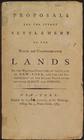
Proposals for the speedy settlement of the waste and unappropriated lands of the western frontiers of the stateof New-York, and for the improvement of the inland navigation between Albany and Oswego
1
place
Kansas
5
Michigan
4
Arkansas
3
California
3
Colorado
3
More
Less
genre
Maps
33
Surveys
3
Cadastral maps
1
Charts
1
Geological maps
1
More
Less
publisher
Surveyor General's Office
5
Published by A.J. Johnson
3
A.J. Johnson
2
Department of the Interior, General Land Office
2
GPO
2
More
Less
division
Map Division
33
Rare Book Division
1
type
cartographic
33
text
1
Date Range
to
34 results found
Filtering on:
x
Topic
: Public lands
Sort by:
Title
Date created
Date digitized
Sequence
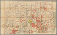
A diagram of Oregon
A new map of the states of Ca…
m
An improved edition of a map …
Arkansas
Arkansas : map of the Arkansa…
m
Chapman's new sectional map o…
Geological map of Alabama
Johnson's Arkansas, Mississip…
Johnson's Kansas and Nebraska
Johnson's Minnesota
Johnson's Missouri and Kansas
Johnson's Wisconsin and Michi…
Map of Colorado territory : c…
Map of Indian Territory
Map of public surveys in Cali…
Map of public surveys in Cali…
m
Map of the Adirondack Forest …
Map of the State of Florida :…
Map of the state of Kansas
Map of the surveyed portions …
Map of the United States show…
Map showing private land clai…
Map showing the progress of t…
Map showing the public domain…
Proposals for the speedy sett…
Sketch of the public surveys …
Sketch of the public surveys …
Sketch of the public surveys …
Sketch of the public surveys …
State of Kansas
Territory of New Mexico
Thayer's map of Colorado
Township no. 20 North, Range …
Utah, township no. 5 south, r…
End of results
|
Top