Click to visit the main New York Public Library Homepage
The New York Public Library
Digital Collections
About Digital Collections
Browse
Search only public domain materials
Items
Collections
Divisions
Home
Search
Browse
About
Search only public domain materials
Items
Collections
Divisions
Digital Collections
Using Images
Using Data
Search
Filtered search
Show filters
Hide filters
Show Only Public Domain
topic
x
Railroads
Administrative and political divisions
244
Canals
97
Roads
88
Surveying
81
More
Less
name
Stanton, Robert Brewster, 1846-1922
79
Rand McNally and Company
74
Sperr, Percy Loomis, 1890-1964
58
Sack, Alexander N. (Alexander Nahum), 1890-1955
55
Portland & Ogdensburg Railroad Company
51
More
Less
collection
Maps of North America
455
Maps of New York City and State
315
Robert N. Dennis collection of stereoscopic views
267
Cigarette cards
149
Photographic views of New York City, 1870's-1970's, from the collections of the New York Public Library
80
More
Less
place
New York (State)
476
New York
252
New York (N.Y.)
224
United States
194
Manhattan (New York, N.Y.)
149
More
Less
genre
Maps
790
Photographs
556
Stereographs
267
Trade cards
154
Advertisements
149
More
Less
publisher
publisher not identified
58
Fotografiia Engelia
38
G.W. & C.B. Colton & Co
31
Detroit Publishing Company
30
Rand, McNally & Co
25
More
Less
division
Map Division
772
Wallach Division: Photography Collection
399
George Arents Collection
149
Manuscripts and Archives Division
92
Milstein Division
91
More
Less
type
still image
822
cartographic
784
text
244
notated music
9
Date Range
to
1,667 results found
Filtering on:
x
Topic
: Railroads
Sort by:
Title
Date created
Date digitized
Sequence
Results 1001 - 1050
Map of the rail roads of the …
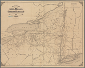
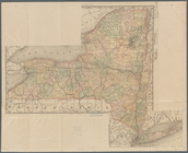
Map of the state of New York …
Rand, McNally & Co.'s New York
m
New railroad, county and town…
Map showing route of the New …
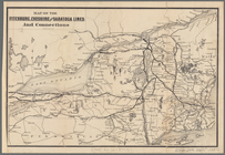
Map of the Fitchburg, Cheshir…
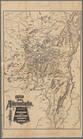
Map of the Adirondacks, as re…
Profiles of the canals and ra…
m
New map of the state of New Y…
Disturnell's new map of the U…
Map of the various channels f…
Map of the Rome, Watertown an…
New York Central & Hudson Riv…
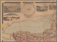
Map of the great pleasure rou…
Bird's-eye view of the mounta…
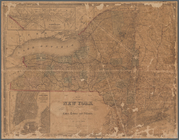
Map of New York
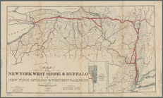
Map of the New York West Shor…
m
Map of the territory of the U…
Rand, McNally & Co.'s new com…
m
National map of the territory…
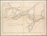
Profile of a survey for a rai…
Boston and Albany Rail Road: …
Map of street railways in eas…
Rapid Transit Commission, pla…
Proposed plan of terminal gro…
Magnus's county map of the Un…
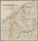
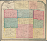
Map of Chautauqua County, N.Y…
Map of part of Orange County,…
m
Map of the United States and …
m
Watson's new county and railr…
Smith's rail road, steam boat…
m
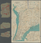
Map of Maine, New Hampshire, …
Telegraph and rail road map o…
Map of Seneca Co., New York: …
m
The Matthews-Northrup up-to-d…
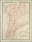
Road map of Westchester Co., …
Sketch of the states of Massa…
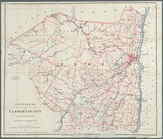
Colton's map of the county of…
Map of Orleans County, New Yo…
Colton's road map of Ulster C…
Railroad map of New England &…
Map of Rockland Co: [New York]
Map of Steuben County: to acc…
Post route map of the state o…
Map of the Dead River, Kenneb…
Railroad map of New Hampshire…
Map of the rail roads of Penn…
Map showing the Lehigh Valley…
Map showing lines filed by Ne…
Geological map of Alabama
1
2
3
4
5
6
7
Previous
Next
1
2
3
4
5
6
7
Previous
Next