Click to visit the main New York Public Library Homepage
The New York Public Library
Digital Collections
About Digital Collections
Browse
Search only public domain materials
Items
Collections
Divisions
Home
Search
Browse
About
Search only public domain materials
Items
Collections
Divisions
Digital Collections
Using Images
Using Data
Search
Filtered keyword search
Show filters
Hide filters
Show Only Public Domain
topic
Railroads
12
Administrative and political divisions
9
Real property
8
Landowners
7
Local transit
5
More
Less
name
Bronx (New York, N.Y.). Topographical Bureau
43
New York (N.Y.). Topographical Bureau
29
Dripps, M. (Matthew)
4
G.W. & C.B. Colton & Co
4
Bourquin, F. (Frederick), 1808-
3
More
Less
collection
Atlases of New York City
162
Maps of North America
29
Maps of New York City and State
27
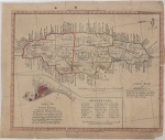
A new map of Jamaica: exhibiting the boundaries of each Parish and the different Post Roads throughout the Island, laid down from the latest surveys
1
Atlases of the United States
1
More
Less
place
Staten Island (New York, N.Y.)
90
Bronx (New York, N.Y.)
72
New York (State)
21
New York
12
New York (N.Y.)
10
More
Less
genre
Maps
224
Topographic maps
98
Cadastral maps
7
Bathymetric maps
2
Nautical charts
2
More
Less
publisher
Topographical Bureau
72
publisher not identified
9
M. Dripps
4
Fairmount Park Commission?
2
G.W. & C.B. Colton
2
More
Less
division
Map Division
222
Manuscripts and Archives Division
1
Schomburg Jean Blackwell Hutson Research and Reference Division
1
type
x
cartographic
text
1
Date Range
to
224 results found for:
x
800
Filtering on:
x
Type
: cartographic
Sort by:
Relevance
Title
Date created
Date digitized
Sequence
A map of the whole continent …
note:
Scale [ca. 1:12,
800
,000] (W 162°--E 18°/N
A new generall chart for the …
A new map of Jamaica: exhibit…
note:
… in.=
800
ft.].
A Plan of the Straits of St. …
note:
Scale approximately 1:
800
,000 (W 86°26ʹ--W 81°58
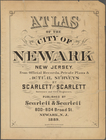
… by Scarlett & Scarlett,
800
collection:
…,
800
-804 Broad St., Newark
m
Bureau of roads
abstract:
… approximately 1:4,
800
; 400 feet
Carte de l'Empire Français Di…
note:
Scale [ca. 1:2,
800
,000] (W 12°00ʹ--E
Colorado : Aspen special map
note:
Scale 1:9,600.
800
feet to an inch (W
Colton's New York City : Broo…
note:
Scale [1:28,
800
]. 2400 ft. to 1 inch. (W
Colton's New York City, Brook…
note:
Scale approximately 1:28,
800
; 2400 ft. to one
Coltons map of the New York w…
note:
… 1:3,
800
,000. Statute miles 60
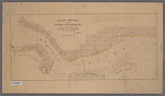
East River from the Battery t…
note:
Scale 1:10,
800
. 900 feet to one inch. (W
Eighth l. h. district
note:
Insets: Galveston [Scale 1:
800
Farrar's map of northern Main…
note:
Scale approximately 1:316,
800
(W 70°33ʹ--W 68°17
G. Woolworth Colton's new map…
abstract:
… approximately 1:28,
800
; 2,400 ft
G. Woolworth Colton's new map…
abstract:
… approximately 1:28,
800
; 2,400 ft
Hagstrom's map of ... New Yor…
note:
Scale approximately 1:16,
800
.
Hawaiian Islands
abstract:
… 1:19,
800
]. "No. 4100 price
Improved map of the territori…
note:
Scale 1:1,900,
800
. 30 geographical miles
Index to the Location of the …
note:
Scale [1:1,
800
]. 150 ft. to 1 in.
Index to the Topographical su…
Johnson's Indiana
note:
Scale approximately 1:844,
800
(W 88°--W 84°/N 42
Map of 163 sections or villa …
note:
Scale approximately 1:
800
(W 73°48ʹ29ʺ--W
Map of Jackson Park : showing…
note:
Scale approximately 1:4,
800
(W 87°36ʹ25ʺ--W
Map of Jamaica in the 4th war…
note:
Scale 1:4,
800
; 400 feet to 1 inch (W 73°49
Map of New England and the pr…
note:
… approximately 1: 5,
800
,000]
m
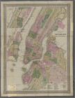
Map of New York City
note:
Scale 1:4,
800
. 400 feet to an inch. (W
Map of New York City showing …
note:
Scale 1:4,
800
. 1 inch = 400 feet. (W
Map of Port-Lawrence & Vistul…
note:
Scale 1:4,
800
. 400 feet to the inch (W
Map of Section 1. [Bounded by…
note:
Scale [1:1,
800
]. 150 ft. to 1 in.
Map of St. Joseph, Mo. and vi…
note:
Scale 1:9,600.
800
feet to an inch (W
m
Map of the borough of Brookly…
note:
Scale [ca. 1:24,
800
].
m
Map of the City of Brooklyn a…
note:
Scale [1:9,600]
800
ft. pr. in. (W 74°03
m
Map of the city of Brooklyn, …
note:
Scale [ca. 1:9,600].
800
feet pr. inch.
Map of the city of New York m…
note:
Scale 1:9,600.
800
feet to 1 inch. (W
Map of the city of New York m…
note:
Scale 1:9,600.
800
feet to 1 inch. (W
Map of the city of New York m…
note:
Scale 1:9,600.
800
feet to 1 inch. (W
Map of the consolidated city …
Map of the Rhode Island state…
note:
Scale 1:4,
800
. 400 ft. to the inch (W
Map of the state of Wisconsin…
note:
Scale approximately 1:2,
800
,000 (W 92°53ʹ--W 86°14
Map of the survey of Wissahic…
note:
Scale 1:9,600.
800
ft. to an inch (W
Map of the territories of Mic…
note:
Scale 1:1,900,
800
. 30 geographical miles
Map of the town of Huron, Mic…
Map or Plan of Section 10. [B…
note:
Scale [1:1,
800
]. 150 ft. to 1 in.
Map or Plan of Section 11. [B…
note:
Scale [1:1,
800
]. 150 ft. to 1 in.
Map or Plan of Section 12. [B…
note:
Scale [1:1,
800
]. 150 ft. to 1 in.
Map or Plan of Section 13. [B…
note:
Scale [1:1,
800
]. 150 ft. to 1 in.
Map or Plan of Section 14. [B…
note:
Scale [1:1,
800
]. 150 ft. to 1 in.
Map or Plan of Section 15. [B…
note:
Scale [1:1,
800
]. 150 ft. to 1 in.
Map or Plan of Section 16. [B…
note:
Scale [1:1,
800
]. 150 ft. to 1 in.