Click to visit the main New York Public Library Homepage
The New York Public Library
Digital Collections
About Digital Collections
Browse
Search only public domain materials
Items
Collections
Divisions
Home
Search
Browse
About
Search only public domain materials
Items
Collections
Divisions
Digital Collections
Using Images
Using Data
Search
Filtered keyword search
Show filters
Hide filters
Show Only Public Domain
topic
Real property
47
Nautical charts
20
Administrative and political divisions
13
Railroads
12
Discovery and exploration
10
More
Less
name
Beers, F. W. (Frederick W.)
30
Cramer, Louis H
28
United States Coast Survey
19
Bache, A. D. (Alexander Dallas), 1806-1867
18
G.W. & C.B. Colton & Co
9
More
Less
collection
Maps of North America
52
Atlases of the United States
35
Maps of New York City and State
17
Lawrence H. Slaughter Collection of English maps, charts, globes, books and atlases
10
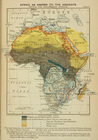
A history of the colonization of Africa by alien races
6
More
Less
place
New York (State)
53
Massachusetts
9
Africa
8
New Jersey
8
Pennsylvania
7
More
Less
genre
Maps
123
Atlases
35
Nautical charts
13
Cadastral maps
9
Bathymetric maps
4
More
Less
publisher
J.B. Beers
28
U.S. Coast Survey
11
G.W. & C.B. Colton & Co
7
University Press
6
F. W. Beers & Co
5
More
Less
division
Map Division
115
Schomburg Jean Blackwell Hutson Research and Reference Division
7
Berg Collection
1
Manuscripts and Archives Division
1
Schomburg Manuscripts, Archives and Rare Books Division
1
type
x
cartographic
still image
4
text
1
Date Range
to
125 results found for:
x
J. H. B
Filtering on:
x
Type
: cartographic
Sort by:
Relevance
Title
Date created
Date digitized
Sequence
Africa as known to the Ancien…
parent:
6c484bd0-c619-012f-
b
115-58d385a7bc34
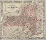
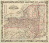
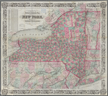
State of New-York for Spaffor…
parent:
6ebd9820-c5d3-012f-e2
b
2-58d385a7bc34
m
Walden Pond. A reduced plan. …
parent:
671d26d0-f962-0139-90
b
7-0242ac110002
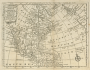
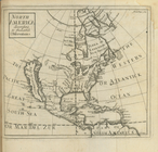
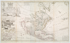
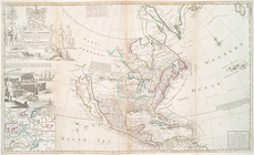
An accurate map of North Amer…
parent:
6a5739c0-c5d4-012f-7f0
b
-58d385a7bc34
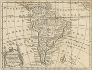
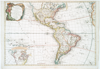
An accurate map of South Amer…
parent:
6ad2def0-c5d4-012f-a7
b
9-58d385a7bc34
North America : according to …
note:
Lawrence
H
. Slaughter Collection ; 3043.
Colton's railroad & township …
parent:
700694
b
0-79a9-0133-3773-00505686a51c
Colton's railroad & township …
parent:
a202
b
2e0-c5a6-012f-9190-58d385a7bc34
Colton's railroad & township …
parent:
119e25
b
0-2edf-0136-f3c2-098a5a8
b
588d
The Course of the River Cali …
parent:
b
24f6030-c6d3-012f-2004-58d385a7bc34
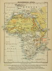
Muhammadan Africa
parent:
6c9ff500-c619-012f-
b
6a7-58d385a7bc34
A map of the most inhabited p…
note:
…. 1966. p. [14], [1755?
b
]
America, N.W. Coast, Strait o…
parent:
7d109db0-c52a-012f-
b
115-3c075448cc4
b
North America west coast, Har…
parent:
267c9660-3221-0133-0f42-58d385a7
b
928
Carte du Canada et de la Loui…
note:
par
J.B
. Nolin geographe.
This map of North America acc…
note:
Herman Moll, geographer ;
B
. Lens delin
This map of North America acc…
parent:
64d8c240-c5d5-012f-6
b
0e-58d385a7bc34
Carte d'Amerique : diviseé en…
note:
… ... par
J.B
. Nolin
… Clinton, K.
B
.
note:
Lawrence
H
. Slaughter Collection ; 812.
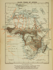
Slave trade of Africa
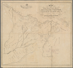
Map of the head waters of the…
parent:
ff3ad580-
b
954-0133-04a6-00505686d14e
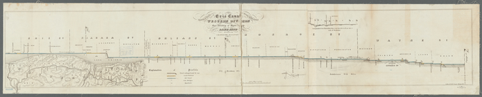
Statistical profile of Erie C…
parent:
3f8241f0-8
b
02-0133-3197-00505686a51c
H4. Map (Scheme
B
) illustrating freight situation
parent:
aaf27ca0-6163-0138-cddd-5d5d9
b
244746
m
United States of America, 1834
parent:
dc6882
b
0-c52a-012f-f8ea-3c075448cc4
b
United States of America
parent:
e21406f0-c52a-012f-655
b
-3c075448cc4
b
Preliminary chart of the sea …
parent:
0
b
61aca0-d632-0132-f6cd-58d385a7
b
928
Map of the states of Ohio Ind…
parent:
f58affb0-c52a-012f-56dd-3c075448cc4
b
Reconnaissance of Smith's or …
parent:
d137
b
0e0-13f6-0136-383d-5de4d29ce4af
Map no. 1 of the El Paso & Fo…
parent:
0781d390-f57c-0135-556
b
-1d53a910dab3
Preliminary survey of Humbold…
parent:
a5e008f0-0
b
7
b
-0136-2673-7f48acd46977
Map of property owned by the …
parent:
44524210-c52
b
-012f-02dd-3c075448cc4
b
Map of New Orleans and Jeffer…
parent:
a533ff30-221e-0135-88ea-23
b
2c52748ca
Passe A Loutre, Mississippi D…
parent:
af813990-22e3-0135-11f1-3
b
7eb8fe3d7e
Patapsco River and the approa…
parent:
3231
b
290-5e70-0135-a200-2bb85970eb5a
Bass River Harbor, Massachuse…
parent:
bac116a0-
b
143-0132-83cb-58d385a7bbd0
Preliminary chart of Bass Riv…
parent:
ad3ce6c0-529
b
-0134-643a-00505686a51c
Preliminary chart of Gloucest…
parent:
bac116a0-
b
143-0132-83cb-58d385a7bbd0
Coast chart no. 10 Cape Cod B…
parent:
1c631620-5
b
2a-0134-d939-00505686a51c
m
Map of Hampden County, Massac…
parent:
c7654d30-5
b
30-0134-1c1d-00505686a51c
Map of the village of Taunton…
parent:
bac116a0-
b
143-0132-83cb-58d385a7bbd0
A map of the City of Worcester
parent:
b
8713690-6bbd-0134-
b
09f-00505686a51c
Preliminary chart of Monomoy …
parent:
bac116a0-
b
143-0132-83cb-58d385a7bbd0
Boston Harbor, Massachusetts:…
parent:
9
b
408420-8f40-0134-1e9f-00505686a51c
Boston Harbor, Massachusetts
parent:
bac116a0-
b
143-0132-83cb-58d385a7bbd0
m
Colton's new sectional map of…
parent:
29c96
b
80-c8ba-0135-5f63-73358482deda
New map of Missouri
parent:
c7
b
9ef20-c8bb-0135-f4e8-4d1647e82ce2
Map of Massabesic Lake and su…
parent:
48983f10-
b
144-0132-e269-58d385a7bbd0
A map of the state of New Jer…
parent:
5ec8
b
680-c52
b
-012f-db9d-3c075448cc4
b
A map of the state of New Jer…
parent:
5961c110-c52
b
-012f-
b
92
b
-3c075448cc4
b
Map of the boundary line betw…
parent:
8
b
038ba0-bb07-0134-5590-00505686a51c