Click to visit the main New York Public Library Homepage
The New York Public Library
Digital Collections
About Digital Collections
Browse
Search only public domain materials
Items
Collections
Divisions
Home
Search
Browse
About
Search only public domain materials
Items
Collections
Divisions
Digital Collections
Using Images
Using Data
Search
Filtered keyword search
Show filters
Hide filters
Show Only Public Domain
topic
Railroads
18
Administrative and political divisions
14
Indian reservations
7
Indians of North America
7
Postal service
6
More
Less
name
Nicholson, W. L
5
United States. Post Office Department
5
Rand McNally and Company
4
United States. General Land Office
4
United States. Surveyor General of Kansas and Nebraska
4
More
Less
collection
Maps of North America
49
Ancestral charts: Families Beekman, Bennett, Brock, Cole, McSpadden, Steinhauer, etc
1
Atlases, gazetteers, guidebooks and other books
1
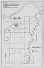
Our Negro population, a sociological study of the Negroes of Kansas City, Missouri
1
place
Kansas
28
Nebraska
12
Missouri
9
West (U.S.)
6
Oklahoma
4
More
Less
genre
Maps
51
Cadastral maps
3
Military maps
2
Illustrations
1
Manuscript maps
1
More
Less
publisher
Post Office Department
4
Department of the Interior, General Land Office
3
Surveyor General's Office
3
Explorations and Surveys, War Dept
2
G.W. & C.B. Colton & Co
2
More
Less
division
Map Division
50
Milstein Division
1
Schomburg Jean Blackwell Hutson Research and Reference Division
1
type
x
cartographic
still image
1
text
1
Date Range
to
52 results found for:
x
Kansas
Filtering on:
x
Type
: cartographic
Sort by:
Relevance
Title
Date created
Date digitized
Sequence
A correct map of the Oklahoma…
Blanchard's Guide map of
Kansas
… of
Kansas
: compiled from
note:
… of
Kansas
.
Congressional map of the state of
Kansas
, 1875 …
… of
Kansas
and Nebraska …
District of New Mexico
Fifteenth l.h. district
note:
…. on the Missouri River to
Kansas
… to the
Kansas
Pacific Railway
Johnson's
Kansas
and Nebraska
abstract:
… state of
Kansas
Johnson's Missouri and
Kansas
abstract:
… eastern third of
Kansas
.
Kansas
Mail and passenger route from…
note:
… River at
Kansas
City
Map illustrating the general …
abstract:
… boundaries;
Kansas
m
Map of an exploring expeditio…
note:
… of the
Kansas
to the Pacific
Map of an exploring expeditio…
note:
… of the
Kansas
to the Pacific
Map of
Kansas
…
abstract:
… removed from
Kansas
. State
Map of
Kansas
abstract:
…. Detached from:
Kansas
, its
Map of
Kansas
and Nebraska …
note:
…,
Kansas
, September 2nd
Map of
Kansas
and western Missouri …
note:
… by the
Kansas
City Investment Co.,
Kansas
City, Mo."…
Map of
Kansas
City, Missouri; Showing
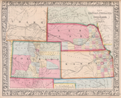
Map of
Kansas
, Nebraska, and Colorado
Map of Leavenworth,
Kansas
…
abstract:
…: Leavenworth,
Kansas
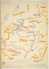
Map of Pfalz
Map of roads from Fort Dodge,…
collection:
Kansas
…,
Kansas
…
Map of the Hannibal & St. Jos…
abstract:
… of
Kansas
and Illinois
Map of the state of
Kansas
…
m
Map of the states of
Kansas
and Texas
Map of the vicinity of
Kansas
City in
Kansas
note:
…: Compliments of "The
Kansas
Map of the vicinity of
Kansas
City in
Kansas
note:
Presented by the "
Kansas
City Times
… surveys in
Kansas
note:
…,
Kansas
, 1861.
… of
Kansas
and Nebraska …
Map showing the route pursued…
abstract:
…
Kansas
, northern New
Map showing the territory ori…
abstract:
… of present states of
Kansas
Military map of Nebraska and …
abstract:
…, and northern portions of
Kansas
Military map of Nebraska and …
abstract:
…, and
Kansas
. Relief shown
Mines of the
Kansas
Ridge, Mosquito …
… and Council Bluffs,
Kansas
Official topographical map of…
m
Post route map of the state o…
m
Post route map of the states …
m
Post route map of the states …
m
Post route map of the states of
Kansas
m
Post route map of the states of
Kansas
note:
… of "
Kansas
City & vicinity."…
m
… of
Kansas
and Nebraska …
Rand, McNally & Co.'s
Kansas
abstract:
… of
Kansas
. Includes
m
Sectional, Nebraska and
Kansas
…
State of
Kansas
…
State of
Kansas
…
Township map of
Kansas
…