Click to visit the main New York Public Library Homepage
The New York Public Library
Digital Collections
About Digital Collections
Browse
Search only public domain materials
Items
Collections
Divisions
Home
Search
Browse
About
Search only public domain materials
Items
Collections
Divisions
Digital Collections
Using Images
Using Data
Search
Filtered keyword search
Show filters
Hide filters
Show Only Public Domain
topic
Geology
16
Railroads
10
Explorations and surveys
8
Pacific railroads
8
Administrative and political divisions
5
More
Less
name
United States. War Department. Office of P.R.R. Surveys
6
Blake, William P. (William Phipps), 1826-1910
5
Williamson, R. S. (Robert Stockton), 1824-1882
5
United States. Army. Corps of Topographical Engineers
4
Ackerman Lithr
3
More
Less
collection
Maps of North America
31
Maps of New York City and State
3
Atlases of the United States
1
place
California
6
Pennsylvania
5
Virginia
4
Nevada
3
New York (State)
3
More
Less
genre
Maps
35
Geological cross-sections
12
Geological maps
6
Diagrams
4
Aerial views
2
More
Less
publisher
War Dept., U.S. Pacific Rail Road Explorations & Surveys
5
publisher not identified
3
Geological Survey of Pennsylvania
2
Jed. Hotchkiss
2
A.H. Mueller
1
More
Less
division
Map Division
35
type
x
cartographic
still image
8
Date Range
to
35 results found for:
x
Railroad crossings
Filtering on:
x
Type
: cartographic
Sort by:
Relevance
Title
Date created
Date digitized
Sequence
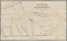
Smyth County, Va.
abstract:
…,
railroads
, and landowners
Hydrographic map of Delavan a…
abstract:
… of Delavan, roads,
railroads
Railroad
map of Illinois, 1894-5 …
note:
…,
Railroad
and Warehouse
Arbachoochee, Alabama : Dense…
abstract:
…,
railroad
, locations
Preliminary map of Kentucky
abstract:
…
railroad
, river, and county
… the highway grade
crossings
note:
Also shows
railroads
, footprints
A geological and topographica…
abstract:
… boundaries. Includes 11
cross
sections, inset of
railroad
Bird's-eye view of the Conema…
abstract:
… by the Pennsylvania
Railroad
, and inset
cross
Map of the Gogebic Iron Range…
abstract:
…, landownership,
railroads
, rivers
Second Geological Survey of P…
note:
… and
railroads
.
[S]econd Geolo[gical Survey o…
abstract:
… tunnels, and
railroads
Map of the states of Californ…
abstract:
…,
railroads
(existing and proposed),
railroad
Map of the Shenandoah Valley …
abstract:
….
Railroads
and outcrops
m
Hotchkiss' geological map of …
abstract:
…. Includes 6
cross
sections
m
Map of Scott Co., Kentucky : …
abstract:
…,
railroads
, locations
Map of the reservoirs, feeder…
note:
…,
railroads
, and major natural
m
…
Railroad
and the mineral
note:
…, and Columbus
Railroad
with geological
cross
Map showing the economic mine…
abstract:
… of the
railroad
and shows
m
National map of the territory…
note:
…,
railroads
, Indian
Route of the Peninsula
Railroad
abstract:
…; and 1
cross
"Section
m
Topographical map of the Wyom…
abstract:
… and proposed
railroads
The battle fields and militar…
abstract:
… are marked by
crossed
swords. Shows roads,
railroads
… to the Santa Fé
crossing
note:
… route for a
railroad
Map of south Florida : showin…
abstract:
… Associated
Railroad
Land
m
Milk R. to the
crossing
of the Columbia R.
topic:
Pacific
railroads
Map of the city of Milwaukee,…
abstract:
…, streets,
railroads
, block
…
Railroad
near the 32d
topic:
Pacific
railroads
Geological section along the …
topic:
Pacific
railroads
Geological section of the Coa…
topic:
Pacific
railroads
Geological section of the Sie…
topic:
Pacific
railroads
Geological section from the C…
topic:
Pacific
railroads
Geological section of the Ber…
topic:
Pacific
railroads
m
Plans for the improvement of …
…., Passaic River,
Cross
St
note:
v. 1. North of
Railroad
Place, Market
Birdseye view of greater New …
note:
….
railroad
and Jamaica Bay Boulevard (
Cross
Bay Blvd
End of results
|
Top