Click to visit the main New York Public Library Homepage
The New York Public Library
Digital Collections
About Digital Collections
Browse
Search only public domain materials
Items
Collections
Divisions
Home
Search
Browse
About
Search only public domain materials
Items
Collections
Divisions
Digital Collections
Using Images
Using Data
Search
Filtered keyword search
Show filters
Hide filters
Show Only Public Domain
topic
Geography
123
Real property
94
Landowners
65
Administrative and political divisions
60
Railroads
31
More
Less
name
Coignet, Michel, 1549-1623
123
Ortelius, Abraham, 1527-1598
123
Shawe, James
123
G.M. Hopkins & Co
75
O.W. Gray & Son
73
More
Less
collection
Atlases of the United States
259
Maps of North America
258
Lawrence H. Slaughter Collection of English maps, charts, globes, books and atlases
147
Maps of New York City and State
26
I. N. Phelps Stokes Collection of American Historical Prints
11
More
Less
place
Pennsylvania
149
Jersey City (N.J.)
76
Philadelphia (Pa.)
76
Hudson County (N.J.)
75
Dutchess County (N.Y.)
72
More
Less
genre
Maps
727
Atlases
254
Cadastral maps
78
Topographic maps
18
Prints
16
More
Less
publisher
Printed for Ieames Shawe, and are to be solde at his shoppe nigh Ludgate,
123
G.M. Hopkins Co.,
75
Reading Publishing House
72
G.W. Bromley and Co.,
69
A.H. Mueller
35
More
Less
division
Map Division
678
Milstein Division
30
Wallach Division: Print Collection
11
General Research Division
3
Manuscripts and Archives Division
3
More
Less
type
x
cartographic
still image
19
text
8
Date Range
to
730 results found for:
x
Waa-Pa-Shaw
Filtering on:
x
Type
: cartographic
Sort by:
Relevance
Title
Date created
Date digitized
Sequence
Pas
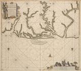
kaart van de zee kusten van
Pas
-kaart vande Rivieren Commewini Suriname
Plan of the town of York Haven
Map of Philadelphia
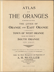
Atlas of the Oranges embracin…
collection:
…, Philadelphia,
PA
., 1911.
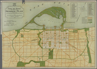
City of Erie. Pennsylvania. G…
Pennsylvania and Maryland map
Pennsylvania - Paoli, Chester…
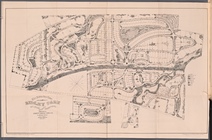
The Suburban Town of Ridley P…
m
Smith's tourist guide of nece…
Plan of the city of Philadelp…
m
New map of the city of Philad…
m
New map of the city of Philad…
New and improved map of the c…
Plan of the city of Philadelp…
Topographical map of Fairmoun…
Plan of the grounds and build…
Our centennial--plan of the g…
Bird's eye view of Philadelph…
Hunt's map of Philadelphia : …
m
To the honourable House of Re…
This plan of the city of Phil…
Map of the survey of Wissahic…
note:
….,
Pa
.
To the citizens of Philadelph…
m
Map of Bates County, Missouri
m
Map of Johnson County, Missou…
A general chart of all the co…
m
A map of Schuylkill County, P…
note:
… Pottsville,
Pa
., April 1855.
m
Kentucky and Tennessee
m
Mississippi
m
Map of Clinton Co., New York:…
Map of the state of Missouri …
Plan of the grounds and build…
m
Map of principal portion of P…
Surveys for a future water su…
Plan of the city of Philadelp…
City of Philadelphia
A Plan of the Straits of St. …
Geological sketch of Philadel…
Surveys for a future water su…
New map of the city of Philad…
New map of the city of Philad…
New map of the city of Philad…
Map of the compact portion of…
A map of Philadelphia and par…
Map of Philadelphia photograp…
Map of Philadelphia photograp…
Map of the centennial grounds…
Reference map of a portion of…
A plan of the operations of t…
topic:
Brandywine, Battle of,
Pa
., 1777
1
2
3
Previous
Next
1
2
3
Previous
Next