Click to visit the main New York Public Library Homepage
The New York Public Library
Digital Collections
About Digital Collections
Browse
Search only public domain materials
Items
Collections
Divisions
Home
Search
Browse
About
Search only public domain materials
Items
Collections
Divisions
Digital Collections
Using Images
Using Data
Search
Filtered keyword search
Show filters
Hide filters
Show Only Public Domain
topic
Real property
51
Railroads
41
Indians of North America
22
History
20
Administrative and political divisions
19
More
Less
name
Bromley, George Washington
71
Bromley, Walter Scott
71
A.H. Mueller (Publisher)
15
United States Coast Survey
13
Bache, A. D. (Alexander Dallas), 1806-1867
12
More
Less
collection
Maps of North America
186
Atlases of the United States
114
Maps of New York City and State
59
Lawrence H. Slaughter Collection of English maps, charts, globes, books and atlases
27
Atlases, gazetteers, guidebooks and other books
8
More
Less
place
Bergen County (N.J.)
69
New York (State)
58
United States
58
West (U.S.)
53
New York (N.Y.)
20
More
Less
genre
Maps
428
Atlases
111
Cadastral maps
20
Nautical charts
14
Geological maps
4
More
Less
publisher
G.W. Bromley and Co.,
69
s.n
19
publisher not identified
16
A.H. Mueller
15
Stone & Stewart
5
More
Less
division
Map Division
399
Schomburg Jean Blackwell Hutson Research and Reference Division
11
Milstein Division
9
Schomburg Manuscripts, Archives and Rare Books Division
4
General Research Division
2
More
Less
type
x
cartographic
text
17
still image
3
Date Range
to
430 results found for:
x
West (U.S.)
Filtering on:
x
Type
: cartographic
Sort by:
Relevance
Title
Date created
Date digitized
Sequence
m
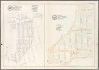
Maps of property in the city …
use:
Can be
used
on NYPL website
m
H.M.
S
. Aeolus and H.M.
S
. Norwich
use:
Can be
used
on NYPL website
Carte des Isles de L'Amerique…
use:
Can be
used
on NYPL website
… the
West
Indies
use:
Can be
used
on NYPL website
Great Falls of Columbia River
use:
Can be
used
on NYPL website
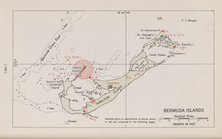
Bermuda Islands
use:
Can be
used
on NYPL website
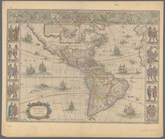
Amerique septentrionale
use:
Can be
used
on NYPL website
City of New York, 1843.
use:
Can be
used
on NYPL website
m
Strip maps of the "Trail to s…
use:
Can be
used
on NYPL website
m
Automobile local tours: Locke…
use:
Can be
used
on NYPL website
… in ye
West
Indies, from
use:
Can be
used
on NYPL website
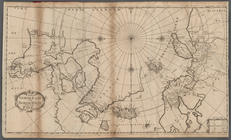
A new generall chart for the
West
use:
Can be
used
on NYPL website
m
Americae nova tabula
use:
Can be
used
on NYPL website
Part of North America: compre…
use:
Can be
used
on NYPL website
A map of the whole continent …
use:
Can be
used
on NYPL website
A new map of the western part…
use:
Can be
used
on NYPL website
A general chart of the
West
India's [sic]
use:
Can be
used
on NYPL website
La America septentrional, des…
use:
Can be
used
on NYPL website
North America, including the
West
Indies
use:
Can be
used
on NYPL website
West
India Islands
use:
Can be
used
on NYPL website
… of the
U
.
S
. mail steam
use:
Can be
used
on NYPL website
A new and accurate map of the…
use:
Can be
used
on NYPL website
A new and correct map of Amer…
use:
Can be
used
on NYPL website
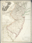
A New map of Virginia.
use:
Can be
used
on NYPL website
m
… America, and the
West
use:
Can be
used
on NYPL website
A new map of North America sh…
use:
Can be
used
on NYPL website
Map of the northern part of t…
use:
Can be
used
on NYPL website
Chart of the Atlantic Ocean.
use:
Can be
used
on NYPL website
m
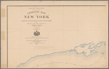
Preliminary geologic map of N…
use:
Can be
used
on NYPL website
A Map or North East and North
West
Parts
use:
Can be
used
on NYPL website
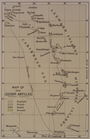
Map of the Lesser Antilles
use:
Can be
used
on NYPL website
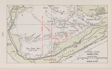
Bermuda Island. Hamilton
use:
Can be
used
on NYPL website
Map of the
U
.
S
. and Territories…North Central.
use:
Can be
used
on NYPL website
Map of the
U
.
S
. and Territories…North East.
use:
Can be
used
on NYPL website
… and
West
Farms Road
use:
Can be
used
on NYPL website
…., Bronx River,
West
Farms
use:
Can be
used
on NYPL website
…, Bacon Street and
U
.
S
use:
Can be
used
on NYPL website
An accurate map of the Britis…
use:
Can be
used
on NYPL website
m
Map of the state of Virginia
use:
Can be
used
on NYPL website
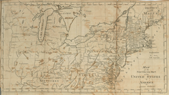
Ornamental map of the United …
use:
Can be
used
on NYPL website
m
…, the
West
Indies and Central
use:
Can be
used
on NYPL website
…, the
West
Indies and Central
use:
Can be
used
on NYPL website
…, the
West
Indies and Central
use:
Can be
used
on NYPL website
m
…, the
West
Indies and Central
use:
Can be
used
on NYPL website
Johnson's new illustrated & e…
use:
Can be
used
on NYPL website
… and
West
, commonly called
use:
Can be
used
on NYPL website
Carte contenant le royaume du…
use:
Can be
used
on NYPL website
A general map of the southern…
use:
Can be
used
on NYPL website
North America
west
coast, Haro and Rosario
use:
Can be
used
on NYPL website
m
Mitchell's new national map e…
use:
Can be
used
on NYPL website
1
2
Previous
Next
1
2
Previous
Next