Click to visit the main New York Public Library Homepage
The New York Public Library
Digital Collections
About Digital Collections
Browse
Search only public domain materials
Items
Collections
Divisions
Home
Search
Browse
About
Search only public domain materials
Items
Collections
Divisions
Digital Collections
Using Images
Using Data
Search
Filtered keyword search
Show filters
Hide filters
Show Only Public Domain
topic
City planning
946
Social conditions
942
Dwellings
316
Apartment houses
305
Description and travel
291
More
Less
name
M.I.T. Press
942
New York (N.Y.). City Planning Commission
942
Brockedon, William (1787-1854)
247
Croly, George (1780-1860)
247
Haghe, Louis (1806-1885 )
246
More
Less
collection
Atlases of New York City
950
I. N. Phelps Stokes Collection of American Historical Prints
584
The World's loose leaf album of apartment houses: containing views and ground plans of the principal high class apartment houses in New York City, together with a map showing the situation of these houses, transportation facilities, etc
304
The Holy Land, Syria, Idumea, Arabia, Egypt and Nubia: From drawings made on the spot
247
Yizkor Book Collection
214
More
Less
place
New York (State)
1666
New York
1532
New York (N.Y.)
1051
Middle East
249
Egypt
147
More
Less
genre
Maps
1430
Prints
1004
Photographs
921
Illustrations
431
Floor plans
308
More
Less
publisher
MIT Press
942
N.Y. World
304
F.G. Moon,
247
Printed by the author, and are to be had at his house
97
Crossman House Photographic Studio
75
More
Less
division
Map Division
1222
Wallach Division: Print Collection
648
Dorot Jewish Division
464
Milstein Division
309
Rare Book Division
226
More
Less
type
x
still image
text
1054
cartographic
322
notated music
1
Date Range
to
Looking for one of these collections?
I. N. Phelps Stokes Collection of American Historical Prints
793 items
The World's loose leaf album of apartment houses: containing views and ground plans of the principal high class apartment houses in New York City, together with a map showing the situation of these houses, transportation facilities, etc.
304 items
The Holy Land, Syria, Idumea, Arabia, Egypt and Nubia: From drawings made on the spot
252 items
3,785 results found for:
x
map
Filtering on:
x
Type
: still image
Sort by:
Relevance
Title
Date created
Date digitized
Sequence
Portugal.
image:
ps_
map
_179
Palestine.
image:
ps_
map
_180
Florida.
image:
ps_
map
_174
Denmark.
image:
ps_
map
_178
Indian Territory [Oklahoma].
image:
ps_
map
_175
Title page
image:
ps_
map
_191
Allen's outline
map
of Ottumwa, Iowa
note:
… catalog of the
Map
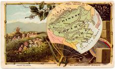
Chinese Empire.
image:
ps_
map
_181
New York.
image:
ps_
map
_176
Map
of the territory of Idaho
note:
Mapping
the Nation (NEH grant, 2015-2018)…
Key
map
Key
map
Key
map
Key
map
Key
map
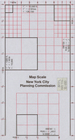
Map
Scale New York City Planning
Arabia.
image:
ps_
map
_177
m
Map
of Columbiana County, Ohio, 1860 …
note:
… along center of
map
Map
of the city of San Francisco
note:
… catalog of the
Map
Octagonal
map
of the environs of Richmond
note:
Mapping
the Nation (NEH grant, 2015-2018)…
Colton's
map
of Oregon & Washington
note:
… catalog of the
Map
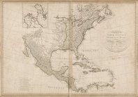
Map
of North America, published under
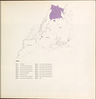
City planning commission
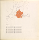
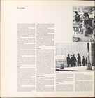
Brooklyn
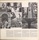
Brooklyn (cont.)
Brooklyn (cont.)
Brooklyn (cont.)
Brooklyn
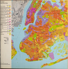
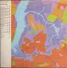
Brooklyn land use policy
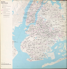
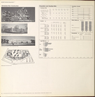
Brooklyn neighborhood improve…
Brooklyn public schools
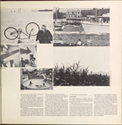
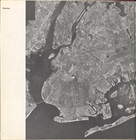
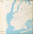
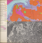
Brooklyn Topography
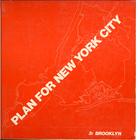
Cover Page
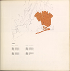
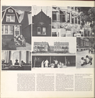
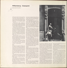
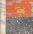
Williamsburg, Greenpoint.
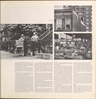
Williamsburg, Greenpoint. (co…
Williamsburg, Greenpoint. (co…
Williamsburg, Greenpoint. (co…
Williamsburg, Greenpoint. (co…
Williamsburg, Greenpoint. (co…
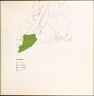
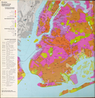
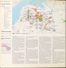
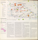
Land use policy
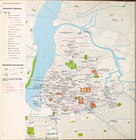
Community resources
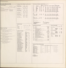
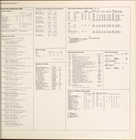
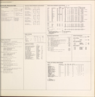
Community resources data
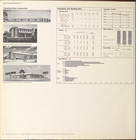
Scheduled new construction
Land use policy
Community resources
Community resources data
Scheduled new construction
Land use policy
Community resources
Community resources data
1
2
3
4
5
6
7
8
9
10
…
15
16
Previous
Next
1
2
3
4
5
6
7
8
9
10
…
15
16
Previous
Next