Click to visit the main New York Public Library Homepage
The New York Public Library
Digital Collections
About Digital Collections
Browse
Search only public domain materials
Items
Collections
Divisions
Home
Search
Browse
About
Search only public domain materials
Items
Collections
Divisions
Digital Collections
Using Images
Using Data
Search
Filtered search
Show filters
Hide filters
Show Only Public Domain
topic
Real property
10812
Fire insurance
5289
Cities & towns
5001
Administrative and political divisions
906
Railroads
784
More
Less
name
Sanborn Map Company
5093
G.W. Bromley & Co
2471
Bromley, George Washington
797
Bromley, Walter Scott
797
Austro-Hungarian Monarchy. Militärgeographisches Institut
773
More
Less
collection
Atlases of New York City
10577
Atlases of the United States
3749
Maps of North America
3345
Maps of New York City and State
2046
Lawrence H. Slaughter Collection of English maps, charts, globes, books and atlases
1101
More
Less
place
New York (State)
12155
New York
3979
New York (N.Y.)
2428
Manhattan (New York, N.Y.)
2374
Brooklyn (New York, N.Y.)
1166
More
Less
genre
Maps
24593
Atlases
3680
Topographic maps
1062
Surveys
1032
land surveys
849
More
Less
publisher
Sanborn Map Company
5129
G.W. Bromley & Co
2294
E. Belcher Hyde
780
K.u.K. Militargeographisches Institut
773
publisher not identified
452
More
Less
division
Map Division
22270
Manuscripts and Archives Division
1082
General Research Division
510
Rare Book Division
337
Schomburg Jean Blackwell Hutson Research and Reference Division
195
More
Less
type
x
cartographic
text
656
still image
329
three dimensional object
12
Date Range
to
24,955 results found
Filtering on:
x
Type
: cartographic
Sort by:
Title
Date created
Date digitized
Sequence
Results 6001 - 6050
Situationsplan der Pyramiden-…
Situationsplan des Pyramidenf…
Giseh [Jîzah]: Grab 86., 87.,…
Pyramiden und Todtenfeld von …
Pyramiden und Todtenfeld von …
Nördlichste Ziegelpyramide vo…
Pyramiden und Todtenfeld von …
Situationsplan der Pyramiden-…
Situationsplan des Pyramiden-…
Fayyûm: Situationsplan des La…
Situationsplan der Ruinen von…
Situationsplan der Ruinen von…
Situationsplan der Umgebungen…
Specialplan der Ruinen von El…
Situationsplan der Ruinen von…
General Karte von Theben [The…
Situations-Plan der Ruinen vo…
Situations-Plan der Ruinen vo…
Situations-Plan der Ruinen vo…
Grundriss der Insel Philae.
Situationsplan der Ruinen von…
Situationsplan des Pyramidenf…
Situationsplan des Pyramidenf…
Situationsplan von Berg Barka…
Situationsplan des Pyramidenf…
Situationsplan von der Ruinen…
Situationsplan von der Ruinen…
Situationsplan der Gebäuderes…
Grundplan der Gebäudeanlagen …
Situationsplan der Ruinen von…
m
The southern part of the Prov…
Territory of Columbia
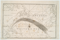
[A Chart of the Atlantic or W…
Nieuwe wassende graade zee ka…
A plan of the city of New-Yor…
Carte de la Virginie et du Ma…
Virginiae partis australis, e…
A new and accurate map of Nor…
L'Amerique septentrionale : d…
America Septentrionalis conci…
Virginia, Marylandia et Carol…
Bowles's new pocket map of th…
D'Engelze volkplanting in Vir…
A new and accurate chart (fro…
A new and accurate chart (fro…
To the members of the Nautica…
A chart of the coast of Ameri…
Carte de la Louisiane et du c…
Carte du Mexique et de la Flo…
America Septentrionalis a Dom…
1
2
…
22
23
24
25
26
27
28
29
…
99
100
Previous
Next
1
2
…
22
23
24
25
26
27
28
29
…
99
100
Previous
Next