Click to visit the main New York Public Library Homepage
The New York Public Library
Digital Collections
About Digital Collections
Browse
Search only public domain materials
Items
Collections
Divisions
Home
Search
Browse
About
Search only public domain materials
Items
Collections
Divisions
Digital Collections
Using Images
Using Data
Search
Filtered keyword search
Show filters
Hide filters
Show Only Public Domain
topic
Railroads
14
Administrative and political divisions
11
Geology
6
Indian reservations
6
Surveys
6
More
Less
name
Rand McNally and Company
6
Geological and Geographical Survey of the Territories (U.S.)
4
Hayden, F. V. (Ferdinand Vandeveer), 1829-1887
4
Nicholson, W. L
4
United States. Post Office Department
4
More
Less
collection
Maps of North America
50
Ancestral charts: Families Beekman, Bennett, Brock, Cole, McSpadden, Steinhauer, etc
1
Atlases, gazetteers, guidebooks and other books
1
I. N. Phelps Stokes Collection of American Historical Prints
1
place
Colorado
37
New Mexico
7
Southwest, New
6
Arizona
5
West (U.S.)
5
More
Less
genre
Maps
53
Topographic maps
6
Geological maps
2
Physical maps
2
Aerial views
1
More
Less
publisher
Post Office Department
4
Department of the Interior, U.S. Geological and Geographical Survey of the Territories
3
Rand, McNally & Co
3
U.S. Geological Survey
3
War Dept., U.S. Pacific Rail Road Explorations & Surveys
3
More
Less
division
Map Division
51
Milstein Division
1
Wallach Division: Print Collection
1
type
x
cartographic
still image
6
text
2
Date Range
to
53 results found for:
x
Colorado
Filtering on:
x
Type
: cartographic
Sort by:
Relevance
Title
Date created
Date digitized
Sequence
Map of
Colorado
territory …
abstract:
… in the
Colorado
Rocky Mountains
Thayer's map of
Colorado
…
… of
Colorado
… of
Colorado
… of
Colorado
Thayer's map of
Colorado
…
State of
Colorado
…
…,
Colorado
…
Rand, McNally & Co.'s
Colorado
… of
Colorado
…
… of the state of
Colorado
…
note:
… for
Colorado
."…
Rand, McNally & Co.'s.
Colorado
Mines of the Kansas Ridge, Mo…
note:
…, Alma,
Colorado
, May
General geological map of
Colorado
…
abstract:
… and geographical atlas of
Colorado
Economic map of
Colorado
…
abstract:
… and geographical atlas of
Colorado
m
… of the state of
Colorado
…
Map of part of the state of
Colorado
abstract:
…,
Colorado
, and New Mexico
m
Colorado
…
… between southern
Colorado
Drainage map of
Colorado
…
abstract:
… atlas of
Colorado
Preliminary map of the surveys in
Colorado
…
Colorado
(Dolores County), Rico special map …
Colorado
, Tenmile District special map …
Post route map of the state of
Colorado
…
m
Post route map of the state of
Colorado
…
Map of part of
Colorado
Territory …
The new empire of western
Colorado
Preliminary map of Central
Colorado
…
Sections of the
Colorado
Desert …
abstract:
… of the
Colorado
Desert
Map of the Cripple Creek Mini…
collection:
Colorado
m
Map of the Denver & Rio Grand…
abstract:
… in Utah,
Colorado
, New
Rollandet's guide map and str…
collection:
Colorado
…, in New Mexico,
Colorado
… of
Colorado
Rio
Colorado
of the West.
Colorado
…
Map showing alignment of the …
collection:
Colorado
Design map of the village of …
collection:
Colorado
Preliminary map of the wester…
abstract:
… to the
Colorado
together
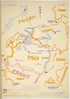
Map of Pfalz
collection:
…,
Colorado
, and of Missouri
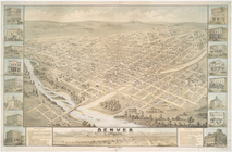
Denver,
Colorado
, 1874
Map of explorations and surve…
abstract:
… of the great
Colorado
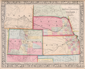
Map of Kansas, Nebraska, and
Colorado
…,
Colorado
, New Mexico
m
Map of the states of Kansas a…
Sectional map of Colfax and M…
Geological sections of the Be…
abstract:
… Bernardino to the
Colorado
Map showing the route pursued…
abstract:
…
Colorado
; settlements
Geological section from the
Colorado
River
Map of the survey of a route …