Click to visit the main New York Public Library Homepage
The New York Public Library
Digital Collections
About Digital Collections
Browse
Search only public domain materials
Items
Collections
Divisions
Home
Search
Browse
About
Search only public domain materials
Items
Collections
Divisions
Digital Collections
Using Images
Using Data
Search
Filtered keyword search
Show filters
Hide filters
Show Only Public Domain
topic
Nautical charts
63
History
31
Real property
30
Landowners
25
Administrative and political divisions
24
More
Less
name
Burr, David H., 1803-1875
69
United States Coast Survey
36
Bache, A. D. (Alexander Dallas), 1806-1867
35
Lesley, J. P. (J. Peter), 1819-1903
26
Geological Survey of Pennsylvania
21
More
Less
collection
Maps of North America
192
Atlases of the United States
86
Maps of New York City and State
70
Lawrence H. Slaughter Collection of English maps, charts, globes, books and atlases
62
Joannis Elerti Bode Uranographia, sive astrorum descriptio viginti tabulis aeneis incisa ex recentissimis et absolutissimis astronomorum observationibus ..
20
More
Less
place
New York (State)
136
New York (N.Y.)
46
Pennsylvania
44
New Jersey
43
United States
42
More
Less
genre
Maps
476
Atlases
87
Nautical charts
30
Prints
29
Bathymetric maps
18
More
Less
publisher
For sale by the principal booksellers
65
Apud Autorem
20
Geological Survey of Pennsylvania
13
U.S. Coast Survey
13
U.S. Coast Survey Office
12
More
Less
division
Map Division
432
General Research Division
23
Schomburg Jean Blackwell Hutson Research and Reference Division
5
Schomburg Manuscripts, Archives and Rare Books Division
5
Wallach Division: Print Collection
5
More
Less
type
x
cartographic
still image
11
Date Range
to
479 results found for:
x
J. P
Filtering on:
x
Type
: cartographic
Sort by:
Relevance
Title
Date created
Date digitized
Sequence
Map of Venango County oil reg…
note:
… by John
P
. Hunt
Hunt's map of Philadelphia : …
note:
… in the year 1875 by John
P
…, Derby
P
.O. Erie Co., N.Y
Geological map of Westmorelan…
note:
J.P
. Lesley, State Geologist ;
J.J
. Stevenson
Geological map of Fulton Coun…
note:
… ;
J.P
. Lesley, State
Map of the Pittsburg & Baltim…
note:
… by
J
.W. Harden.
Albany Rural Cemetery, 1884: …
note:
compiled from deeds by
J.P
. Thomas, supt
Geological map of Fayette Cou…
note:
… ;
J.P
. Lesley, State Geologist ;
J.J
. Stevenson
….
J
.
P
. Myers, No. 63
Map of southern Butler County…
note:
J.P
. Lesley, state geologist ; I.C. White
Geological map of Berks Count…
note:
J.P
. Lesley, State Geologist ; compiled from
m
Geological map of Pennsylvani…
note:
… the direction of
J.P
. Lesley
Map of the Albany Rural Cemet…
note:
…"
J.P
. Thomas, superintendent; B.A. Thomas
Geological map of Allegheny C…
note:
… ;
J.P
. Lesley, state geologist ;
J.J
. Stevenson
Map illustrating the general …
note:
by Professor James Hall, assisted by
J.P
Geological map of Potter Coun…
note:
J.P
. Lesley, State Geologist ; Andrew Sherwood
Map of Newport, R.I.
note:
… the direction of
J.P
. Cotton
Proposed improvement of Back …
note:
Park Dept., City of Boston ;
J.P
. Davis, city
Geological map of Potter Coun…
note:
J.P
. Lesley, State Geologist ; Andrew Sherwood
Map of North Allegheny, showi…
note:
J.P
. Lesley, state geologist ; I.C. White
General map of the anthracite…
note:
… ;
J.P
. Lesley, state
Map of the Shenandoah Valley …
abstract:
…; section 5 after Prof.
J.P
m
Topographical map of the stat…
note:
… geological formations / by
J
Preliminary chart of York Riv…
note:
… by Lieut.
J.P
. Roy, U.S.A
m
Colton's new sectional map of…
note:
… in the year 1860 by
J
Map of Beaver County showing …
note:
… ;
J.P
. Lesley, state
General map of the anthracite…
note:
…,
J.P
. Lesley, State
Geological and topographical …
note:
… assistants,
J.P
. Lesley, A.A
Topographical map in ten-foot…
note:
…,
J.P
. Lesley, State
Statistical profile, Erie Can…
note:
H.C. Seymour, S. Eng. & C. 1851 ;
J.P
Preliminary chart of Bull's B…
note:
… of Lieuts. Comdg.
J
.N. Maffit and
J.P
. Bankhead
Geological map of the environ…
note:
… ;
J.P
. Lesley, State
Second Geological Survey of P…
note:
J.P
. Lesley, State Geologist ; Chas. A
Second Geological Survey of P…
note:
[
J.P
. Lesley, State Geologist ; Chas. A
Preliminary chart of Port Roy…
note:
…, and
J.P
. Bankhead, U.S.N
[S]econd Geolo[gical Survey o…
note:
[
J.P
. Lesl]ey, State Geologist ; [Chas
A series of columnar sections…
note:
J.P
. Lesley, state geologist, Chas. A
m
City of Houston, Harris Co., …
note:
…. Rease ; views by
J.P
Second Geological Survey of P…
note:
J.P
. Lesley, State Geologist ; Chas. A
Map of the mines of the Panth…
note:
…,
J.P
. Lesley, State
Itinéraire, de Karak a Chauba…
m
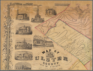
Map of Ulster County, New York
note:
Differ from DLC's Oliver
J
. Tillson &
P
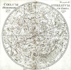
Coelum stellatum; hemisphaeri…
note:
Exhibited: Seeing Is Believing, illus.
p
.25, 65
Coelum stellatum; hemisphaeri…
note:
Exhibited: Seeing Is Believing, illus.
p
.25, 65
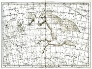
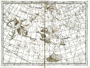
Delphinus, Equuleus, Pegasus.
note:
Exhibited: Seeing Is Believing, illus.
p
.25, 65
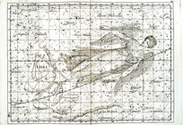
Virgo, Libra, Turdus Solitari…
note:
Exhibited: Seeing Is Believing, illus.
p
.25, 65
… Heer
P
. Kalm
note:
… t.-
p
., engraved by C
North America
note:
… Division, I,
p
. 244
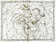
Ursa minor, Cepheus, Draco., …
note:
Exhibited: Seeing Is Believing, illus.
p
.25, 65
Cassiopeja, Andromeda, Triang…
note:
Exhibited: Seeing Is Believing, illus.
p
.25, 65
1
2
Previous
Next
1
2
Previous
Next