Click to visit the main New York Public Library Homepage
The New York Public Library
Digital Collections
About Digital Collections
Browse
Search only public domain materials
Items
Collections
Divisions
Home
Search
Browse
About
Search only public domain materials
Items
Collections
Divisions
Digital Collections
Using Images
Using Data
Search
Filtered keyword search
Show filters
Hide filters
Show Only Public Domain
topic
Real property
31
Cities & towns
17
Fire insurance
17
Maps
4
Landowners
3
More
Less
name
Sanborn Map Company
17
E. Robinson Co
5
Robinson, E. (Elisha)
5
Bromley, George Washington
4
Bromley, Walter Scott
4
More
Less
collection
Atlases of New York City
32
Maps of New York City and State
6
Maps of North America
2
Atlases of the United States
1
Cartographic materials from the Emmet collection of manuscripts etc. relating to American history
1
More
Less
place
New York (State)
31
Brooklyn (New York, N.Y.)
15
New York
11
Kingston
3
Kingston (N.Y.)
3
More
Less
genre
Maps
43
Cadastral maps
3
Atlases
1
publisher
Sanborn Map Company
17
E. Robinson Co
5
G.W. Bromley & Co
4
G.M. Hopkins & Co
3
s.n
3
More
Less
division
Map Division
43
type
x
cartographic
Date Range
to
43 results found for:
x
Kingston (N.Y.)
Filtering on:
x
Type
: cartographic
Sort by:
Relevance
Title
Date created
Date digitized
Sequence
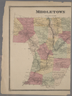
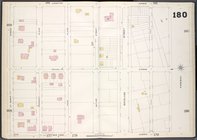
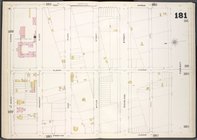
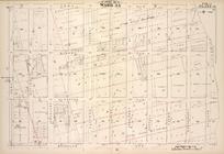
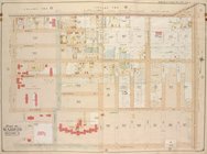
Kingstone
.
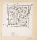
Map of part of
Kingston
,
N
.
Y
., on Rondout
note:
… the city of
Kingston
.
m
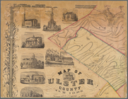
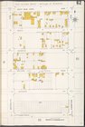
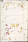
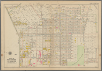
Map of Ulster County, New York
note:
…. Red in
Kingston
.
m
Map of Ulster County, New York
note:
…. Red in
Kingston
.
m
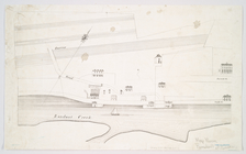
…
Kingston
[Village
… by Fulton St.,
Kingston
Ave
….,
Kingston
Ave., Park Pl
….,
Kingston
Ave.]
….,
Kingston
Ave., Eastern
… Parkway,
Kingston
Ave.]
…,
Kingston
Ave., Crown St
… to
Kingston
.
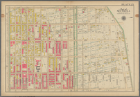
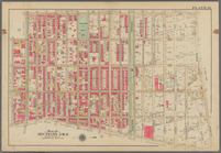
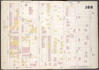
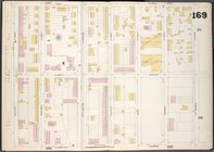
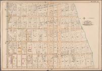
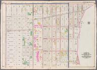
Plate 26: [Bounded by
Kingston
Avenue, Malabone
… York Avenue,
Kingston
Bounded by
Kingston
Avenue, Malbone Street
… by
Kingston
Ave., St.Marks Ave
….,
Kingston
Ave., Fulton St.]
… by
Kingston
Ave., Parkway, New
…,
Kingston
Ave., St. Marks
….,
Kingston
Ave., Hawthorne St
…., Albany Ave.,
Kingston
Ave.]
….,
Kingston
Ave., E. 39th St
…., Dean St.,
Kingston
Ave.]
….,
Kingston
Ave.]
….,
Kingston
Ave., E. New York
… Ave.,
Kingston
Ave.]
…, Malbone Street,
Kingston
…,
Kingston
Avenue, Fenimore
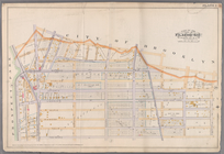
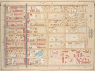
Plate 2: [Bounded by Fenimore Street,
Kingston
Bounded by Malbone Street,
Kingston
Avenue
…,
Kingston
Ave., Albany Ave.
note:
Cover title: City atlas of Brooklyn,
N.Y
.
The Century atlas, New York, …
note:
… Yonkers to
Kingston
.
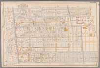
Plate 29: [Bounded by Malbone…
collection:
… Avenue and
Kingston
… Donough St.,
Kingston
Ave
note:
Cover title: City atlas of Brooklyn,
N.Y
.
….,
Kingston
Ave., Butler St
note:
Cover title: City atlas of Brooklyn,
N.Y
.
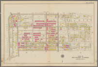
Bounded by Ralph Avenue, E. 9…
collection:
…, Winthorp Street,
Kingston
…, Lefferts Street,
Kingston
Brooklyn, Vol. 5, Double Page…
abstract:
… York Ave.,
Kingston
Ave
Brooklyn, Vol. 5, Double Page…
abstract:
…., Winthrop St.,
Kingston
Ave.
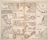
Les principales forteresses, …
note:
… --
Kingston
Harbour in Jamaica
A map of the British Empire i…
note:
… --
Kingston
-- Port Antonio
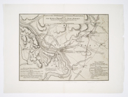
Plan of the operations of Gen…
note:
… to
Kingston
, New Jersey
m
Map of Rockingham Co., New Ha…
note:
… 71°27ʹ04ʺ--W 70°34ʹ30ʺ/
N
43°16ʹ27ʺ--
N
42°44ʹ15ʺ).
End of results
|
Top