Click to visit the main New York Public Library Homepage
The New York Public Library
Digital Collections
About Digital Collections
Browse
Search only public domain materials
Items
Collections
Divisions
Home
Search
Browse
About
Search only public domain materials
Items
Collections
Divisions
Digital Collections
Using Images
Using Data
Search
Filtered keyword search
Show filters
Hide filters
Show Only Public Domain
topic
Real property
286
Nautical charts
139
Railroads
85
Administrative and political divisions
81
History
45
More
Less
name
G.W. Bromley & Co
221
Bromley, George Washington
196
Bromley, Walter Scott
196
United States Coast Survey
116
Bache, A. D. (Alexander Dallas), 1806-1867
100
More
Less
collection
Maps of North America
523
Atlases of the United States
282
Atlases of New York City
151
Maps of New York City and State
108
Lawrence H. Slaughter Collection of English maps, charts, globes, books and atlases
30
More
Less
place
New York (State)
346
Westchester County
136
Westchester County (N.Y.)
136
Staten Island (New York, N.Y.)
94
United States
94
More
Less
genre
Maps
1121
Atlases
282
Nautical charts
108
Bathymetric maps
56
Topographic maps
34
More
Less
publisher
G.W. Bromley & Co
216
G.W. Bromley and Co.,
69
U.S. Coast Survey
56
publisher not identified
43
U.S. Coast Survey Office
35
More
Less
division
Map Division
1125
Schomburg Jean Blackwell Hutson Research and Reference Division
3
Rare Book Division
2
Manuscripts and Archives Division
1
Wallach Division: Print Collection
1
type
x
cartographic
text
16
still image
14
Date Range
to
1,132 results found for:
x
S. W
Filtering on:
x
Type
: cartographic
Sort by:
Relevance
Title
Date created
Date digitized
Sequence
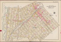
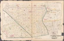
… bounded by Avenue T,
W
.9th St., Avenue
S
,
W
. 4th
Plan of the New Haven City bu…
note:
Surveyed Sep. 3d, 1862 by
S.W
. Searl
… Well Ave., Avenue
S
,
W
Preliminary reconnaissance of…
note:
… ; engd. by
W
. Smith, & App,
S.W
. Bradley.
Geological map of Keweenaw Po…
note:
…. geologists ;
S.W
. Hill and
W
Geological map of Isle Royale…
note:
… ; assisted by
S.W
. Hill &
W.S
Reconnaissance of Pass Fourch…
note:
…. by Apps. F.R. Bartle &
S.W
Reconnaissance of Olympia Har…
note:
…"Engd. by
S.W
. Bradley & App. F.
W
. Benner."…
Geological map of the distric…
note:
… ;
S.W
. Hill &
W
Preliminary chart of Stellwag…
note:
…"Engg by App.
S.W
. Bradley" -- lower right
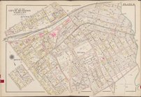
… by E. 2nd St., Avenue
S
,
W
. 6th St
Bass River Harbor, Massachuse…
note:
…. Hazzard & App.
S.W
Preliminary chart of Ship Isl…
note:
…. Yeager & App.
S.W
Reconnaissance of Doboy Bar a…
note:
…. by App.
S.W
. Bradley.
Reconnaissance of the eastern…
note:
….
S.W
. Bradley.
Map of central portion of the…
note:
this map has been drawn by Mr.
S.W
. Balch
Price, Lee & Co's. new map of…
note:
Surveyed by
S.W
. Searle, surveyor
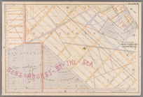
Tidal currents of Nantucket S…
note:
…. Bartle &
S.W
. Bradley.
Reconnaissance of the entranc…
note:
….
S.W
. Bradley.
Reconnaissance of Doboy Bar a…
note:
…. by App.
S.W
. Bradley
Preliminary chart of Bass Riv…
note:
….
S.W
. Bradley" -- lower
Preliminary chart of Cedar Ke…
note:
….
S.W
. Bradley" -- lower
County & township map of the …
note:
Drawn and engraved by
W
.H. Gamble.
… [Map bounded by
W
collection:
… and official plans. By G.
W
. and
W
.
S
. Bromley
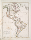
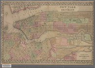
America
note:
gezeichnet von F. v. Stülpnagel, 1843 ; gest. v.
W
Map of the vicinity of Kansas…
note:
…' and Manufacturers' Bureau" Theo.
S
. Case, sec'y., 127
W
… / George
S
. Green, Engineer
note:
… feet to one inch. (
W
73°58ʹ27ʺ--
W
73°57ʹ59ʺ/N
….
S
. Stivers; Office Orange County Press; J.
W
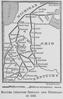
Routes through Indiana and Mi…
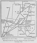
Network of routes through Gre…
m
Title map of the coal field o…
note:
…, Kanawha County
W
. Va
…. of M.
S
. Hayne
Res. of
W
.
S
. Benedict, Warwick, N.Y
Mines of the Kansas Ridge, Mo…
note:
… feet to the inch (
W
106°46ʹ--
W
106°08ʹ/N
… by
S
. Scholes Street
collection:
… and official records by G.
W
….,
S
. 1st Ave., Park
collection:
… and official plans. By G.
W
. and
W
.
S
. Bromley
… Avenue,
W
. 11th Street, Avenue P,
W
. 8th Street
New York and Brooklyn
note:
Scale not given. (
W
74°02ʹ31ʺ--
W
73°55ʹ26ʺ/N
… Court,
W
. 3rd Street, Avenue R.,
W
. 5th Street
… by George
W
. and Walter
collection:
… and official plans. By G.
W
. and
W
.
S
. Bromley
… by George
W
. and Walter
collection:
… and official plans. By G.
W
. and
W
.
S
. Bromley
… of
S
. R. Weeks
Vernon Co., Mo. : plat of tow…
note:
…"
W
.
S
. Pope, execr.; 3380 acres."…
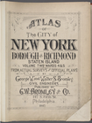
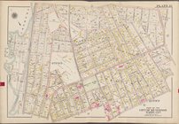
Atlas of The City of New York…
note:
… by George
W
. and Walter
S
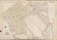
Atlas of The City of New York…
note:
… by George
W
. and Walter
S
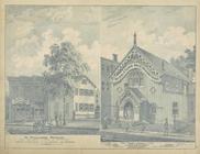
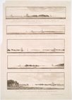
Views of the entrance to New …
note:
… Island) bearing
S
. b[y]
W
.
….,
W
. Sidney Ave
collection:
… and official plans. By G.
W
. and
W
.
S
. Bromley
…, New York City,
W
. 4th
collection:
… and official plans. By G.
W
. and
W
.
S
. Bromley
… [Map bounded by
W
collection:
… and official plans. By G.
W
. and
W
.
S
. Bromley
m
Map of the City of New York n…
note:
Scale [ca. 1:3,600]. (
W
73°57ʹ13ʺ--
W
73°54
1
2
3
4
5
Previous
Next
1
2
3
4
5
Previous
Next