Click to visit the main New York Public Library Homepage
The New York Public Library
Digital Collections
About Digital Collections
Browse
Search only public domain materials
Items
Collections
Divisions
Home
Search
Browse
About
Search only public domain materials
Items
Collections
Divisions
Digital Collections
Using Images
Using Data
Search
Filtered keyword search
Show filters
Hide filters
Show Only Public Domain
topic
Railroads
10
Local transit
9
Electric railroads
6
Railroads, Elevated
4
Real property
4
More
Less
name
C.S. Hammond & Company
3
Edison Electric Illuminating Co. of New York
3
Matthews-Northrup Company
3
Rand McNally and Company
3
Columbus Lithograph Co
2
More
Less
collection
Maps of New York City and State
24
Maps of North America
11
Atlases of the United States
1
The electric zone, New York District, Sept. 30th, 1906 : photographs form nature, and from architects' and engineers' drawings, maps, etc., mounted on paper
1
place
New York (State)
21
New York
14
New York (N.Y.)
11
Manhattan (New York, N.Y.)
8
Brooklyn
4
More
Less
genre
Maps
37
Cadastral maps
4
Mass transit
2
Road maps
2
Advertisements
1
More
Less
publisher
Edison Electric Illuminating Co
3
August R. Ohman
2
Brooklyn Daily Eagle
2
C.S. Hammond & Co
2
Matthews, Northrup & Co
2
More
Less
division
Map Division
36
General Research Division
1
type
x
cartographic
text
1
Date Range
to
37 results found for:
x
new york electric
Filtering on:
x
Type
: cartographic
Sort by:
Relevance
Title
Date created
Date digitized
Sequence
m
… showing the
electric
service of The
New
York
use:
… partner (e.g.,
New
York
m
The United
Electric
Light and Power Company
use:
… partner (e.g.,
New
York
Rand McNally & Co.'s
new
handy map
use:
… partner (e.g.,
New
York
m
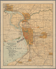
Hammond's complete map of Bro…
use:
… partner (e.g.,
New
York
m
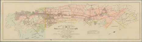
N.Y.C. & H.R.R.R.
Electric
Zone -
New
York
use:
… partner (e.g.,
New
York
m
Map of Brooklyn
use:
… partner (e.g.,
New
York
…, & Rutherford
Electric
R'y
use:
… partner (e.g.,
New
York
m
… Illuminating Co. of
New
York
use:
… partner (e.g.,
New
York
m
Map of part of
New
York
City
use:
… partner (e.g.,
New
York
Map of part of
New
York
City
use:
… partner (e.g.,
New
York
Railroad map of Ohio
use:
… partner (e.g.,
New
York
1899 Railroad map of Ohio
use:
… partner (e.g.,
New
York
New
Indexed Map of the vicinity of
New
York
City.
use:
… partner (e.g.,
New
York
Track map of the trolley line…
use:
… partner (e.g.,
New
York
… territory served by the
New
York
Central and West
use:
… partner (e.g.,
New
York
Map of Saratoga Springs, N.Y.
use:
… partner (e.g.,
New
York
The Matthews-Northrup up-to-d…
use:
… partner (e.g.,
New
York
… and
electric
pipes, sewers
use:
… partner (e.g.,
New
York
m
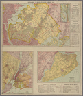
Brooklyn Daily Eagle Long Isl…
use:
… partner (e.g.,
New
York
Sub-division of parts of Jack…
use:
… partner (e.g.,
New
York
m
Hammond's complete map of Bro…
use:
… partner (e.g.,
New
York
Rand McNally standard map of
New
York
use:
… partner (e.g.,
New
York
… Greenbush,
New
York
use:
… partner (e.g.,
New
York
Rand, McNally & Co.'s indexed…
use:
… partner (e.g.,
New
York
…, City of
New
York
;
New
York
City and Vicinity
use:
… partner (e.g.,
New
York
m
Map of
New
York
City
use:
… partner (e.g.,
New
York
m
Map of Boston showing locatio…
use:
… partner (e.g.,
New
York
Map of the city of Washington…
use:
… partner (e.g.,
New
York
Map of
New
York
use:
… partner (e.g.,
New
York
m
New
map of
New
York
City
use:
… partner (e.g.,
New
York
… in the counties of
New
York
and Westchester, State of
New
York
use:
… partner (e.g.,
New
York
… map of Manhattan,
New
York
City : with index
use:
… partner (e.g.,
New
York
m
…" roads,
New
York
use:
… partner (e.g.,
New
York
Spokane Falls : showing in re…
use:
… partner (e.g.,
New
York
Rollandet's guide map and str…
use:
… partner (e.g.,
New
York
City of Spokane Falls, Washin…
use:
… partner (e.g.,
New
York
Map of the country adjacent t…
use:
… partner (e.g.,
New
York
End of results
|
Top