Click to visit the main New York Public Library Homepage
The New York Public Library
Digital Collections
About Digital Collections
Browse
Search only public domain materials
Items
Collections
Divisions
Home
Search
Browse
About
Search only public domain materials
Items
Collections
Divisions
Digital Collections
Using Images
Using Data
Search
Filtered keyword search
Show filters
Hide filters
Show Only Public Domain
topic
History
5
Atlases, British
3
Coasts
3
Great Britain
2
Manuscripts, Italian
2
More
Less
name
Godbid, Anne
3
Playford, John, ca. 1655-1685 or 6
3
Seller, John, fl. 1658-1698
3
Agnese, Battista, 16th cent
2
Agnese, Battista, active 16th century
2
More
Less
collection
Lawrence H. Slaughter Collection of English maps, charts, globes, books and atlases
5
Portolan atlas
2
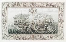
The tapestry hangings of the House of lords; representing the several engagements between the English and Spanish fleets, in the ever memorable year MDLXXXVIII, with the portraits of the lord high-admiral, and the other noble commanders, taken from the life. To which are added, from a book entitled, Expeditionis hispanorum in Angliam vera descriptio, A.D. 1588, done, as is supposed, for the said tapestry to be work'd after, ten charts of the sea-coasts of England, and a general one of England, Scotland, Ireland, France, Holland, &c. shewing the places of action between the two fleets; ornamented with medals struck upon that occasion, and other suitars. ble devices. Also an historical account of each day's action, collected from the most authentic manuscripts and writers
2
Isole famose porti: fortezze, e terre maritime sottoposte alla Ser.ma Sig.ria di Venetia, ad altri Principi Christiani, et al Sig.or Turco nouamẽnte poste in luce
1
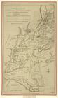
Maps of North America
1
More
Less
place
America
2
England
2
London
2
West Indies, British
2
Mediterranean Sea
1
More
Less
genre
Maps
10
Manuscripts
3
Prints
3
Portolan charts
2
Bird's-eye views
1
More
Less
publisher
Printed by A. Godbid and J. Playford, for John Seller ...,
3
Printed by the author, and are to be had at his house
2
Sold by J. Pine
2
Alla libraria del segno di S. Marco
1
U.S. Army Corps of Topographical Engineers
1
division
Map Division
6
Wallach Division: Print Collection
3
Spencer Collection
2
Manuscripts and Archives Division
1
Rare Book Division
1
type
x
still image
cartographic
5
text
3
notated music
1
Date Range
to
13 results found for:
x
Sea charts
Filtering on:
x
Type
: still image
Sort by:
Relevance
Title
Date created
Date digitized
Sequence
m
Isole famose porti: fortezze,…
abstract:
… of the Mediterranean
sea
; also of Italy
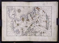
Portolan map of the Grecian A…
note:
… of the Aegean
Sea
, the Bosporus, the
Sea
of Marmara
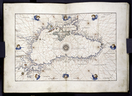
Portolan map of the Black
Sea
…, the Guarapucu ... in the
Sea
Barometric profile of the rou…
abstract:
…
chart
showing the height above
sea
level of towns
…, with ...
Sea
-Spiders
collection:
…, with ...
Sea
-Spiders, and horrible
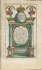
Title page
collection:
…, A
sea
-atlas: describing the
sea
-coasts in most
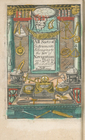
Frontispiece
collection:
…, A
sea
-atlas: describing the
sea
-coasts in most
A mapp of the world
collection:
…, A
sea
-atlas: describing the
sea
-coasts in most
… and
sea
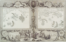
Plate IV from the tapestry ha…
collection:
…, ten
charts
of the
sea
-coasts of England
m
Plate from The tapestry hangi…
collection:
…, ten
charts
of the
sea
-coasts of England
… the
sea
into a hole
note:
De Ricci, 1329. Wustefeld article.
Chart
End of results
|
Top