Click to visit the main New York Public Library Homepage
The New York Public Library
Digital Collections
About Digital Collections
Browse
Search only public domain materials
Items
Collections
Divisions
Home
Search
Browse
About
Search only public domain materials
Items
Collections
Divisions
Digital Collections
Using Images
Using Data
Search
Keyword search
Show filters
Hide filters
Show Only Public Domain
topic
Real property
11050
Fire insurance
5305
Cities & towns
5016
City planning
1101
Social conditions
946
More
Less
name
Sanborn Map Company
5108
G.W. Bromley & Co
2551
New York (N.Y.). City Planning Commission
980
M.I.T. Press
942
Bromley, George Washington
857
More
Less
collection
Atlases of New York City
11722
Atlases of the United States
3868
Maps of North America
3345
Maps of New York City and State
2059
Lawrence H. Slaughter Collection of English maps, charts, globes, books and atlases
1248
More
Less
place
New York (State)
14041
New York
5623
New York (N.Y.)
3512
Manhattan (New York, N.Y.)
2386
Brooklyn (New York, N.Y.)
1222
More
Less
genre
Maps
25784
Atlases
3791
Prints
1409
Topographic maps
1062
Surveys
1034
More
Less
publisher
Sanborn Map Company
5145
G.W. Bromley & Co
2371
MIT Press
942
E. Belcher Hyde
807
K.u.K. Militargeographisches Institut
774
More
Less
division
Map Division
23798
Manuscripts and Archives Division
1281
Wallach Division: Print Collection
746
Rare Book Division
518
Dorot Jewish Division
477
More
Less
type
cartographic
24808
still image
3764
text
2059
notated music
10
sound recording
3
More
Less
Date Range
to
Looking for one of these collections?
Atlases of New York City
11,722 items
Atlases of the United States
3,868 items
Maps of North America
3,345 items
Maps of New York City and State
2,059 items
Lawrence H. Slaughter Collection of English maps, charts, globes, books and atlases
1,252 items
Bancker plans
1,080 items
28,754 results found for:
New York Maps
Sort by:
Relevance
Title
Date created
Date digitized
Sequence
Results 751 - 800
Mare del Nort.
use:
… partner (e.g.,
New
York
A chart of the Atlantic Ocean…
use:
… partner (e.g.,
New
York
A general
map
of North America : drawn
use:
… partner (e.g.,
New
York
America noviter delineata
use:
… partner (e.g.,
New
York
Carte physique et politique d…
use:
… partner (e.g.,
New
York
North America drawn from the …
use:
… partner (e.g.,
New
York
The British governments in Nt…
use:
… partner (e.g.,
New
York
North America
use:
… partner (e.g.,
New
York
Moral and political chart of …
use:
… partner (e.g.,
New
York
A chart of the world : exhibi…
use:
… partner (e.g.,
New
York
Mappe-monde : dressee pour l'…
use:
… partner (e.g.,
New
York
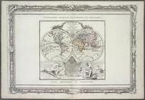
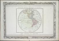
Hémisphère occidental.
use:
… partner (e.g.,
New
York
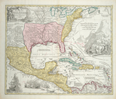
Regni Mexicani seu Novae Hisp…
use:
… partner (e.g.,
New
York
Chart of the coast of America…
use:
… partner (e.g.,
New
York
A
new
map
of Virginia : from the best
use:
… partner (e.g.,
New
York
Mitchell's
new
general atlas
use:
… partner (e.g.,
New
York
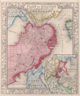
Plan of Boston.
use:
… partner (e.g.,
New
York
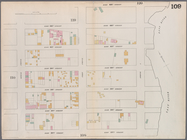
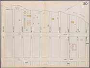
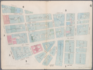
Map
bounded by West 42nd Street, Tenth
use:
… partner (e.g.,
New
York
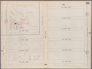
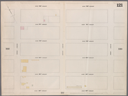
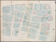
Map
bounded by West 47th Street, Sixth
use:
… partner (e.g.,
New
York
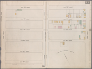
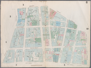
Map
bounded by West 47th Street, Eighth
use:
… partner (e.g.,
New
York
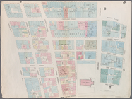
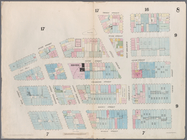
Map
bounded by West 47th Street, Tenth
use:
… partner (e.g.,
New
York
Map
bounded by West 52nd Street, Sixth
use:
… partner (e.g.,
New
York
Map
bounded by West 52nd Street, Eighth
use:
… partner (e.g.,
New
York
Map
bounded by West 52nd Street, Tenth
use:
… partner (e.g.,
New
York
Map
bounded by West 57th Street, Tenth
use:
… partner (e.g.,
New
York
Map
bounded by West 57th Street, Eighth
use:
… partner (e.g.,
New
York
Map
bounded by West 57th Street, Sixth
use:
… partner (e.g.,
New
York
Map
bounded by East 57th Street, Second
use:
… partner (e.g.,
New
York
Map
bounded by East 57th Street, East River
use:
… partner (e.g.,
New
York
Map
bounded by East 62nd Street, First
use:
… partner (e.g.,
New
York
Map
bounded by East 62nd Street, Second
use:
… partner (e.g.,
New
York
Map
bounded by East 62nd Street, Fourth
use:
… partner (e.g.,
New
York
Map
bounded by West 59th Street, Sixth
use:
… partner (e.g.,
New
York
Map
bounded by West 62nd Street, Eighth
use:
… partner (e.g.,
New
York
Map
bounded by West 64th Street, Tenth
use:
… partner (e.g.,
New
York
Map
bounded by West 72nd Street, Tenth
use:
… partner (e.g.,
New
York
Map
bounded by West 67th Street, Eighth
use:
… partner (e.g.,
New
York
Map
bounded by West 72nd Street, Eighth
use:
… partner (e.g.,
New
York
Map
bounded by East 67th Street, Third
use:
… partner (e.g.,
New
York
Map
bounded by East 67th Street, First
use:
… partner (e.g.,
New
York
Map
bounded by East 72nd Street, East River
use:
… partner (e.g.,
New
York
Map
bounded by East 72nd Street, First
use:
… partner (e.g.,
New
York
Map
bounded by East 72nd Street, Third
use:
… partner (e.g.,
New
York
Map
bounded by Dey Street, Broadway, Maiden
use:
… partner (e.g.,
New
York
Map
bounded by Maiden Lane, South Street
use:
… partner (e.g.,
New
York
Map
bounded by Frankfort Street, Franklin
use:
… partner (e.g.,
New
York
Map
bounded by City Hall Square, Frankfort
use:
… partner (e.g.,
New
York
Map
bounded by Duane Street, Hudson
use:
… partner (e.g.,
New
York
Map
bounded by Chatham Street, James
use:
… partner (e.g.,
New
York
Map
bounded by Chatham Square, Division
use:
… partner (e.g.,
New
York
1
2
3
4
5
6
7
8
9
10
…
115
116
Previous
Next
1
2
3
4
5
6
7
8
9
10
…
115
116
Previous
Next