Click to visit the main New York Public Library Homepage
The New York Public Library
Digital Collections
About Digital Collections
Browse
Search only public domain materials
Items
Collections
Divisions
Home
Search
Browse
About
Search only public domain materials
Items
Collections
Divisions
Digital Collections
Using Images
Using Data
Search
Keyword search
Show filters
Hide filters
Show Only Public Domain
topic
Indians of North America
2054
Birds
712
Administrative and political divisions
568
Railroads
466
History
383
More
Less
name
Hubacher, Max Henry, 1900-1989
785
Audubon, John James, 1785-1851
659
Bowen, John T., approximately 1801-1856?
485
Catlin, George, 1796-1872
263
United States Coast Survey
251
More
Less
collection
Maps of North America
3345
Wallach Division Picture Collection
1375
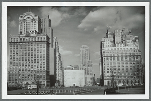
Collection of photographs of New York City, New York State and more by Max Hubacher
785
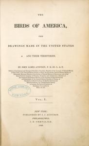
The birds of America: from drawings made in the United States and their territories
506
Robert N. Dennis collection of stereoscopic views
331
More
Less
place
North America
2013
United States
888
Brooklyn (New York, N.Y.)
423
New York (N.Y.)
329
Massachusetts
326
More
Less
genre
Maps
3817
Prints
2312
Illustrations
1681
Photographs
1619
Scientific illustrations
809
More
Less
publisher
J.J. Audubon
659
J.B. Chevalier
506
publisher not identified
344
J. Dobson
280
Amer. Entomol. Soc
161
More
Less
division
Map Division
3770
Wallach Division: Picture Collection
1244
General Research Division
1197
Milstein Division
873
Wallach Division: Photography Collection
781
More
Less
type
still image
5446
cartographic
3816
text
514
moving image
16
sound recording
7
More
Less
Date Range
to
Looking for one of these collections?
Maps of North America
3,345 items
Collection of photographs of New York City, New York State and more by Max Hubacher
785 items
The birds of America: from drawings made in the United States and their territories
506 items
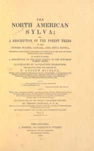
The North American sylva; or, A description of the forest trees of the United States, Canada, and Nova Scotia, considered particularly with respect to their use in the arts, and their introduction into commerce: to which is added a description of the m...
283 items
9,308 results found for:
North America
Sort by:
Relevance
Title
Date created
Date digitized
Sequence
Results 1501 - 1550
City of Malden: [Massachusett…
collection:
Maps of
North
America
Plan of cottage sites at Magn…
abstract:
… with
north
toward the upper
Map of the city of Malden
collection:
Maps of
North
America
Historical map of Nantucket
collection:
Maps of
North
America
Map of the Department of the …
collection:
Maps of
North
America
Map of the United States defi…
collection:
Maps of
North
America
… States of
America
Preliminary chart of Nantucke…
collection:
Maps of
North
America
Map of the city of New Haven:…
collection:
Maps of
North
America
Franklin County
collection:
Maps of
North
America
A new map of the state of Cal…
collection:
Maps of
North
America
m
Military map of Nebraska and …
collection:
Maps of
North
America
Map of the proposed line of r…
collection:
Maps of
North
America
Middle Virginia and
North
Carolina …
m
Map of Elizabeth City Co., Va…
abstract:
…. Oriented with
north
…, Maryland, and
North
Military map refering to the …
collection:
Maps of
North
America
Map of Nashville, Tennessee
collection:
Maps of
North
America
A plan of the land belonging …
collection:
Maps of
North
America
Map of eastern Virginia : com…
collection:
Maps of
North
America
Map of western Virginia : com…
collection:
Maps of
North
America
Johnson's map of the vicinity…
abstract:
… by soundings.
North
is oriented
Preliminary chart of part of …
collection:
Maps of
North
America
Colton's new topographical ma…
collection:
Maps of
North
America
Map of Madison County, Virgin…
collection:
Maps of
North
America
Military map of south-eastern…
collection:
Maps of
North
America
Military map of south-eastern…
note:
… of
North
Carolina by W.D
A topographical map of easter…
collection:
Maps of
North
America
Official map of the territory…
collection:
Maps of
North
America
Iron Mountain City : [Missour…
collection:
Maps of
North
America
Philadelphia and vicinity : P…
collection:
Maps of
North
America
New map of the city of Philad…
collection:
Maps of
North
America
Map of Pittsburgh and Alleghe…
collection:
Maps of
North
America
Pittsburgh & Western Pennsylv…
collection:
Maps of
North
America
Railroad and county map of Ne…
collection:
Maps of
North
America
Map of Pittsburgh and Alleghe…
collection:
Maps of
North
America
A geographically correct map …
topic:
Indians of
North
America
Colton's new map of the state…
collection:
Maps of
North
America
m
County & township map of the …
collection:
Maps of
North
America
Johnson's Nebraska, Dakota, I…
collection:
Maps of
North
America
Map of the state of Missouri
collection:
Maps of
North
America
Johnson's Missouri and Kansas
topic:
Indians of
North
America
Topographical plan showing po…
abstract:
… with
north
to the upper left
Mining lands of Jasper and Ne…
collection:
Maps of
North
America
Vernon Co., Mo. : plat of tow…
collection:
Maps of
North
America
County map of the state of Te…
collection:
Maps of
North
America
Rand, McNally & Co.'s indexed…
collection:
Maps of
North
America
Map of the city of St. Louis …
abstract:
… with
north
to right. Removed
Map of the Hannibal & St. Jos…
collection:
Maps of
North
America
Map of Nebraska
collection:
Maps of
North
America
1
2
…
4
5
6
7
8
9
10
11
…
37
38
Previous
Next
1
2
…
4
5
6
7
8
9
10
11
…
37
38
Previous
Next