Click to visit the main New York Public Library Homepage
The New York Public Library
Digital Collections
About Digital Collections
Browse
Search only public domain materials
Items
Collections
Divisions
Home
Search
Browse
About
Search only public domain materials
Items
Collections
Divisions
Digital Collections
Using Images
Using Data
Search
Keyword search
Show filters
Hide filters
Show Only Public Domain
topic
Bas-reliefs
771
Politics and culture
632
Antiquities
570
Political satire, Mexican
452
Administrative and political divisions
425
More
Less
name
Vanegas Arroyo, Antonio, 1852-1917
632
Posada, José Guadalupe, 1852-1913
578
United States. Farm Security Administration
219
Flandin, Eugène, 1809-1876
175
Holt, Claire
159
More
Less
collection
Maps of North America
1835
Posada Collection
632
Maps of New York City and State
570
Lawrence H. Slaughter Collection of English maps, charts, globes, books and atlases
326
Farm Security Administration Photographs
217
More
Less
place
Mexico
679
New York (State)
625
Egypt
572
United States
480
Assyria
290
More
Less
genre
Maps
3021
Prints
1875
Illustrations
1556
Photographs
820
Ephemera
633
More
Less
publisher
publisher not identified
200
J. Murray
118
Impr. impériale
114
Imprimerie nationale
110
Society of Biblical Archaeology
94
More
Less
division
Map Division
2975
General Research Division
847
Wallach Division: Print Collection
763
Wallach Division: Photography Collection
404
Wallach Division: Picture Collection
231
More
Less
type
cartographic
3017
still image
2965
text
882
sound recording
11
moving image
3
More
Less
Date Range
to
Looking for one of these collections?
Maps of North America
3,345 items
Posada Collection
665 items
6,018 results found for:
Reliefs
Sort by:
Relevance
Title
Date created
Date digitized
Sequence
Results 4501 - 4550
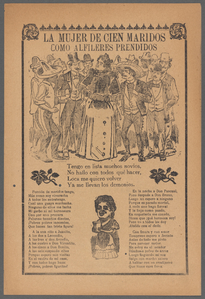
Group portrait with man in bl…
topic:
Relief
(Sculpture)…
Group portrait with man in bl…
topic:
Relief
(Sculpture)…
Topographical map made from s…
note:
Relief
shown by contours.
Map of the country between th…
note:
Relief
shown by hachures.
Hydrographic map of the Chain…
abstract:
Relief
shown by hypsometric tints, bathymetric
Campaign map of the Departmen…
abstract:
….
Relief
shown by hachures
Harbor of Michigan City, Indi…
note:
Relief
shown by hachures; depths
m
Czestochowa (1958): nayer tsu…
Montana territory
abstract:
…, D.C.
Relief
shown
m
A topographical map of Lincol…
note:
Relief
shown by hachures.
Map of the United States and …
note:
Relief
shown by hachures.
A map of part of Rhode Island…
note:
Relief
shown by hachures.
m
Map of Washington County, New…
abstract:
…, etc.
Relief
shown
m
Topographical map of Union Co…
note:
Relief
shown by hachures.
Plan of Boston and its vicini…
note:
Relief
shown by hachures and spot heights.
Map of the boundary between t…
note:
Relief
shown by hachures.
Plan of Gettysburg with the b…
abstract:
… of national cemetery.
Relief
Eastern Virginia showing the …
abstract:
….
Relief
shown by hachures
m
Lloyd's topographical map of …
note:
Relief
shown by hachures. Depths in New
Aqueduct Commissioners topogr…
note:
Relief
shown by contours and spot heights.
Map of the Patuxent & St. Mar…
abstract:
Relief
shown by hachures, depths shown
Leavitt's map with views of t…
note:
Relief
shown pictorially.
Plan of the siege of Charlest…
abstract:
… Point.
Relief
shown
Preliminary Chart of entrance…
abstract:
Relief
shown by hachures. Depths shown
Map of the Western Territory …
note:
Relief
shown by hachures.
Topographical map of Fairmoun…
abstract:
Relief
shown by contours and spot heights
A map of the Creek territory …
abstract:
Relief
shown by hachures. Prime meridian
m
Letter to --
abstract:
… looking towards the
relief
Map of the state of New York …
note:
Relief
shown by hachures.
County and township map of Ar…
abstract:
….
Relief
shown by hachures
Map of Byram River from its m…
note:
Relief
shown by hachures.
Map of the seat of war to acc…
note:
Relief
shown by hachures.
A map of a portion of the Ind…
note:
Relief
shown by hachures.
Map of the Sea Coast of Monmo…
note:
Relief
shown by contours. Depths shown
Map of the Black and Grand pr…
abstract:
… at Oklahoma border.
Relief
Map of Sullivan County, New Y…
note:
Relief
shown by hachures.
Colton's new topographical ma…
abstract:
… of the coast.
Relief
shown
Map of Massachusetts, Connect…
note:
Relief
shown pictorially.
Map of a part of Washington T…
abstract:
Relief
shown by hachures. Includes township
A new plan of ye great town o…
abstract:
Relief
shown pictorially. Oriented
m
Topographical map of the Dist…
note:
Relief
shown by contours. Depths shown
Rochester and Ontario beach q…
note:
Relief
shown by contours and spot heights
Geological section along the …
note:
Some
relief
shown pictorially.
m
Map of the state of Minnesota…
abstract:
….
Relief
shown by hachures.
Plan No. 3 : Milwaukee Harbor…
abstract:
Relief
shown by hachures. North oriented
Military map refering to the …
abstract:
Relief
shown by hachures. Shows battle
Sectional map of Colfax and M…
abstract:
… and coal veins.
Relief
North western America : showi…
abstract:
… settlements.
Relief
shown
m
Map of Albany County, New Yor…
abstract:
Relief
shown by hachures. Shows landowners
m
Map of lands belonging to the…
note:
Relief
shown by hachures.
1
2
…
16
17
18
19
20
21
22
23
24
25
Previous
Next
1
2
…
16
17
18
19
20
21
22
23
24
25
Previous
Next