Click to visit the main New York Public Library Homepage
The New York Public Library
Digital Collections
About Digital Collections
Browse
Search only public domain materials
Items
Collections
Divisions
Home
Search
Browse
About
Search only public domain materials
Items
Collections
Divisions
Digital Collections
Using Images
Using Data
Search
Keyword search
Show filters
Hide filters
Show Only Public Domain
topic
Flowers
492
Parks
468
Fires
369
History
324
Public figures
281
More
Less
name
L. Prang & Co
1298
Soule, John P
629
Swope, Martha
276
Buttolph, Frank, 1850-1924
233
Friedman-Abeles (Firm)
165
More
Less
collection
Robert N. Dennis collection of stereoscopic views
2472
Publisher's proofs of the publications of L. Prang & Co., and scrapbooks of colored advertising cards, published by L. Prang & Co. and other firms
1288
Wallach Division Picture Collection
1095
Maps of North America
422
Print Collection portrait file
281
More
Less
place
Massachusetts
2415
Boston (Mass.)
1839
Boston
1497
United States
1024
New York (State)
410
More
Less
genre
Photographs
3771
Stereographs
2472
Prints
1291
Proofs
1259
Greeting cards
677
More
Less
publisher
L. Prang & Co
1289
John P. Soule
242
Detroit Publishing Company
192
B. Whidden
163
Walter Jacobs
162
More
Less
division
Wallach Division: Photography Collection
3083
Wallach Division: Print Collection
1781
Wallach Division: Picture Collection
801
Manuscripts and Archives Division
678
Map Division
583
More
Less
type
still image
8175
text
1607
cartographic
595
notated music
451
moving image
82
More
Less
Date Range
to
Looking for this collection?
Publisher's proofs of the publications of L. Prang & Co., and scrapbooks of colored advertising cards, published by L. Prang & Co. and other firms
1,808 items
10,268 results found for:
boston
Sort by:
Relevance
Title
Date created
Date digitized
Sequence
Results 1501 - 1550
Sketch map of Pascataway, Mai…
Topographical map of Monadnoc…
The lake country of New Hamps…
Crawford's map of the White M…
note:
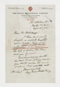
… Water Street,
Boston
Map of New England with adjac…
note:
Includes inset "15 miles around
Boston
."…
Maine
note:
….
Boston
, 1835. p. 183.
Map of Bar Harbor, Maine, 1896
Map of the White Mountains of…
Path map of the eastern part …
Map of Long Island Sound show…
Geo. W. Eldridge's chart B: N…
m
Watson's new topographical, t…
note:
Insets: Hartford -- Springfield --
Boston
.
Historical maps of Sanbornton
Historical map of Sanbornton
Mount Desert [Island] via
Boston
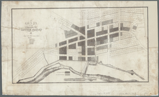
Plan of Suffolk Street Distri…
Boston
Harbor, Massachusetts
note:
Covers
Boston
Bay and adjacent water and land
Plan of Church St. district: …
Plan of
Boston
note:
Shows
Boston
city wards, roads, railroads
Map of parts of
Boston
Harbor and its
Boston
and surroundings
note:
Shows township boundaries,
Boston
city wards
Plan of
Boston
note:
… of South
Boston
. [Scale
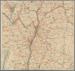
Map of the city of
Boston
and vicinity
note:
… by City of
Boston
.
Plan of
Boston
note:
… of East
Boston
. [Scale
Plan of
Boston
note:
… of South
Boston
. [Scale
Map of the city of
Boston
and vicinity
Map of
Boston
for 1874
note:
… to
Boston
since 1865.
Map of
Boston
note:
Inset: Plan of East
Boston
, 1872.
Map of
Boston
note:
Inset: Plan of East
Boston
, 1873.
Map of
Boston
for 1876
note:
… expressly for the
Boston
almanac &
Boston
directory."…
Railroad map of New England &…
note:
Inset:
Boston
& vicinity showing the Grand
Sketch of the states of Massa…
Map of the village at Little …
note:
Purchase;
Boston
Rare Maps, 88 High
Map of New England
Telegraph and rail road map o…
note:
Inset: Map of
Boston
showing
Road map of the Albany-Troy d…
note:
….,
Boston
."…
Smith's rail road, steam boat…
note:
Inset maps: 15 miles around
Boston
m
Watson's new county and railr…
Map of the city of
Boston
and vicinity
note:
… in
Boston
.
Plan of the town of Lowell an…
Map of Taunton: [Massachusett…
A plan of the salt marsh and …
Charles River embankment, sec…
note:
… the Charles River in
Boston
.
… for the New York and
Boston
Inland Railroad,
Boston
Map of
Boston
for 1887
Map of
Boston
for 1888
note:
…"Published expressly for the
Boston
Map of
Boston
for 1889
m
A map of the most inhabited p…
note:
… of
Boston
Harbor from
Plan of the town of
Boston
topic:
Bunker Hill, Battle of,
Boston
, Mass
Map of the town of Roxbury
note:
Reprint. Originally published: [
Boston
: Eng'd
1
2
…
4
5
6
7
8
9
10
11
…
41
42
Previous
Next
1
2
…
4
5
6
7
8
9
10
11
…
41
42
Previous
Next