Click to visit the main New York Public Library Homepage
The New York Public Library
Digital Collections
About Digital Collections
Browse
Search only public domain materials
Items
Collections
Divisions
Home
Search
Browse
About
Search only public domain materials
Items
Collections
Divisions
Digital Collections
Using Images
Using Data
Search
Keyword search
Show filters
Hide filters
Show Only Public Domain
topic
Real property
9284
Fire insurance
5282
Cities & towns
5016
City planning
1101
Social conditions
943
More
Less
name
Sanborn Map Company
5099
G.W. Bromley & Co
2477
New York (N.Y.). City Planning Commission
980
M.I.T. Press
942
Bromley, George Washington
789
More
Less
collection
Atlases of New York City
11722
Maps of New York City and State
2059
Atlases of the United States
987
Maps of North America
942
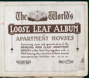
The World's loose leaf album of apartment houses: containing views and ground plans of the principal high class apartment houses in New York City, together with a map showing the situation of these houses, transportation facilities, etc
304
More
Less
place
New York (State)
11880
New York
5364
New York (N.Y.)
3292
Manhattan (New York, N.Y.)
2373
Brooklyn (New York, N.Y.)
1216
More
Less
genre
Maps
15968
Atlases
940
Cadastral maps
468
Photographs
319
Floor plans
304
More
Less
publisher
Sanborn Map Company
5145
G.W. Bromley & Co
2297
MIT Press
942
E. Belcher Hyde
689
E. Robinson Co
343
More
Less
division
Map Division
15831
Milstein Division
344
Wallach Division: Print Collection
128
Manuscripts and Archives Division
119
Rare Book Division
45
More
Less
type
cartographic
15018
still image
1559
text
848
moving image
1
sound recording
1
Date Range
to
Looking for one of these collections?
Atlases of New York City
11,722 items
Maps of New York City and State
2,059 items
The World's loose leaf album of apartment houses: containing views and ground plans of the principal high class apartment houses in New York City, together with a map showing the situation of these houses, transportation facilities, etc.
304 items
16,769 results found for:
new york city map
Sort by:
Relevance
Title
Date created
Date digitized
Sequence
Results 15001 - 15050
Part of the
city
of Honolulu, Oahu H.I.
use:
… partner (e.g.,
New
York
Guide
map
of the best and shortest
use:
… partner (e.g.,
New
York
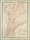
Colton's
map
of the county of Westchester
use:
… partner (e.g.,
New
York
… & township
map
of the State of
New
York
, with parts
use:
… partner (e.g.,
New
York
m
Map
of Madison County, Tenn. …
use:
… partner (e.g.,
New
York
Outline
map
of Massachusetts
use:
… partner (e.g.,
New
York
Map
of Boston and vicinity
use:
… partner (e.g.,
New
York
Map
of Boston for 1876
use:
… partner (e.g.,
New
York
Vermont, from actual survey :…
use:
… partner (e.g.,
New
York
m
… of the
city
and suburbs
use:
… partner (e.g.,
New
York
m
Map
of Charlotte, Mecklenberg Co. N.C. …
use:
… partner (e.g.,
New
York
Plan of Boston and its vicini…
use:
… partner (e.g.,
New
York
Centennial
map
of the
city
of Charlestown
use:
… partner (e.g.,
New
York
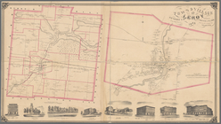
Town & Village of Leroy, Gene…
use:
… partner (e.g.,
New
York
m
… of
New
-
York
& &…
use:
… partner (e.g.,
New
York
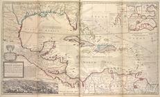
A
map
of the West-Indies or the Islands
use:
… partner (e.g.,
New
York
A
new
plan of ye
use:
… partner (e.g.,
New
York
Plan of the
city
of Philadelphia, 1876
use:
… partner (e.g.,
New
York
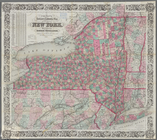
Map
of the state of
New
York
use:
… partner (e.g.,
New
York
Map
of the State of
New
York
showing
use:
… partner (e.g.,
New
York
Map
of the State of
New
York
use:
… partner (e.g.,
New
York
Map
of the state of
New
York
use:
… partner (e.g.,
New
York
… County,
New
York
; plan of Ulster County,
New
York
use:
… partner (e.g.,
New
York
m
Map
of the route of the proposed
New
York
& Erie
use:
… partner (e.g.,
New
York
State of
New
York
: in Senate Jany. 7th, 1836
use:
… partner (e.g.,
New
York
… County,
New
York
use:
… partner (e.g.,
New
York
m
… of
New
York
, 1823
use:
… partner (e.g.,
New
York
m
… of
New
York
use:
… partner (e.g.,
New
York
… of
New
York
use:
… partner (e.g.,
New
York
Plan of an extension of the v…
use:
… partner (e.g.,
New
York
Map
of the Adirondack wilderness
use:
… partner (e.g.,
New
York
Map
of the State of
New
York
use:
… partner (e.g.,
New
York
Map
of Chenango County,
New
York
use:
… partner (e.g.,
New
York
Map
of Livingston Manor anno 1714
use:
… partner (e.g.,
New
York
m
Map
of Ontario County,
New
York
use:
… partner (e.g.,
New
York
m
Map
of Dutchess County,
New
-
York
from
use:
… partner (e.g.,
New
York
Map
of the counties of Dutchess and Putnam
use:
… partner (e.g.,
New
York
Map
of the county of Westchester
use:
… partner (e.g.,
New
York
m
Map
of the Catskill Mountains
use:
… partner (e.g.,
New
York
Map
of Washington Co., Pennsylvania …
use:
… partner (e.g.,
New
York
Map
of the great pleasure route to Saratoga
use:
… partner (e.g.,
New
York
Grundriss des nördlichen Thei…
use:
… partner (e.g.,
New
York
m
Double Page Plate No. 12: Wes…
use:
… partner (e.g.,
New
York
m
Double Page Plate No. 5: Rich…
use:
… partner (e.g.,
New
York
m
Double Page Plate No. 13: Wes…
use:
… partner (e.g.,
New
York
m
Double Page Plate No. 6: Newa…
use:
… partner (e.g.,
New
York
m
Double Page Plate No. 11: Wes…
use:
… partner (e.g.,
New
York
m
Double Page Plate No. 7: Newa…
use:
… partner (e.g.,
New
York
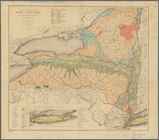
… and geologic
map
of the state of
New
York
showing
use:
… partner (e.g.,
New
York
Map
of Brooklyn at the time
use:
… partner (e.g.,
New
York
1
2
…
58
59
60
61
62
63
64
65
…
67
68
Previous
Next
1
2
…
58
59
60
61
62
63
64
65
…
67
68
Previous
Next