Click to visit the main New York Public Library Homepage
The New York Public Library
Digital Collections
About Digital Collections
Browse
Search only public domain materials
Items
Collections
Divisions
Home
Search
Browse
About
Search only public domain materials
Items
Collections
Divisions
Digital Collections
Using Images
Using Data
Search
Keyword search
Show filters
Hide filters
Show Only Public Domain
topic
Description and travel
15
Discovery and exploration
5
Angels
4
Animals
3
Indians of North America
3
More
Less
name
Ogilby, John (1600-1676)
12
Green, John, fl. 1730-1753
6
Astley, Thomas, -1839
4
Blaeu, Joan, 1596-1673
3
Blaeu, Willem Janszoon, 1571-1638
3
More
Less
collection
Africa: being an accurate description of the regions of Ægypt, Barbary, Lybia, and Billedulgerid, the land of Negroes, Guinee, Æthiopia, and the Abyssines, with all the adjacent islands ... collected and translated from most authentick authors ... by John Ogilby ..
12
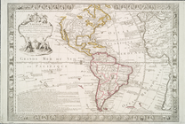
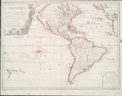
Maps of North and South America
7
Lawrence H. Slaughter Collection of English maps, charts, globes, books and atlases
5
A new general collection of voyages and travels: consisting of the most esteemed relations, which have been hitherto published in any language; comprehending everything remarkable in its kind, in Europe, Asia, Africa, and America
4
Atlases, gazetteers, guidebooks and other books
4
More
Less
place
South Africa
17
Africa
16
Islands of the Atlantic
12
Islands of the Indian Ocean
12
America
9
More
Less
genre
Maps
34
Prints
18
Illustrations
17
Books
4
Photographs
4
More
Less
publisher
Printed for T. Astley
4
Joan Blaeu
3
A. M. E. Sunday School Union
1
Anthony Iacobsz op t'Water inde Lootsman,
1
B. White and Son [etc.]
1
More
Less
division
Map Division
18
General Research Division
13
Schomburg Jean Blackwell Hutson Research and Reference Division
8
Rare Book Division
4
Schomburg Manuscripts, Archives and Rare Books Division
4
More
Less
type
cartographic
46
text
9
still image
8
Date Range
to
51 results found for:
South Africa Maps
Sort by:
Relevance
Title
Date created
Date digitized
Sequence
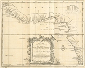
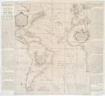
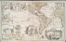
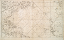
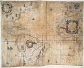
A chart of coasts of CIMBEBAS…
m
A chart of North and
South
America
note:
… of the
South
Sea to the
south
of the line & Chart of
South
A chart of North and
South
America
image:
psnypl_
map
_226
… of the eastern coast of
Africa
… of the western coast of
Africa
… of the western coast of
Africa
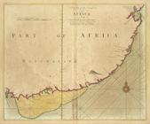
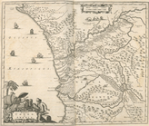
A draught of Cape Bona ESPERA…
A draught of the
south
part of
AFRICA
A general sketch of the coast…
collection:
…, in
South
Africa
, in 1816
A new and correct chart shewi…
note:
… and
South
Atlantic Oceans,
South
America, West
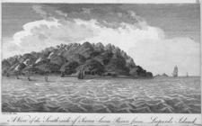
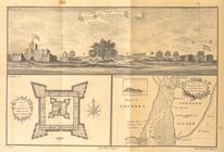
A View of the
South
side of Sierra-leone
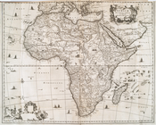
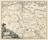
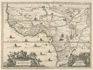
Aethipia Superior vel Interio…
collection:
Africa
: being an accurate description
m
Africa
abstract:
… on a north to
south
traverse
Africa
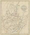
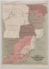
North East of the Cape Colony, Exhibiting
Africae
Accurata Tabula ex Officina
m
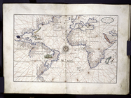
America and Europe, Atlantic …
collection:
… and
South
America, and on
Africa
, also including
America.
note:
… and earlier
maps
as a penisula
m
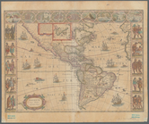
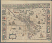
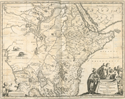
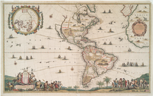
Americae nova tabula
note:
… and
South
America
m
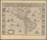
Americae nova tabula
note:
… and
Africa
in the east.
m
Americae nova tabula
note:
… and
South
America
Barbaria Biledulgered o: Liby…
collection:
Africa
: being an accurate description
Carte generale de la terre : …
note:
… America,
South
America, Europe, and
Africa
Carte nouvelle de la mer du S…
note:
…, and
Africa
.
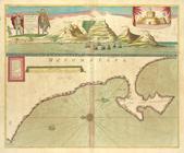
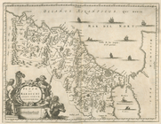
Fezzae et Marocchi Regna
Africae
Gvinea.
collection:
Africa
: being an accurate description
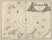
Insulae Canariae alias Fortun…
collection:
Africa
: being an accurate description
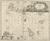
Insulae Promontori Viridis, H…
collection:
Africa
: being an accurate description
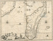
Insvla S. Lavrentii, vulgo Ma…
collection:
Africa
: being an accurate description
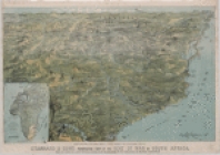
Johannesburg―the Hub of
South
Africa
L'Amerique meridionale et sep…
note:
… Hemisphere from
south
Pacific
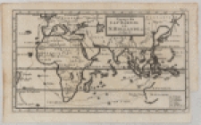
L'Amerique, ou, Le nouveau co…
note:
… and
Africa
.
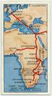
m
Map
of England -
South
Africa
route.
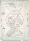
Map
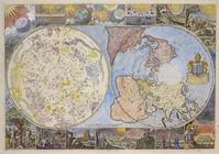
of the heavens and the earth
note:
… continents of
South
America and
Africa
].
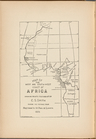
… and
South
-West Coast of
Africa
Showing Points
collection:
Map
of the West and
South
-West Coast of
Africa
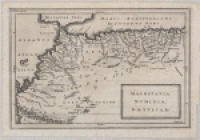
Mauretania, Numidia, Gaetulia…
note:
Map
of northwestern
Africa
, including
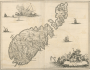
Melite Insula vulgo Masia.
collection:
Africa
: being an accurate description
m
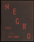
Negro anthology: 1931-1933
Nieuwe wassende Graade Zee ka…
note:
Stokes Addenda,
Maps
, C.1690-
Maps
-8
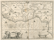
Nigritarum Regio.
collection:
Africa
: being an accurate description
Nova Aegypti Tabula.
collection:
Africa
: being an accurate description
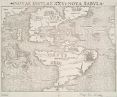
Novae insvlae XXVI nova tabvla
note:
… and
South
America
…
Africa
, van Cabo Negro
collection:
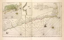
Pas-kaarte van de Zuyd-west-kust van
Africa
, van
Regna Congo et Angola.
collection:
Africa
: being an accurate description
m
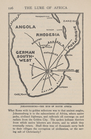
South
and Central
Africa
South
prospect
… of war in
South
Africa
note:
Inset:
map
of
Africa
.
The Graphic
map
of
South
-Central
Africa
m
The Story of
Africa
South
of the Sahara
Voyage du Captaine Dampier a …
note:
…
Africa
and around
West-Indische paskaert: waer …
note:
… of southern
South
Africa
.