

- The Library Shop
- Privacy Policy
- Rules and Regulations
- Using the Internet
- Website Terms and Conditions
- Gifts of Materials to NYPL
-
© The New York Public Library, 2024
The New York Public Library is a 501(c)(3) | EIN 13-1887440
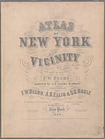
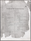
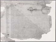
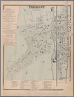
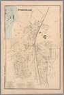
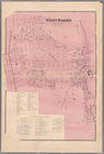
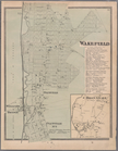
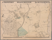
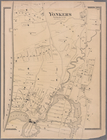
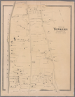
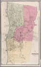
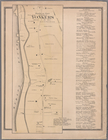
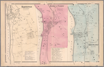
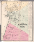
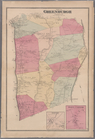
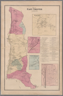
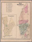
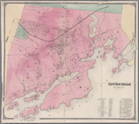
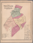
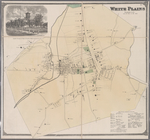
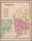
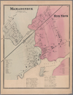
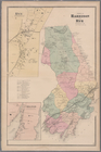
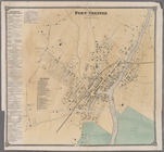
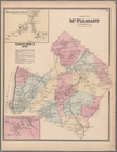
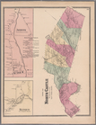
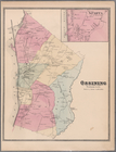
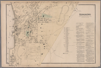
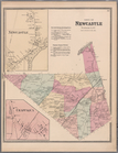
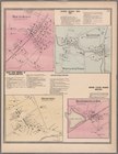
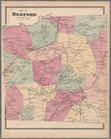
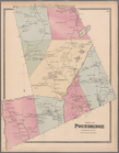
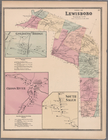
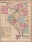
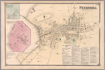
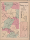
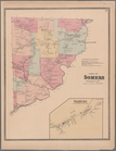
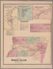
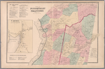
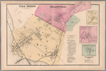
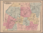
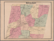
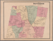
This group of maps includes the extent of NYPL's holding of real estate maps by William Perris (d.1862), the English-trained civil engineer and surveyor who originated the format. The Perris maps depict Manhattan and Brooklyn in the 1850s-1860s, when the two boroughs were still separate cities; their sequencing replicates their original published volumes. Commonly called "fire insurance maps," these maps show streets, blocks, tax lots, and current use classifications; they also indicate locations of former streams and related natural features, earlier roads, previous land uses, lot lines, and more. Other makers or publishers over time include Hyde, Hopkins, Bromley, and the most recent and prolific, Sanborn. Today, "Sanborn" has become shorthand for "fire insurance map" to a wide range of map users in local government and the real estate, hazard insurance and related industries, throughout the nation and the world.
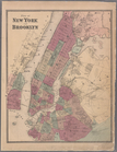
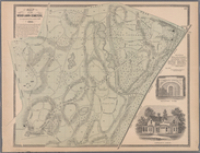
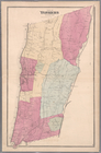
Other maps in this digital presentation include aerial maps of New York City from 1924, topographical surveys of Central Park, and atlases covering the Bronx, Long Island, Queens, and Staten Island.
Digitization of the "fire insurance" group of maps was made possible by a grant from METRO (Metropolitan New York Library Council).
The New York City conflagration of 1835, which destroyed 20 million dollars worth of property and bankrupted many small insurance companies, brought about substantial changes in the way insured property was identified and described; the Perris maps were one of the results. Beginning with Perris's earliest productions, the format of the maps has stayed relatively constant, measuring slightly smaller than 2 x 3 ft., bound or in single sheets. Uniquely, NYPL's Perris map collection contains manuscript notations from previous owners, which possibly include a real estate office. These notations appear as slips of paper pasted to the maps or as direct handwritten revisions; often they indicate multiple house numbers, showing when and where renumbering took place.
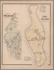
Both Brooklyn and Manhattan of the 1850s are of substantial interest to the entire metropolitan region as the two boroughs are the locus of many early homesteads, prominent family domiciles and leading businesses important for the study of the history of New York City and its other boroughs as well as the surrounding suburbs in New York and adjacent states. Local historians, architects, archaeologists and urban planners are all avid users of historical maps of New York City at the block and lot level. They use the maps to research the history of particular buildings and neighborhoods, for purposes of social history and design as well as for ecological and engineering reasons. Sometimes the maps speak directly about the histories of the companies or homes documented, and sometimes they facilitate research more obliquely.
For practical reasons, developers and architects are eager to learn why there is water in their new building site, and using these maps they can determine that an underground stream is the problem, or perhaps an old swamp or wetland area, such as that which Canal Street, once a canal, was built to drain. Cemeteries long ago built over are locatable; and brownstone owners can determine that yes, wooden porches did grace the back of the row houses on their block. Scholars also find the maps support their historical detective-work, confirming folklore or triangulating multiple and potentially conflicting accounts.
Hoehn, R. Philip, W. S. Peterson-Hunt and E. L. Woodruff. Union List of Sanborn Fire Insurance Maps Held by Institutions in the United States and Canada. (c1976-1977) V. 1. Alabama to Missouri --V. 2. Montana to Wyoming; Canada and Mexico. Occasional paper; \no.2-3; Occasional paper (Western Association of Map Libraries); no. 2.
Oswald, Diane L. Fire Insurance Maps: Their History and Applications. (c1997)
Sanborn Map Company. Fire Insurance Maps from the Sanborn Map Company Archives: New York City Late 19th Century to 1990; A Microfilm Project of University Publications of America. (c1997) Research Collections in Urban History and Urban Studies.