Click to visit the main New York Public Library Homepage
The New York Public Library
Digital Collections
About Digital Collections
Browse
Search only public domain materials
Items
Collections
Divisions
Home
Search
Browse
About
Search only public domain materials
Items
Collections
Divisions
Digital Collections
Using Images
Using Data
Collections
Charting America: Maps from the Lawrence H. Slaughter Collection and Others
Charting America: Maps from the Lawrence H. Slaughter Collection and Others
Navigation
Filters
Charting America: Maps from the Lawrence H. Slaughter Collection and Others
Previous
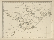
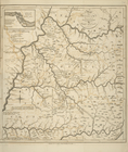
The south part of Virginia, now the north part of Carolina
0
Atlases, gazetteers, guidebooks and other books
377
Maps of the World
16
Maps of the Oceans
24
Maps of North and South America
23
Maps of North America.
551
Maps of New York City and State
1340
Lawrence H. Slaughter Collection of English maps, charts, globes, books and atlases
1020
John H. Levine Collection
60
More
Show filters
Hide filters
Show Only Public Domain
topic
Geography
26
History
2
name
x
Morse, Jedidiah, 1761-1826
Stockdale, John, 1749?-1814
27
Mutlow, I
2
Thomas & Andrews
2
Allen, George, active 1790-1821
1
More
Less
collection
Lawrence H. Slaughter Collection of English maps, charts, globes, books and atlases
29
Maps of North and South America
1
place
United States
26
America
2
Delaware
2
Georgia
2
Maryland
2
More
Less
genre
Maps
28
Prints
1
Title pages
1
publisher
Printed for J. Stockdale
26
At the Presses of S. Hall, and Thomas & Andrews, and sold by E. Larkin, and the other booksellers in Boston; by Gaine & Ten Eyck, and S. Campbell, New-York; [etc.,etc.]
2
Published ... by I. Stockdale, Piccadily,
1
Richardson & Lord?
1
division
Map Division
30
type
cartographic
29
text
1
Date Range
to
30 results found for:
x
America
Filtering on:
x
Name
: Morse, Jedidiah, 1761-1826
Sort by:
Relevance
Title
Date created
Date digitized
Sequence
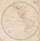
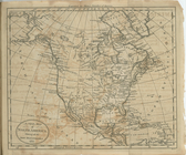
Western Hemisphere.
collection:
Maps of North and South
America
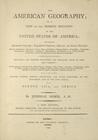
The American geography ... , …
collection:
… of the United States of
America
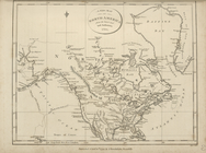
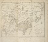
A new map of North
America
from the latest
A new map of Upper and Lower …
collection:
… of the United States of
America
A new map of Nova Scotia, New…
collection:
… of the United States of
America
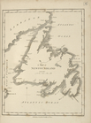
A map of Newfoundland.
collection:
… of the United States of
America
… dominions in North
America
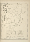
A map of Vermont.
collection:
… of the United States of
America
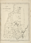
A map of New Hampshire.
collection:
… of the United States of
America
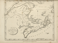
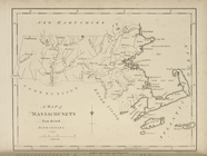
A map of Massachusets [sic] f…
collection:
… of the United States of
America
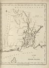
A map of Rhode Island.
collection:
… of the United States of
America
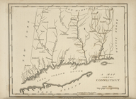
A map of Connecticut.
collection:
… of the United States of
America
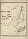
A map of the State of New Yor…
collection:
… of the United States of
America
A map of New Jersey : from th…
collection:
… of the United States of
America
A map of Pennsylvania, from t…
collection:
… of the United States of
America
A map of the states of Virgin…
collection:
… of the United States of
America
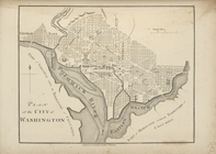
Plan of the city of Washingto…
collection:
… of the United States of
America
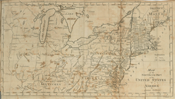
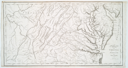
Map of Virginia, Maryland and…
collection:
… of the United States of
America
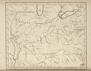
A map of the Back Settlements.
collection:
… of the United States of
America
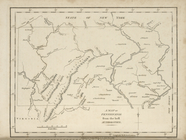
A map of Kentucky, drawn from…
collection:
… of the United States of
America
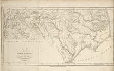
A map of North Carolina, from…
collection:
… of the United States of
America
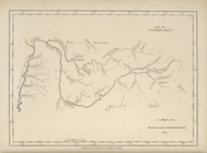
A map of the Tennessee Govern…
collection:
… of the United States of
America
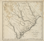
A map of South Carolina, from…
collection:
… of the United States of
America
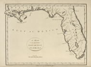
A map of the East and West Fl…
collection:
… of the United States of
America
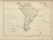
A map of South
America
and the adjacent
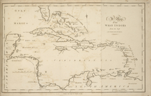
A map of the West Indies, fro…
collection:
… of the United States of
America
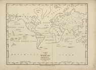
A map of the world, exhibitin…
collection:
… of the United States of
America
A new map of North
America
shewing all
… States of
America
Map of Virginia, Maryland and…
note:
Phillips. Maps of
America
, 985
End of results
|
Top