Click to visit the main New York Public Library Homepage
The New York Public Library
Digital Collections
About Digital Collections
Browse
Search only public domain materials
Items
Collections
Divisions
Home
Search
Browse
About
Search only public domain materials
Items
Collections
Divisions
Digital Collections
Using Images
Using Data
Collections
Charting America: Maps from the Lawrence H. Slaughter Collection and Others
Charting America: Maps from the Lawrence H. Slaughter Collection and Others
Navigation
Filters
Charting America: Maps from the Lawrence H. Slaughter Collection and Others
Previous
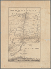
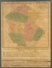
The south part of Virginia, now the north part of Carolina
0
Atlases, gazetteers, guidebooks and other books
377
Maps of the World
16
Maps of the Oceans
24
Maps of North and South America
23
Maps of North America.
551
Maps of New York City and State
1340
Lawrence H. Slaughter Collection of English maps, charts, globes, books and atlases
1020
John H. Levine Collection
60
More
Show filters
Hide filters
Show Only Public Domain
topic
City planning
122
Administrative and political divisions
118
Local transit
103
Railroads
96
Piers
77
More
Less
name
New York (N.Y.). Common Council
90
Valentine, D. T. (David Thomas), 1801-1869
32
Burr, David H., 1803-1875
22
Ohman, August R
21
Rand McNally and Company
19
More
Less
collection
x
Maps of New York City and State
place
x
New York (N.Y.)
New York (State)
403
Manhattan (New York, N.Y.)
311
New York
223
Brooklyn (New York, N.Y.)
75
More
Less
genre
Maps
606
Manuscript maps
36
Cadastral maps
24
Aerial views
9
Topographic maps
5
More
Less
publisher
publisher not identified
16
s.n
15
G.W. & C.B. Colton & Co
14
Museum of the American Indian, Heye Foundation
12
producer not identified
10
More
Less
division
Map Division
608
Manuscripts and Archives Division
1
type
cartographic
604
still image
11
text
10
Date Range
to
609 results found for:
x
Maps?tab=filter
Filtering on:
x
Place
: New York (N.Y.)
x
Collection
: Maps of New York City and State
Sort by:
Relevance
Title
Date created
Date digitized
Sequence
A
map
of the State of New York : exhibiting
note:
Map
printed on 4 sheets, pieced together.
Distance
map
of the state of New York
note:
… of the
map
.
m
Map
of New York exhibiting the post offices
note:
LC Railroad
maps
, 259
m
Map
of the route of the proposed New York & Erie
note:
…
maps
.
Map
of the state of New York : showing
note:
… to Early
Maps
of the Middle
Map
of the state of New York : showing
note:
… to Early
Maps
of the Middle
Map
of the state of New York : showing
note:
… to Early
Maps
of the Middle
Map
of the state of New York : with parts
note:
… to Early
Maps
of the Middle
Map
of the state of New York with part
note:
Creek, A.
Maps
of the Genesee Valley & Finger
Map
of the state of New York
note:
… to Early
Maps
of the Middle
m
Map
of the state of New-York : with parts
note:
… to Early
Maps
of the Middle
New-York
note:
… to Early
Maps
of the Middle
New-York
note:
… to Early
Maps
of the Middle
The Empire State, New York : …
note:
… to Early
Maps
of the Middle
Distance
map
of the state of New York
note:
Prime meridian on
map
: Washington
Map
of the State of New-York exhibiting
note:
…. Leventhal
Map
Center website
m
Asher & Adams' new topographical
map
of the state
note:
Mapping
the Nation (NEH grant, 2015-2018)…
m
Map
of the state of New-York
note:
Mapping
the Nation (NEH grant, 2015-2018)…
m
The State of New York: from n…
note:
…: Meteorological
map
of the state
m
The State of New York: from n…
note:
…: Meteorological
map
of the state
m
The State of New York: from n…
note:
…: Meteorological
map
of the state
Map
of New Netherland with a view of New
note:
Title in English;
map
in Dutch.
A
map
of the eastern part
note:
… to Early
Maps
of the Middle
A
map
of the eastern part
note:
Jolly, D.C.
Maps
of America in periodicals
Map
and profile of the Champlain Canal as made from
note:
… to Early
Maps
of the Middle
Map
of the counties of Dutchess and Putnam
note:
… to Early
Maps
of the Middle
Map
of part of New York State between
note:
… to Early
Maps
of the Middle
Van Der Donck's
map
of New Netherland, 1656
note:
In lower left corner of
map
: E
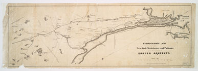
Hydrographic
map
of the counties of New-York
note:
… to Early
Maps
of the Middle
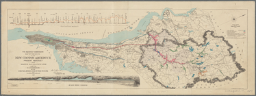
Map
of the route of the new Croton Aqueduct
note:
Mapping
the Nation (NEH grant, 2015-2018)…
Map
of Hudson's River, with the adjacent
note:
… to Early
Maps
of the Middle
m
An improved
map
of the Hudson River
note:
Variant of Phillips.
Maps
of America, 325
m
Hudson River & vicinity
note:
… to Early
Maps
of the Middle
Map
of the Hudson River from Newburgh
note:
NYPL. Dictionary catalog of the
Map
m
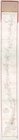
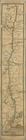
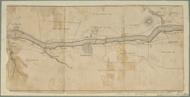
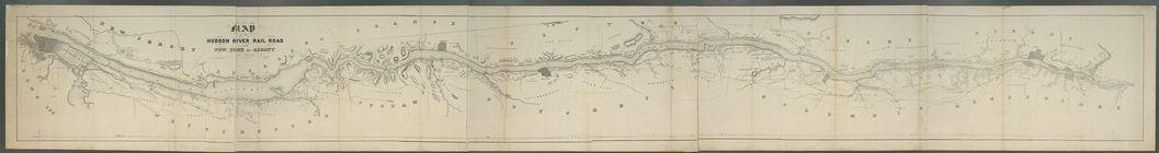
Map
of the Hudson River Rail Road from New
note:
… to Early
Maps
of the Middle
m
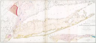
Geological
map
of Long & Staten islands
note:
Includes inset "
Map
of New-York Island."…
Long Island Sound from New Yo…
note:
Copy in
Map
Div. 97-682: Mercator Society
m
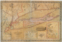
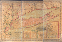
Map
of Long Island with the environs of New-York
note:
… to Early
Maps
of the Middle
m
Map
of Long Island with the environs of New-York
note:
… to Early
Maps
of the Middle
m
Map
of Dutchess County, New-York from
note:
… to Early
Maps
of the Middle
Map
of the county of Sullivan
note:
At head of the
map
: No. 10.
Map
of the county of Westchester
note:
… to Early
Maps
of the Middle
Albany
note:
… to Early
Maps
of the Middle
The Fort of Albany
note:
… to Early
Maps
of the Middle
m
Map
of the city of Albany
note:
… to Early
Maps
of the Middle
Map
of the city of Albany
note:
… to Early
Maps
of the Middle
m
Map
of the city of Albany
note:
… to Early
Maps
of the Middle
Albany Rural Cemetery
note:
… to Early
Maps
of the Middle
Map
of lots in the 5th ward of the city
note:
… to Early
Maps
of the Middle
Map
of the village of Hermannville, Town of Islip
note:
Inset:
Map
of Long Island, 1850.
1
2
3
Previous
Next
1
2
3
Previous
Next