Click to visit the main New York Public Library Homepage
The New York Public Library
Digital Collections
About Digital Collections
Browse
Search only public domain materials
Items
Collections
Divisions
Home
Search
Browse
About
Search only public domain materials
Items
Collections
Divisions
Digital Collections
Using Images
Using Data
Collections
Charting America: Maps from the Lawrence H. Slaughter Collection and Others
Charting America: Maps from the Lawrence H. Slaughter Collection and Others
Navigation
Filters
Charting America: Maps from the Lawrence H. Slaughter Collection and Others
Previous
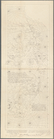
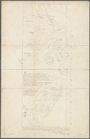
The south part of Virginia, now the north part of Carolina
0
Atlases, gazetteers, guidebooks and other books
377
Maps of the World
16
Maps of the Oceans
24
Maps of North and South America
23
Maps of North America.
551
Maps of New York City and State
1340
Lawrence H. Slaughter Collection of English maps, charts, globes, books and atlases
1020
John H. Levine Collection
60
More
Show filters
Hide filters
Show Only Public Domain
topic
Real property
24
Railroads
16
Landowners
15
Administrative and political divisions
13
Canals
5
More
Less
name
Gavit, John E., 1817-1874
3
American Photo-Lithographic Company
2
Brodhead, John Romeyn, 1814-1873
2
Haffen, Louis F., 1854-1935
2
New York, Ontario, and Western Railway Co
2
More
Less
collection
Maps of New York City and State
72
place
New York (State)
58
New York
17
Brooklyn (New York, N.Y.)
16
New York (N.Y.)
7
Bronx (New York, N.Y.)
6
More
Less
genre
Maps
72
Cadastral maps
22
Manuscript maps
5
Facsimiles
3
Early maps
2
More
Less
publisher
x
publisher not identified
Heffron & Phelps litho
1
Lith of R.H. Pease
1
Lith. by Berggoetz & Co
1
Robert A. Welcke, Photo-Lith
1
More
Less
division
Map Division
72
type
cartographic
72
text
1
Date Range
to
72 results found for:
x
North Hempstead (N.Y. : Town) -- Maps?tab=filter
Filtering on:
x
Publisher
: publisher not identified
Sort by:
Relevance
Title
Date created
Date digitized
Sequence
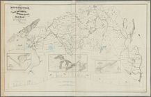
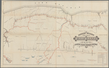
Map
of the rail roads of the state
note:
Also shows counties, principal cities and
towns
Map
of the rail roads of the State
note:
Mapping
the Nation (NEH grant, 2015-2018)…
Engineers
map
of the state of New York
note:
Map
within decorative border.
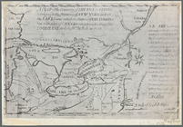
Map
of New Netherland which was annexed
note:
Map
signed by "The Hague, 27th July, 1841
Map
of New Netherland
note:
… the original
map
deposited by M
A
map
of the countrey of the Five
note:
Mapping
the Nation (NEH grant, 2015-2018)…
Map
of New York, New England
note:
Photocopy of a manuscript
map
, hand colored.
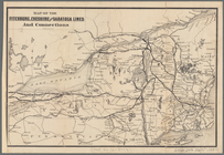
Map
of the Fitchburg, Cheshire
note:
Shows principal cities and
towns
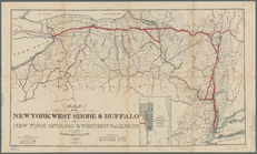
Map
of the New York West Shore & Buffalo
note:
… Wall St.,
N.Y
.
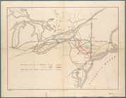
Map
showing route of the New York, Ontario
note:
Map
also shows lakes, rivers.
Map
of the great pleasure route to Saratoga
note:
Mapping
the Nation (NEH grant, 2015-2018)…
Map
of the head waters of the rivers
note:
Reduced version of the
map
lithographed
Map
showing the only all rail route
note:
Mapping
the Nation (NEH grant, 2015-2018)…
A
map
of a tract of land in the State
note:
Mapping
the Nation (NEH grant, 2015-2018)…
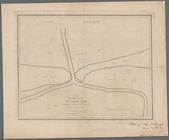
Map
of the mouth of big Sandy Creek
note:
Mapping
the Nation (NEH grant, 2015-2018)…
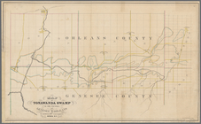
Map
of Tonawanda Swamp in the counties
note:
…,
N.Y
. ; J. Wilson Carr
A
map
of part of the land in the Royal Grant
note:
…"Reduced one fifth from the original
map
."…
Map
of Dobbs Ferry and Hastings
note:
Map
also shows street names, roads
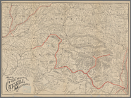
A
map
of the country between Crown
note:
Mapping
the Nation (NEH grant, 2015-2018)…
Map
of the Albany Rural Cemetery
note:
Oriented with
north
to the upper left.
Map
& profile of the Lake Ontario & Hudson
note:
Shows counties, principal cities and
towns
Western Division of the Erie Canal :
map
note:
… to Seneca county,
N.Y
.
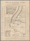
Map
of Niagara Falls, and guide table
note:
Mapping
the Nation (NEH grant, 2015-2018)…
Map
of the River Niagara and vicinity
note:
Mapping
the Nation (NEH grant, 2015-2018)…
m
Map
of Albany County, New York
note:
by Jay Gould, Roxbury
N.Y
. and I.B
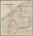
Map
of Chautauqua County,
N
.
Y
note:
… County,
N.Y
., for 1873-4, Syracuse,
N.Y
., 1873.
m
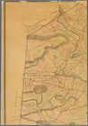
Map
of the highlands of the Hudson
note:
by James P. Kirby, E.C., Newburgh,
N.Y
Map
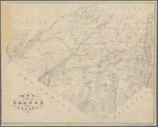
of Orange County
note:
Geological
map
Map
of Seneca Co., New York
note:
…"H.J. Ormsbee Eng. Co., Syr.,
N.Y
."…
m
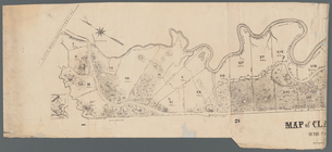
Map
of Clasons Point
note:
Mapping
the Nation (NEH grant, 2015-2018)…
Map
of part of Orange County, New York
note:
Mapping
the Nation (NEH grant, 2015-2018)…
Map
of the tertiary of Essex Co. …
note:
… catalog of the
Map
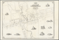
Map
of the village of Williamsville in Erie County,
N
note:
Cadastral
map
showing building
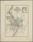
Map
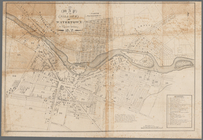
of the city of Rochester
note:
Mapping
the Nation (NEH grant, 2015-2018)…
Map
of part of
Town
of Fishkill
note:
Mapping
the Nation (NEH grant, 2015-2018)…
Map
of the water pipes in the city
note:
Mapping
the Nation (NEH grant, 2015-2018)…
Map
of the upper part of the village
note:
Mapping
the Nation (NEH grant, 2015-2018)…
… of Ogdensburgh,
N
.
Y
.
note:
Cadastral
map
showing lot numbers
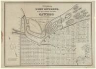
Village of Port Ontario, in the
Town
note:
Cadastral
map
showing blocks, lot
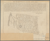
Map
of Livingston Manor anno 1714
note:
Oriented with
north
toward the lower left.
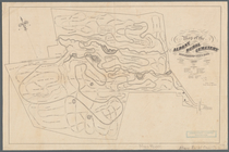
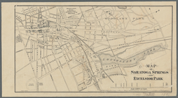
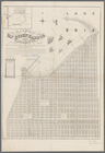
Map
of Saratoga Springs and Excelsior Park
note:
Oriented with
north
toward the upper right.
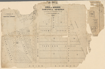
Map
of pr[op]erty of Union Avenue, Saratoga
note:
Oriented with
north
to the lower right.
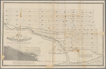
Map
of Schuylerville
note:
Map
shows blocks and lot numbers, mills
…, Chatauque Co.
N
.
Y
.
note:
Includes text, note, and inset
map
of: "Part
… County,
N
.
Y
.
note:
Map
shows townships, block and lot numbers
Map
of lots situated in the city
note:
Oriented with
north
toward the upper right.
m
Map
showing steam, cable, and horse roads
Historical sketch
map
of Kings Bridge
note:
From: History of the
town
of Kings Bridge
Map
of Highbridgeville in the
town
note:
Mapping
the Nation (NEH grant, 2015-2018)…
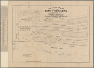
Map
of the 23rd and 24th wards of the City
note:
Oriented with
north
to the upper left of sheet.