Click to visit the main New York Public Library Homepage
The New York Public Library
Digital Collections
About Digital Collections
Browse
Search only public domain materials
Items
Collections
Divisions
Home
Search
Browse
About
Search only public domain materials
Items
Collections
Divisions
Digital Collections
Using Images
Using Data
Collections
Charting America: Maps from the Lawrence H. Slaughter Collection and Others
Charting America: Maps from the Lawrence H. Slaughter Collection and Others
Navigation
Filters
Charting America: Maps from the Lawrence H. Slaughter Collection and Others
Previous
The south part of Virginia, now the north part of Carolina
0
Atlases, gazetteers, guidebooks and other books
377
Maps of the World
16
Maps of the Oceans
24
Maps of North and South America
23
Maps of North America.
551
Maps of New York City and State
1340
Lawrence H. Slaughter Collection of English maps, charts, globes, books and atlases
1020
John H. Levine Collection
60
More
Show filters
Hide filters
Show Only Public Domain
topic
x
Nautical charts
Coasts
5
Harbors
5
Pilot guides
4
name
Blunt, Edmund M. (Edmund March), 1770-1862
6
Fisher, Joshua, 1707-1783
6
Hooker, William
6
Blunt, G. W. (George William), 1802-1878
4
Dury, Andrew
4
More
Less
collection
x
Lawrence H. Slaughter Collection of English maps, charts, globes, books and atlases
place
New York (N.Y.)
16
New Jersey
14
Delaware Bay (Del. and N.J.)
10
Delaware
8
Atlantic Coast (North America)
6
More
Less
genre
Maps
41
publisher
Pub. by E.M. Blunt for W. Hooker
4
Printed for Robt. Sayer & John Bennett, sea chart & map-sellers ..
2
Published ... by Andrew Dury, Duke's Court, St. Martins Lane
2
Published for the use of the Royal Navy of Great Britain by Joseph F. W. Des Barres
2
Rob[er]t Laurie & James Whittle, No. 53 Fleet Street
2
More
Less
division
Map Division
41
type
cartographic
41
Date Range
to
41 results found for:
x
New York (N.Y.)?tab=filter
Filtering on:
x
Collection
: 6a373d50-c5d3-012f-a6fb-58d385a7bc34
x
Topic
: Nautical charts
Sort by:
Relevance
Title
Date created
Date digitized
Sequence
A
new
generall chart for the West
use:
… partner (e.g.,
New
York
A chart of Delaware Bay and R…
use:
… partner (e.g.,
New
York
Pascaerte van Westindien : de…
use:
… partner (e.g.,
New
York
Chart of Long Island Sound, 1…
use:
… partner (e.g.,
New
York
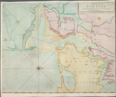
Entrance to
New
York
Bay from Sandy
use:
… partner (e.g.,
New
York
Nautical chart of Little Egg Harbour,
New
use:
… partner (e.g.,
New
York
The Bay and river of Delaware
use:
… partner (e.g.,
New
York
A
new
and accurate chart (from Captain
use:
… partner (e.g.,
New
York
A
new
and accurate
use:
… partner (e.g.,
New
York
… of the city of
New
York
use:
… partner (e.g.,
New
York
A Generall chart for the West…
use:
… partner (e.g.,
New
York
Ocean Atlantique, ou, Mer du …
use:
… partner (e.g.,
New
York
A
new
generall chart for the West
use:
… partner (e.g.,
New
York
A
New
and correct chart of the Atlantick
use:
… partner (e.g.,
New
York
A
New
generall chart for the West
use:
… partner (e.g.,
New
York
A chart of Delaware Bay and R…
use:
… partner (e.g.,
New
York
A chart of Delaware Bay and R…
use:
… partner (e.g.,
New
York
A chart of Delaware Bay and R…
use:
… partner (e.g.,
New
York
A chart of Delaware Bay and R…
use:
… partner (e.g.,
New
York
Baye de la Delaware avec les …
use:
… partner (e.g.,
New
York
Carte de la baye et riviere d…
use:
… partner (e.g.,
New
York
A chart of Delawar Bay : with…
use:
… partner (e.g.,
New
York
A chart of Delawar River from…
use:
… partner (e.g.,
New
York
The bay and river of Delaware
use:
… partner (e.g.,
New
York
A Chart of ye coast of
New
England,
New
York
use:
… partner (e.g.,
New
York
… England,
New
York
,
New
use:
… partner (e.g.,
New
York
… anders genaamt Niew
York
use:
… partner (e.g.,
New
York
Ocean Atlantique, ou, Mer du …
use:
… partner (e.g.,
New
York
…, from Sandy Hook to
New
York
: with the banks
use:
… partner (e.g.,
New
York
…, from Sandy Hook to
New
York
: with the banks
use:
… partner (e.g.,
New
York
Cours de la rivière d'Hudson …
use:
… partner (e.g.,
New
York
… to
New
York
Town.
use:
… partner (e.g.,
New
York
m
The provinces of
New
York
, and
New
use:
… partner (e.g.,
New
York
A draught of
New
York
and Perthamboy
use:
… partner (e.g.,
New
York
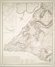
A chart of
New
York
Harbour : with the banks
use:
… partner (e.g.,
New
York
[A chart of
New
York
Island & North
use:
… partner (e.g.,
New
York
A chart of
New
York
Island & North River
use:
… partner (e.g.,
New
York
A plan of the city of
New
-
York
& its
use:
… partner (e.g.,
New
York
A plan of the city of
New
-
York
& its
use:
… partner (e.g.,
New
York
… in the Province of
New
Jersey
use:
… partner (e.g.,
New
York
Long Island Sound from
New
York
use:
… partner (e.g.,
New
York
End of results
|
Top