Click to visit the main New York Public Library Homepage
The New York Public Library
Digital Collections
About Digital Collections
Browse
Search only public domain materials
Items
Collections
Divisions
Home
Search
Browse
About
Search only public domain materials
Items
Collections
Divisions
Digital Collections
Using Images
Using Data
Collections
Charting America: Maps from the Lawrence H. Slaughter Collection and Others
Charting America: Maps from the Lawrence H. Slaughter Collection and Others
Navigation
Filters
Charting America: Maps from the Lawrence H. Slaughter Collection and Others
Previous
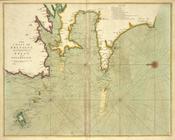
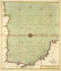
The south part of Virginia, now the north part of Carolina
0
Atlases, gazetteers, guidebooks and other books
377
Maps of the World
16
Maps of the Oceans
24
Maps of North and South America
23
Maps of North America.
551
Maps of New York City and State
1340
Lawrence H. Slaughter Collection of English maps, charts, globes, books and atlases
1020
John H. Levine Collection
60
More
Show filters
Hide filters
Show Only Public Domain
topic
Geography
35
Colonies
10
Atlases
8
Maps in education
6
Nautical charts
6
More
Less
name
Coignet, Michel, 1549-1623
27
Ortelius, Abraham, 1527-1598
27
Shawe, James
27
Thornton, Samuel
27
Moll, Herman, -1732
9
More
Less
collection
Lawrence H. Slaughter Collection of English maps, charts, globes, books and atlases
70
Atlases, gazetteers, guidebooks and other books
34
John H. Levine Collection
6
Maps of the Oceans
4
Maps of New York City and State
2
More
Less
place
France
20
North America
16
Biscay, Bay of (France and Spain)
14
America
13
Great Britain
13
More
Less
genre
Maps
117
Nautical charts
27
publisher
Printed for Ieames Shawe, and are to be solde at his shoppe nigh Ludgate,
27
... Sold ... by Tho. Bowles, print and map-seller in St. Paul's-Churchyard
8
Chapman and Hall
5
P. Goos
3
Chez Brocas
2
More
Less
division
Map Division
117
type
x
cartographic
text
1
Date Range
to
117 results found for:
x
New France?tab=filter
Filtering on:
x
Type
: cartographic
Sort by:
Relevance
Title
Date created
Date digitized
Sequence
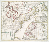
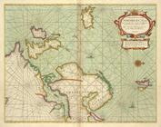
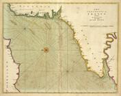
Carte du Canada ou de la Nouvelle
France
use:
… partner (e.g.,
New
York
Carte nouvelle de l'Amerique …
use:
… partner (e.g.,
New
York
Carte réduite des côtes orien…
use:
… partner (e.g.,
New
York
m
Nova tabula geographica compl…
use:
… partner (e.g.,
New
York
A
new
map of the English empire in America : …
use:
… partner (e.g.,
New
York
Nova tabula geographica compl…
use:
… partner (e.g.,
New
York
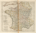
France
, divided into circles and departments
use:
… partner (e.g.,
New
York
Map of
France
, Spain, and Portugal
use:
… partner (e.g.,
New
York
Paskaert van't in comen van't…
use:
… partner (e.g.,
New
York
Paskaerte van de Bocht van Vr…
use:
… partner (e.g.,
New
York
Pas-caart van Hispangien, ver…
use:
… partner (e.g.,
New
York
Carte particulìere des pays q…
use:
… partner (e.g.,
New
York
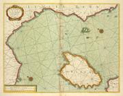
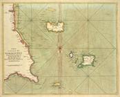
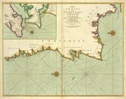
The sea coast of the Island S…
use:
… partner (e.g.,
New
York
The sea coast of ITALY from c…
use:
… partner (e.g.,
New
York
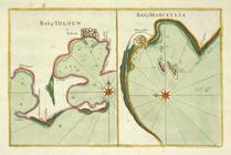
Bay of Touloun ; Bay of Marce…
use:
… partner (e.g.,
New
York
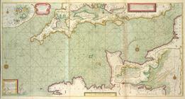
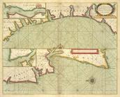
The sea coast of LANGUEDOC PR…
use:
… partner (e.g.,
New
York
… from
France
to Greene
use:
… partner (e.g.,
New
York
A
new
and correct
use:
… partner (e.g.,
New
York
The sea-coasts of
FRANCE
from Calais
use:
… partner (e.g.,
New
York
The sea-coast of
FRANCE
from Havre de
use:
… partner (e.g.,
New
York
The coast of NORMANDIE from c…
use:
… partner (e.g.,
New
York
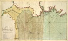
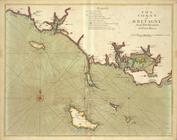
The coast of BRETAGNE from GR…
use:
… partner (e.g.,
New
York
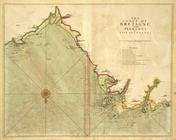
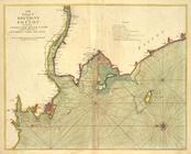
The coast of BRETAGNE from Pl…
use:
… partner (e.g.,
New
York
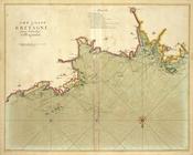
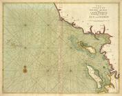
The coast of BRETAGNE from I …
use:
… partner (e.g.,
New
York
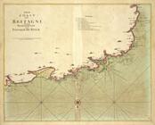
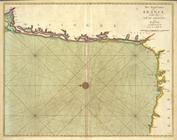
The coast of BRETAGNE from Pl…
use:
… partner (e.g.,
New
York
The coast of BRETAGNE includi…
use:
… partner (e.g.,
New
York
… of
France
at Brest
use:
… partner (e.g.,
New
York
A chart of the bay of BISCAY …
use:
… partner (e.g.,
New
York
The coast of BRETAGNE from th…
use:
… partner (e.g.,
New
York
The coast of BRETAGNE from Po…
use:
… partner (e.g.,
New
York
The coast of BRETAGNE and POI…
use:
… partner (e.g.,
New
York
The coast of POITOU AUNIS and…
use:
… partner (e.g.,
New
York
The sea coast of
FRANCE
from the Bay
use:
… partner (e.g.,
New
York
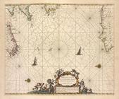
A large chart of the BAY OF B…
use:
… partner (e.g.,
New
York
The sea coast of
FRANCE
from Ushent
use:
… partner (e.g.,
New
York
The sea coasts of
FRANCE
from Olwne to Cape
use:
… partner (e.g.,
New
York
The chart of sea coasts BISCA…
use:
… partner (e.g.,
New
York
The coasts of PORTUGALL and p…
use:
… partner (e.g.,
New
York
A sea chart of part of the co…
use:
… partner (e.g.,
New
York
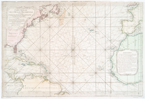
Chart of the Atlantic Ocean, …
use:
… partner (e.g.,
New
York
Carte réduite de l'Ocean occi…
use:
… partner (e.g.,
New
York
Tableau des courants observés…
use:
… partner (e.g.,
New
York
Carte reduite des mers compri…
use:
… partner (e.g.,
New
York
…
France
, que d'Espagne l
use:
… partner (e.g.,
New
York
France
, divided into military governments
use:
… partner (e.g.,
New
York
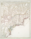
… of Richmond,
New
York City
use:
… partner (e.g.,
New
York
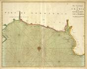
Carte de la Nouvelle
France
use:
… partner (e.g.,
New
York
A
new
map of ye
use:
… partner (e.g.,
New
York
Le Canada, ou Nouvelle
France
, la Floride
use:
… partner (e.g.,
New
York
North America from the French…
use:
… partner (e.g.,
New
York