Click to visit the main New York Public Library Homepage
The New York Public Library
Digital Collections
About Digital Collections
Browse
Search only public domain materials
Items
Collections
Divisions
Home
Search
Browse
About
Search only public domain materials
Items
Collections
Divisions
Digital Collections
Using Images
Using Data
Collections
Charting America: Maps from the Lawrence H. Slaughter Collection and Others
Charting America: Maps from the Lawrence H. Slaughter Collection and Others
Navigation
Filters
Charting America: Maps from the Lawrence H. Slaughter Collection and Others
Previous
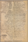
The south part of Virginia, now the north part of Carolina
0
Atlases, gazetteers, guidebooks and other books
377
Maps of the World
16
Maps of the Oceans
24
Maps of North and South America
23
Maps of North America.
551
Maps of New York City and State
1340
Lawrence H. Slaughter Collection of English maps, charts, globes, books and atlases
1020
John H. Levine Collection
60
More
Show filters
Hide filters
Show Only Public Domain
topic
Administrative and political divisions
340
Railroads
316
Real property
301
Landowners
215
Geography
157
More
Less
name
New York (N.Y.). Common Council
99
Moll, Herman, -1732
81
Sayer, Robert, 1725-1794
80
Dunn, Samuel, d. 1794
76
Colles, Christopher, 1738-1816
54
More
Less
collection
Maps of New York City and State
2004
Lawrence H. Slaughter Collection of English maps, charts, globes, books and atlases
382
Atlases, gazetteers, guidebooks and other books
124
John H. Levine Collection
28
Maps of North and South America
8
More
Less
place
New York (State)
1295
New York (N.Y.)
628
New York
524
Manhattan (New York, N.Y.)
341
Brooklyn (New York, N.Y.)
266
More
Less
genre
Maps
2488
Cadastral maps
183
Manuscript maps
71
Aerial views
30
Topographic maps
29
More
Less
publisher
publisher not identified
118
Printed for Robert Sayer, No. 53, Fleet-Street
76
Printed for Timothy Childe at the White Hart at the West-end of St. Paul's Church-yard
46
s.n
41
S. A. Mitchell, jr
34
More
Less
division
Map Division
2552
Manuscripts and Archives Division
2
type
cartographic
2478
text
83
still image
36
Date Range
to
2,554 results found for:
New York (State)?tab=filter
Sort by:
Relevance
Title
Date created
Date digitized
Sequence
Results 1251 - 1300
m
… of the
state
of
New
York
use:
… partner (e.g.,
New
York
m
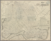
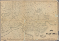
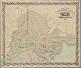
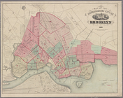
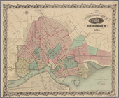
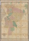
Map of the city of Brooklyn 1…
use:
… partner (e.g.,
New
York
Map of property situated in t…
use:
… partner (e.g.,
New
York
m
Map of property situated in t…
use:
… partner (e.g.,
New
York
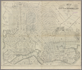
Map of the consolidated city …
use:
… partner (e.g.,
New
York
Map of the consolidated city …
use:
… partner (e.g.,
New
York
m
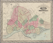
Map of the city of Brooklyn
use:
… partner (e.g.,
New
York
m
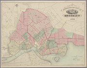
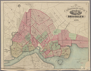
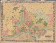
Map of Brooklyn and vicinity
use:
… partner (e.g.,
New
York
m
Higginson's plan of the city …
use:
… partner (e.g.,
New
York
Map of the consolidated city …
use:
… partner (e.g.,
New
York
m
Map of Brooklyn and vicinity
use:
… partner (e.g.,
New
York
Map of the consolidated city …
use:
… partner (e.g.,
New
York
m
Map of Brooklyn and vicinity
use:
… partner (e.g.,
New
York
Map of the consolidated city …
use:
… partner (e.g.,
New
York
m
Map of Brooklyn Ferry, in 176…
use:
… partner (e.g.,
New
York
m
Watson's
new
map of the city of Brooklyn
use:
… partner (e.g.,
New
York
Map of the consolidated city …
use:
… partner (e.g.,
New
York
Map of Brooklyn and vicinity
use:
… partner (e.g.,
New
York
m
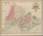
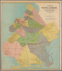
Map of Kings County N.Y.
use:
… partner (e.g.,
New
York
Map of the city of Brooklyn, …
use:
… partner (e.g.,
New
York
m
Map of Brooklyn and vicinity
use:
… partner (e.g.,
New
York
Map of the city of Brooklyn
use:
… partner (e.g.,
New
York
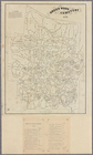
Map of the county of Kings, s…
use:
… partner (e.g.,
New
York
Map of the county of Kings, s…
use:
… partner (e.g.,
New
York
m
Fire Department map of the ci…
use:
… partner (e.g.,
New
York
m
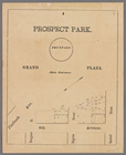
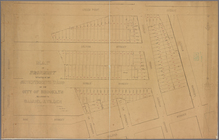
Prospect Park, plaza lots
use:
… partner (e.g.,
New
York
m
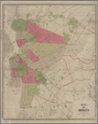
Map of the city of Brooklyn. …
use:
… partner (e.g.,
New
York
m
Brooklyn City Hall
use:
… partner (e.g.,
New
York
m
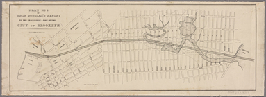
Plan No. 2 of Major Douglas's…
use:
… partner (e.g.,
New
York
m
Map showing the injury to the…
use:
… partner (e.g.,
New
York
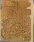
Greenwood cemetery [Legend on…
use:
… partner (e.g.,
New
York
m
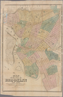
Map of the city of Brooklyn
use:
… partner (e.g.,
New
York
m
Map of the village of East
New
York
, Kings
use:
… partner (e.g.,
New
York
Map of Brooklyn and vicinity
use:
… partner (e.g.,
New
York
Map of the city of Brooklyn,
New
York
use:
… partner (e.g.,
New
York
Plan of the former township o…
use:
… partner (e.g.,
New
York
Brooklyn
use:
… partner (e.g.,
New
York
m
Map of the city of Brooklyn
use:
… partner (e.g.,
New
York
m
New
map of the city of Brooklyn
use:
… partner (e.g.,
New
York
m
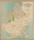
Map of Kings County: showing …
use:
… partner (e.g.,
New
York
Map of the homestead of the l…
use:
… partner (e.g.,
New
York
Plan exhibiting the system of…
use:
… partner (e.g.,
New
York
The
New
York
and Manhattan Beach R.R. and its
use:
… partner (e.g.,
New
York
New
map of Brooklyn including Kings Co.
use:
… partner (e.g.,
New
York
m
Map of Kings County, includin…
use:
… partner (e.g.,
New
York
m
Map of Coney Island and Sheep…
use:
… partner (e.g.,
New
York
m
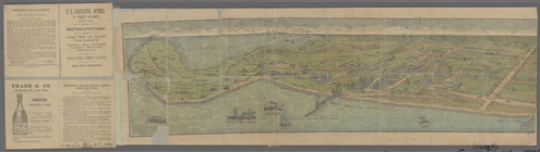
Birdseye view of Coney Island…
use:
… partner (e.g.,
New
York
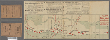
Taunton's map of Coney Island…
use:
… partner (e.g.,
New
York
New
map of Brooklyn and vicinity
use:
… partner (e.g.,
New
York
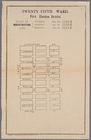
Twenty fifth ward, first elec…
use:
… partner (e.g.,
New
York
1
2
3
4
5
6
7
8
9
10
11
Previous
Next
1
2
3
4
5
6
7
8
9
10
11
Previous
Next