Click to visit the main New York Public Library Homepage
The New York Public Library
Digital Collections
About Digital Collections
Browse
Search only public domain materials
Items
Collections
Divisions
Home
Search
Browse
About
Search only public domain materials
Items
Collections
Divisions
Digital Collections
Using Images
Using Data
Collections
Charting America: Maps from the Lawrence H. Slaughter Collection and Others
Charting America: Maps from the Lawrence H. Slaughter Collection and Others
Navigation
Filters
Charting America: Maps from the Lawrence H. Slaughter Collection and Others
Previous
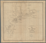
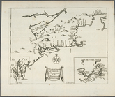
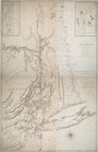
The south part of Virginia, now the north part of Carolina
0
Atlases, gazetteers, guidebooks and other books
377
Maps of the World
16
Maps of the Oceans
24
Maps of North and South America
23
Maps of North America.
551
Maps of New York City and State
1340
Lawrence H. Slaughter Collection of English maps, charts, globes, books and atlases
1020
John H. Levine Collection
60
More
Show filters
Hide filters
Show Only Public Domain
topic
Geography
79
Administrative and political divisions
58
Road maps
53
Nautical charts
31
Maps
30
More
Less
name
Moll, Herman, -1732
82
Tiebout, Cornelius, 1777-1832
54
Colles, Christopher, 1738-1816
53
Childe, Timothy
47
Falconer, Robert, active 1700
47
More
Less
collection
Lawrence H. Slaughter Collection of English maps, charts, globes, books and atlases
344
Maps of New York City and State
251
John H. Levine Collection
26
Maps of the World
4
Atlases, gazetteers, guidebooks and other books
3
More
Less
place
New York (N.Y.)
139
New York (State)
139
United States
137
Middle Atlantic States
98
Manhattan (New York, N.Y.) -- Maps
59
More
Less
genre
Maps
627
Title pages
4
Early works to 1800
2
Facsimiles
1
Posters
1
More
Less
publisher
Printed for Timothy Childe at the White Hart at the West-end of St. Paul's Church-yard
47
... Sold ... by Tho. Bowles, print and map-seller in St. Paul's-Churchyard
32
Printed for J. Stockdale
26
s.n
26
M. Carey
15
More
Less
division
Map Division
630
type
cartographic
617
text
19
still image
8
Date Range
to
632 results found for:
Middle Atlantic States?tab=filter
Sort by:
Relevance
Title
Date created
Date digitized
Sequence
Pas kaart van de zee kusten v…
note:
… of the
Middle
Atlantic
Seaboard.
Isothermal chart, or, View of…
note:
…. Woodbridge of the
state
Map of Virginia, Maryland and…
note:
… to Early Maps of the
Middle
Atlantic
Seaboard.
A map of New Jersey : from th…
note:
… to Early Maps of the
Middle
Atlantic
Seaboard.
Map of the
state
of New York
m
London surveyed or a new map …
note:
… to Early Maps of the
Middle
Atlantic
Seaboard.
… and
states
: also
note:
… to Early Maps of the
Middle
Atlantic
Seaboard.
Middle
part of Long Island Sound …
note:
…
States
; A.D. Bache
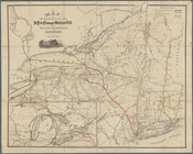
Map showing route of the New …
collection:
Maps of New York City and
State
Kaart van Nieuw Nederland: be…
note:
… Mid-
Atlantic
States
.
Map shewing the location of t…
note:
by Van R. Richmond,
State
Engr. & Surv.
m
The southern part of the Prov…
note:
… to Early Maps of the
Middle
Atlantic
Seaboard.
Carte de la Virginie et du Ma…
note:
The second
state
is described in Joshua Fry
Virginiae partis australis, e…
note:
Covers
Atlantic
Coast from Virginia
Virginia, Marylandia et Carol…
note:
… to Early Maps of the
Middle
Atlantic
Seaboard.
… independent
states
of North
note:
… of the
Middle
British Colonies
D'Engelze volkplanting in Vir…
note:
… to Early Maps of the
Middle
Atlantic
Seaboard.
…
States
of North America
note:
… to Early Maps of the
Middle
Atlantic
Seaboard.
A new and accurate chart (fro…
note:
… to Early Maps of the
Middle
Atlantic
Seaboard.
To the members of the Nautica…
note:
Covers
Atlantic
Coast of U.S. from New
A chart of the coast of Ameri…
note:
… to Early Maps of the
Middle
Atlantic
Seaboard.
Carte de la Louisiane et du c…
note:
… United
States
from the
Atlantic
Ocean and Hudson
The United
States
of North America
note:
… to Early Maps of the
Middle
Atlantic
Seaboard.
Carte nouvelle de l'Amerique …
note:
… to Early Maps of the
Middle
Atlantic
Seaboard.
Costes et rivieres de Virgini…
note:
… to Early Maps of the
Middle
Atlantic
Seaboard.
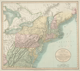
Map of the United
States
in North America : …
note:
… to Early Maps of the
Middle
Atlantic
Seaboard.
Vereinigte Staaten in Nord Am…
note:
… to Early Maps of the
Middle
Atlantic
Seaboard.
Carte du theatre de la guerre…
note:
… to Early Maps of the
Middle
Atlantic
Seaboard.
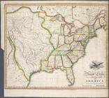
United
States
of America
note:
… to Early Maps of the
Middle
Atlantic
Seaboard.
A new map of part of the United
States
of North
note:
… to Early Maps of the
Middle
Atlantic
Seaboard.
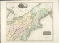
Northern provinces of the United
States
note:
… to Early Maps of the
Middle
Atlantic
Seaboard.
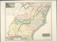
Southern provinces of the United
States
.
note:
… to Early Maps of the
Middle
Atlantic
Seaboard.
A Map of Carolana and of the …
note:
… to Early Maps of the
Middle
Atlantic
Seaboard.
m
Map of the
state
of New York
note:
… in the
state
of New York. 1 l.
A map of the
State
of New York
note:
… of the
state
."…
The country twenty five miles…
note:
… to Early Maps of the
Middle
Atlantic
Seaboard.
A plan of Fort Montgomery & F…
note:
From Des Barres'
Atlantic
neptune.
The provinces of New York, an…
note:
… to Early Maps of the
Middle
Atlantic
Seaboard.
A map of the Province of New …
note:
… to Early Maps of the
Middle
Atlantic
Seaboard.
A draught of New York and Per…
note:
… to Early Maps of the
Middle
Atlantic
Seaboard.
The provinces of New York, an…
note:
… to Early Maps of the
Middle
Atlantic
Seaboard.
[A chart of New York Island &…
note:
2nd
state
according to LC Maps of North
To His Excellency Sr. Henry M…
note:
First
state
--before addition of Faden
Mappa geographica Provinciae …
note:
… to Early Maps of the
Middle
Atlantic
Seaboard.
A map of the provinces of New…
note:
… to Early Maps of the
Middle
Atlantic
Seaboard.
… by the
states
of Virginia
note:
… to Early Maps of the
Middle
Atlantic
Seaboard.
… by the
states
of Virginia
note:
… to Early Maps of the
Middle
Atlantic
Seaboard.
…
States
of America : lat
note:
… to Early Maps of the
Middle
Atlantic
Seaboard.
… by the
states
of Virginia
note:
… to Early Maps of the
Middle
Atlantic
Seaboard.
United
States
of Nth. America = Carte
note:
… to Early Maps of the
Middle
Atlantic
Seaboard.
1
2
3
Previous
Next
1
2
3
Previous
Next