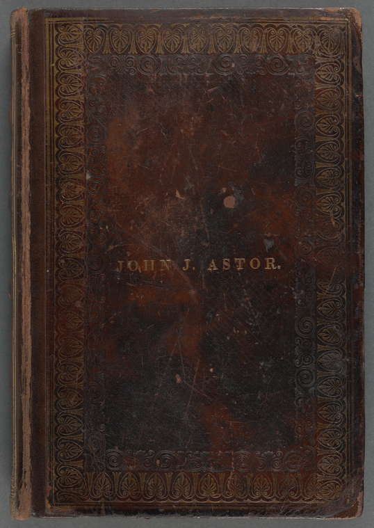
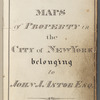
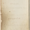
TitleMaps of property in the city of New York belonging to John J. Astor Esq.
NamesSmith, Geo. Wm.(George William), 1817-1876 (Creator)Smith, Geo. Wm.(George William), 1817-1876 (Cartographer)
Dates / OriginDate Created: 1840-1870s?Place: New York
Library locationsNo Division, NYPL item, but not associated with any one Division, e.g. NYPL Art WorkShelf locator: MssCol unassigned
TopicsAstor, John Jacob, 1763-1848 -- Homes and hauntsAstor family -- Homes and hauntsLandowners -- New York (State) -- New YorkReal property -- New York (State) -- New YorkManhattan (New York, N.Y.)New York (N.Y.)CartographersSurveyors
GenresCadastral mapsManuscript mapsMapsManuscripts
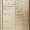
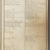
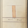
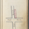
NotesStatement of responsibility: Drawn by Geo. Wm. Smith, city surveyor.Content: Foliation: I-IV (title, two-page street index, map of 277 Pearl Street), map leaves 1 to 154 (lacking leaves 130, 133, 136, 142 and 153.) Maps 56 and 147 are fold-out maps (38 x 22 cm. or smaller.) A few pages contain two maps. Numbered maps 62½, 83, and 150½, and some unnumbered maps, appear opposite numbered leaves. Several numbered leaves are blank.Content: Includes index.Content: Title from title page, dated February 1840.Additional physical form: Available as digital images.
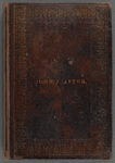
Physical DescriptionExtent: 1 volume (153 leaves) : color maps ; 24 x 16 cm
DescriptionThe volume, dated 1840-1870s?, contains manuscript cadastral maps of Manhattan properties owned by financier John Jacob Astor (1763-1848), drawn on paper by City Surveyor George W. Smith (1817-1876), with related real estate notes and street index. George W. Smith was the son of surveyor George B. Smith (1781-1857), estate agent for John Jacob Astor and his son William B. Astor (1792-1875). Maps were completed February 1840 as dated on the title page, with later revisions and possible additions. Real estate notations date from the 1840s through what is likely the 1870s, with lease terms expiring in the 1880s and 1890s. Street locations as indexed range from Lower Manhattan to 149th Street on the Upper West Side. Maps are drawn in pen-and-ink with color washes on the rectos of numbered leaves. These show blocks, property and lot lines, lot numbers and dimensions, and owner names for Astor family members. Notations as to disposal of property by family wills and gifts are also found there. Property rental details are recorded in pencil on pages facing the maps or on the maps themselves, typically noting the lot number, lessee, and lease terms. A few dated sales and purchases are included. The volume shows signs of heavy use, with many erasures and revisions as information was updated.
Type of ResourceTextCartographic
IdentifiersNYPL catalog ID (B-number): b23248316Universal Unique Identifier (UUID): 28d2e320-b973-013c-70ec-0242ac110005
Rights StatementThe New York Public Library believes that this item is in the public domain under the laws of the United States, but did not make a determination as to its copyright status under the copyright laws of other countries. This item may not be in the public domain under the laws of other countries. Though not required, if you want to credit us as the source, please use the following statement, "From The New York Public Library," and provide a link back to the item on our Digital Collections site. Doing so helps us track how our collection is used and helps justify freely releasing even more content in the future.
Item timeline of events
-
-
-
-
-
-