


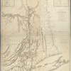
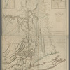
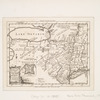
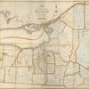
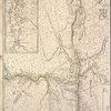
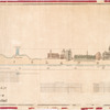
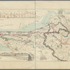
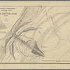
![Plate II. Sketches of villages of the Croton watershed: Westchester County, pt. A [showing sketches of: Bedford Station, Cross River, Katonah, and Mt. Kisco]](https://images.nypl.org/index.php?id=5652833&t=b)
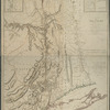
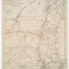
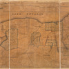
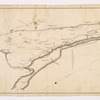
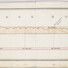
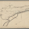
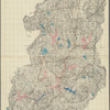
![Plate III : Sketches of villages of the Croton watershed: Westchester County, pt. B [showing sketches of: Somers, Golden's Bridge, Croton Falls, Purdys, South Salem, Salem Center, and North Salem]](https://images.nypl.org/index.php?id=5652834&t=b)
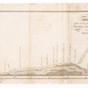
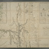
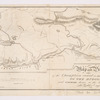
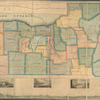
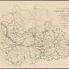
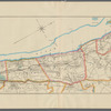
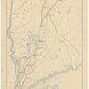
![Plate IV. Sketches of villages of the Croton watershed: Putnam County [showing sketches of: Patterson, Carmel, and Brewster]](https://images.nypl.org/index.php?id=5652835&t=b)
- The Library Shop
- Privacy Policy
- Rules and Regulations
- Using the Internet
- Website Terms and Conditions
- Gifts of Materials to NYPL
-
© The New York Public Library, 2024
The New York Public Library is a 501(c)(3) | EIN 13-1887440
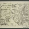
Lionel Pincus and Princess Firyal Map Division, The New York Public Library. "Aqueduct Commissioners topographical map of Croton Water Shed" The New York Public Library Digital Collections. 1895. https://digitalcollections.nypl.org/items/49c3eff0-b8b0-0133-f4f6-00505686a51c
Lionel Pincus and Princess Firyal Map Division, The New York Public Library. "Aqueduct Commissioners topographical map of Croton Water Shed" New York Public Library Digital Collections. Accessed April 28, 2024. https://digitalcollections.nypl.org/items/49c3eff0-b8b0-0133-f4f6-00505686a51c
Lionel Pincus and Princess Firyal Map Division, The New York Public Library. (1895). Aqueduct Commissioners topographical map of Croton Water Shed Retrieved from https://digitalcollections.nypl.org/items/49c3eff0-b8b0-0133-f4f6-00505686a51c
<ref name=NYPL>{{cite web | url=https://digitalcollections.nypl.org/items/49c3eff0-b8b0-0133-f4f6-00505686a51c | title=
(cartographic)
Aqueduct Commissioners topographical map of Croton Water Shed, (1895)
|author=Digital Collections, The New York Public Library |accessdate=April 28, 2024 |publisher=The New York Public Library, Astor, Lenox, and Tilden Foundations}}</ref>