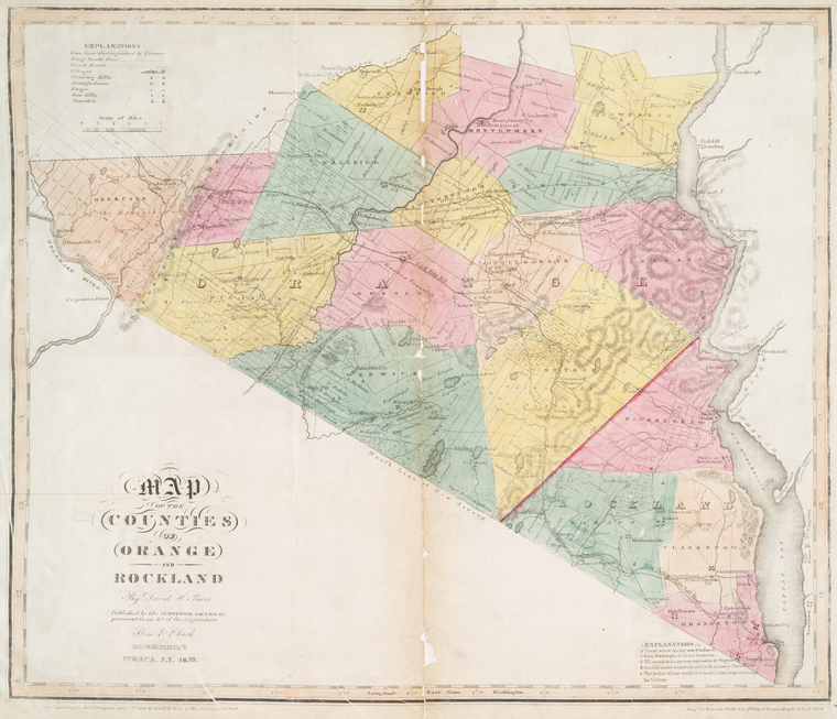
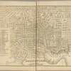
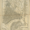
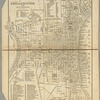
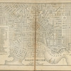
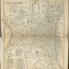
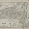
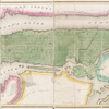
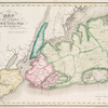
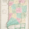
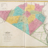
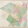
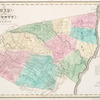
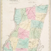
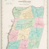
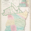
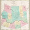
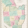
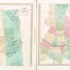
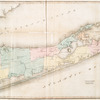
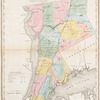
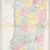
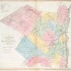
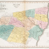
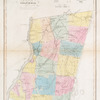
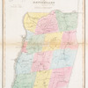
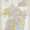
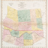
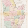
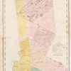
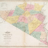
TitleMap of the counties of Orange and Rockland
NamesBurr, David H., 1803-1875 (Cartographer)De Witt, Simeon, 1756-1834 (Cartographer)Stone and Clark (Publisher)Rawdon, Clark & Co. (Engraver)Rawdon, Wright & Co. (Engraver)New York (State). Surveyor General (Publisher)
CollectionAtlases of the United States
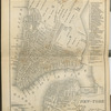
New York
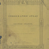
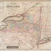
An atlas of the state of New York, designed for the use of engineers, containing a map of the state and of the several counties.
Dates / OriginDate Created: 1829 (Approximate)Date Issued: 1839Place: Ithaca, N.Y.Publisher: Stone and Clark
Library locationsLionel Pincus and Princess Firyal Map DivisionShelf locator: Map Div. +++ 02-230Shelf locator: Map Div. +++ 02-230 (No. 7)
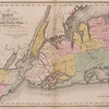
TopicsNew York (N.Y.)Landowners -- New York (State) -- Orange CountyLandowners -- New York (State) -- Rockland CountyOrange County (N.Y.) -- MapsReal property -- New York (State) -- Orange CountyReal property -- New York (State) -- Rockland CountyRockland County (N.Y.) -- Maps
GenresAtlasesMaps
NotesContent: National Endowment for the Humanities Grant for Access to Early Maps of the Middle Atlantic Seaboard.Content: Originally publ. in 1829 by David H. Burr, New York.Content: Republished with corrections and improvements.Content: Title vignette.Statement of responsibility: Projected and drawn ... under the superintendence and direction of Simeon de Witt.Date: Copyright date: 1829.Content: "Entered according to Act of Congress Jany 5th. 1829 by David H. Burr of the state of New York."Content: "Published by the Surveyor General, pursuant to an Act of the Legislature. Stone & Clark, republishers, Ithaca, N.Y."Content: Prime meridian: Washington, D.C.Content: Relief shown by hachures.Content: Shows flouring mills, factories, forges, saw mills, churches, and landowners.Statement of responsibility: by David H. Burr ; engd. by Rawdon, Clark & Co., Albany, & Rawdon, Wright & Co., N. York.
Physical DescriptionExtent: 1 map : hand col. ; 41 x 50 cm.
Type of ResourceCartographic
IdentifiersRLIN/OCLC: 13549415NYPL catalog ID (B-number): b13994137RLIN/OCLC: 48909105NYPL catalog ID (B-number): b15334440Universal Unique Identifier (UUID): b7da7720-c5ed-012f-171b-58d385a7bc34
Rights StatementThe New York Public Library believes that this item is in the public domain under the laws of the United States, but did not make a determination as to its copyright status under the copyright laws of other countries. This item may not be in the public domain under the laws of other countries. Though not required, if you want to credit us as the source, please use the following statement, "From The New York Public Library," and provide a link back to the item on our Digital Collections site. Doing so helps us track how our collection is used and helps justify freely releasing even more content in the future.
Item timeline of events
-
-
-
-
-
-