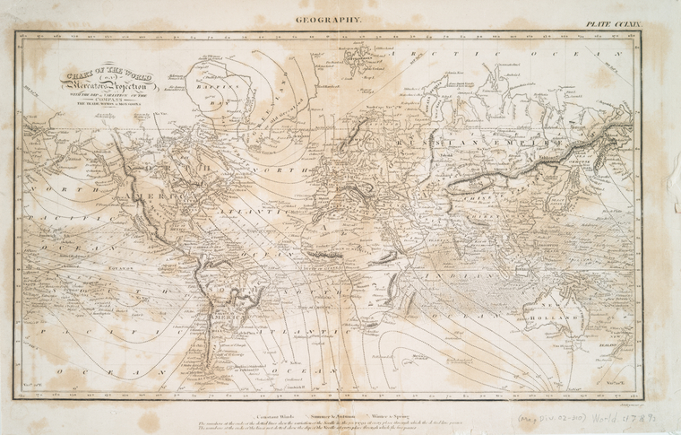


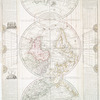
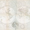
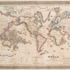
![No. 1: [This map shows the position of our continent as compared with Europe and Africa on one side, and Asia on the other, placing us in the centre]](https://images.nypl.org/index.php?id=465011&t=b)

- The Library Shop
- Privacy Policy
- Rules and Regulations
- Using the Internet
- Website Terms and Conditions
- Gifts of Materials to NYPL
-
© The New York Public Library, 2024
The New York Public Library is a 501(c)(3) | EIN 13-1887440
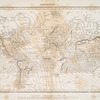
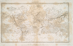
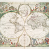
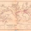
Lionel Pincus and Princess Firyal Map Division, The New York Public Library. "Chart of the world on Mercators projection : with the dip & variation of the compass, the trade winds & monsoons" The New York Public Library Digital Collections. 1794. https://digitalcollections.nypl.org/items/510d47db-afe9-a3d9-e040-e00a18064a99
Lionel Pincus and Princess Firyal Map Division, The New York Public Library. "Chart of the world on Mercators projection : with the dip & variation of the compass, the trade winds & monsoons" New York Public Library Digital Collections. Accessed April 28, 2024. https://digitalcollections.nypl.org/items/510d47db-afe9-a3d9-e040-e00a18064a99
Lionel Pincus and Princess Firyal Map Division, The New York Public Library. (1794). Chart of the world on Mercators projection : with the dip & variation of the compass, the trade winds & monsoons Retrieved from https://digitalcollections.nypl.org/items/510d47db-afe9-a3d9-e040-e00a18064a99
<ref name=NYPL>{{cite web | url=https://digitalcollections.nypl.org/items/510d47db-afe9-a3d9-e040-e00a18064a99 | title=
(cartographic)
Chart of the world on Mercators projection : with the dip & variation of the compass, the trade winds & monsoons, (1794)
|author=Digital Collections, The New York Public Library |accessdate=April 28, 2024 |publisher=The New York Public Library, Astor, Lenox, and Tilden Foundations}}</ref>