


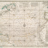
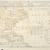
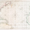
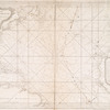
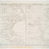

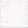
![Chart of the Atlantic Ocean : with an illustration of the character and rout[e] of a storm which occurred on the American coast in August 1830](https://images.nypl.org/index.php?id=465018&t=b)
- The Library Shop
- Privacy Policy
- Rules and Regulations
- Using the Internet
- Website Terms and Conditions
- Gifts of Materials to NYPL
-
© The New York Public Library, 2024
The New York Public Library is a 501(c)(3) | EIN 13-1887440
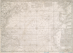
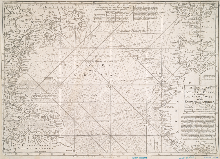
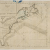
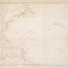
Lionel Pincus and Princess Firyal Map Division, The New York Public Library. "A new chart of the vast Atlantic Ocean : exhibiting the seat of war, both in Europe and America, likewise the trade winds & course of sailing from one continent to the other, with the banks, shoals and rocks drawn according to the latest discoveries, and regulated by astronomical observations" The New York Public Library Digital Collections. 1740. https://digitalcollections.nypl.org/items/510d47df-f4e1-a3d9-e040-e00a18064a99
Lionel Pincus and Princess Firyal Map Division, The New York Public Library. "A new chart of the vast Atlantic Ocean : exhibiting the seat of war, both in Europe and America, likewise the trade winds & course of sailing from one continent to the other, with the banks, shoals and rocks drawn according to the latest discoveries, and regulated by astronomical observations" New York Public Library Digital Collections. Accessed April 26, 2024. https://digitalcollections.nypl.org/items/510d47df-f4e1-a3d9-e040-e00a18064a99
Lionel Pincus and Princess Firyal Map Division, The New York Public Library. (1740). A new chart of the vast Atlantic Ocean : exhibiting the seat of war, both in Europe and America, likewise the trade winds & course of sailing from one continent to the other, with the banks, shoals and rocks drawn according to the latest discoveries, and regulated by astronomical observations Retrieved from https://digitalcollections.nypl.org/items/510d47df-f4e1-a3d9-e040-e00a18064a99
<ref name=NYPL>{{cite web | url=https://digitalcollections.nypl.org/items/510d47df-f4e1-a3d9-e040-e00a18064a99 | title=
(cartographic)
A new chart of the vast Atlantic Ocean : exhibiting the seat of war, both in Europe and America, likewise the trade winds & course of sailing from one continent to the other, with the banks, shoals and rocks drawn according to the latest discoveries, and regulated by astronomical observations, (1740)
|author=Digital Collections, The New York Public Library |accessdate=April 26, 2024 |publisher=The New York Public Library, Astor, Lenox, and Tilden Foundations}}</ref>