


- The Library Shop
- Privacy Policy
- Rules and Regulations
- Using the Internet
- Website Terms and Conditions
- Gifts of Materials to NYPL
-
© The New York Public Library, 2024
The New York Public Library is a 501(c)(3) | EIN 13-1887440
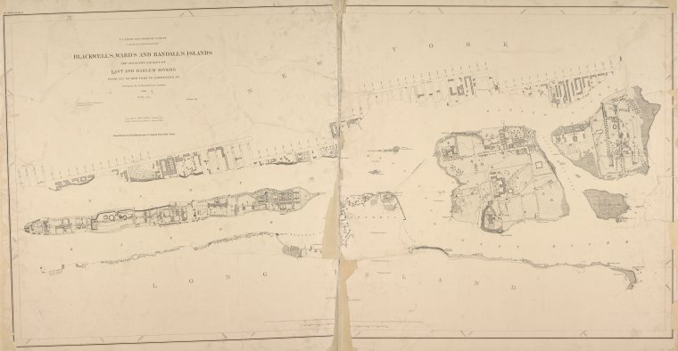
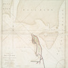
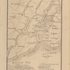
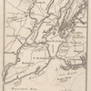
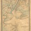
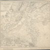
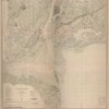
Lionel Pincus and Princess Firyal Map Division, The New York Public Library. "Blackwell's, Ward's and Randall's islands and adjacent shores of East and Harlem Rivers : from 51st St. New York to Lawrence's Pt." The New York Public Library Digital Collections. 1886. https://digitalcollections.nypl.org/items/65f48ef5-6483-04b0-e040-e00a1806391e
Lionel Pincus and Princess Firyal Map Division, The New York Public Library. "Blackwell's, Ward's and Randall's islands and adjacent shores of East and Harlem Rivers : from 51st St. New York to Lawrence's Pt." New York Public Library Digital Collections. Accessed May 10, 2024. https://digitalcollections.nypl.org/items/65f48ef5-6483-04b0-e040-e00a1806391e
Lionel Pincus and Princess Firyal Map Division, The New York Public Library. (1886). Blackwell's, Ward's and Randall's islands and adjacent shores of East and Harlem Rivers : from 51st St. New York to Lawrence's Pt. Retrieved from https://digitalcollections.nypl.org/items/65f48ef5-6483-04b0-e040-e00a1806391e
<ref name=NYPL>{{cite web | url=https://digitalcollections.nypl.org/items/65f48ef5-6483-04b0-e040-e00a1806391e | title=
(cartographic)
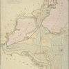
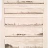
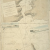
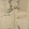
Blackwell's, Ward's and Randall's islands and adjacent shores of East and Harlem Rivers : from 51st St. New York to Lawrence's Pt., (1886)
|author=Digital Collections, The New York Public Library |accessdate=May 10, 2024 |publisher=The New York Public Library, Astor, Lenox, and Tilden Foundations}}</ref>