


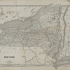

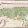

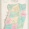
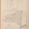
![New York State, Double Page Plate No. 2 [Map of the State of New York]](https://images.nypl.org/index.php?id=2056499&t=b)
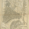
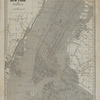
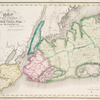
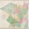
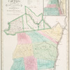
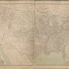
![New York State, Double Page Plate No. 3 [Map of the State of New York showing the location of the original Land Grants Patents and Purchases]](https://images.nypl.org/index.php?id=2056500&t=b)
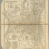
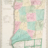
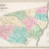
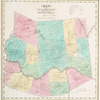
![New York State, Double Page Plate No. 5 [Statistics, United States, Statistics, New York State]](https://images.nypl.org/index.php?id=2056502&t=b)
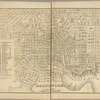
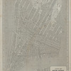
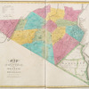
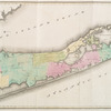
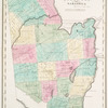
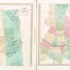
![New York State, Double Page Plate No. 6 [Map of New York Kings, Queens, Richmond, Rockland, Westchester, and Putnam Counties]](https://images.nypl.org/index.php?id=2056503&t=b)
- The Library Shop
- Privacy Policy
- Rules and Regulations
- Using the Internet
- Website Terms and Conditions
- Gifts of Materials to NYPL
-
© The New York Public Library, 2024
The New York Public Library is a 501(c)(3) | EIN 13-1887440
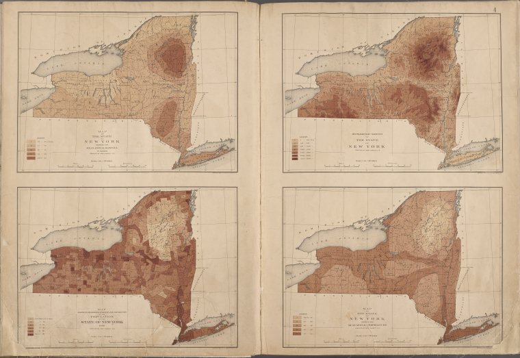
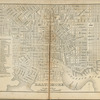
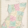
![New York State, Double Page Plate No. 4 [Map of the state of New York showing the mean annual rail fall, Map showing in six degrees of density, The distribution of the Papulation of the state of New York, 1890, Hypsometric sketch of the State of New York, Map of the State of New York showing the mean annual Temperature]](https://images.nypl.org/index.php?id=2056501&t=b)
Lionel Pincus and Princess Firyal Map Division, The New York Public Library. "New York State, Double Page Plate No. 4 [Map of the state of New York showing the mean annual rail fall, Map showing in six degrees of density, The distribution of the Papulation of the state of New York, 1890, Hypsometric sketch of the State of New York, Map of the State of New York showing the mean annual Temperature]" The New York Public Library Digital Collections. 1895. https://digitalcollections.nypl.org/items/a665f304-565e-941a-e040-e00a18060724
Lionel Pincus and Princess Firyal Map Division, The New York Public Library. "New York State, Double Page Plate No. 4 [Map of the state of New York showing the mean annual rail fall, Map showing in six degrees of density, The distribution of the Papulation of the state of New York, 1890, Hypsometric sketch of the State of New York, Map of the State of New York showing the mean annual Temperature]" New York Public Library Digital Collections. Accessed April 27, 2024. https://digitalcollections.nypl.org/items/a665f304-565e-941a-e040-e00a18060724
Lionel Pincus and Princess Firyal Map Division, The New York Public Library. (1895). New York State, Double Page Plate No. 4 [Map of the state of New York showing the mean annual rail fall, Map showing in six degrees of density, The distribution of the Papulation of the state of New York, 1890, Hypsometric sketch of the State of New York, Map of the State of New York showing the mean annual Temperature] Retrieved from https://digitalcollections.nypl.org/items/a665f304-565e-941a-e040-e00a18060724
<ref name=NYPL>{{cite web | url=https://digitalcollections.nypl.org/items/a665f304-565e-941a-e040-e00a18060724 | title=
(cartographic)
New York State, Double Page Plate No. 4 [Map of the state of New York showing the mean annual rail fall, Map showing in six degrees of density, The distribution of the Papulation of the state of New York, 1890, Hypsometric sketch of the State of New York, Map of the State of New York showing the mean annual Temperature], (1895)
|author=Digital Collections, The New York Public Library |accessdate=April 27, 2024 |publisher=The New York Public Library, Astor, Lenox, and Tilden Foundations}}</ref>
![New York State, Double Page Plate No. 4 [Map of the state of New York showing the mean annual rail fall, Map showing in six degrees of density, The distribution of the Papulation of the state of New York, 1890, Hypsometric sketch of the State of New York, Map of the State of New York showing the mean annual Temperature]](https://images.nypl.org/index.php?id=2056501&t=t)