


- The Library Shop
- Privacy Policy
- Rules and Regulations
- Using the Internet
- Website Terms and Conditions
- Gifts of Materials to NYPL
-
© The New York Public Library, 2024
The New York Public Library is a 501(c)(3) | EIN 13-1887440
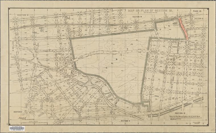
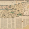
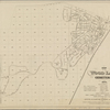
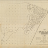
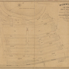
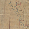
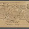
![Map or plan of section 10 [Crotona Park]](https://images.nypl.org/index.php?id=5082686&t=b)
Lionel Pincus and Princess Firyal Map Division, The New York Public Library. "Map or plan of section 10 [Crotona Park]" The New York Public Library Digital Collections. 1894. https://digitalcollections.nypl.org/items/ac50f5a0-f94a-0130-4897-58d385a7bbd0
Lionel Pincus and Princess Firyal Map Division, The New York Public Library. "Map or plan of section 10 [Crotona Park]" New York Public Library Digital Collections. Accessed April 27, 2024. https://digitalcollections.nypl.org/items/ac50f5a0-f94a-0130-4897-58d385a7bbd0
Lionel Pincus and Princess Firyal Map Division, The New York Public Library. (1894). Map or plan of section 10 [Crotona Park] Retrieved from https://digitalcollections.nypl.org/items/ac50f5a0-f94a-0130-4897-58d385a7bbd0
<ref name=NYPL>{{cite web | url=https://digitalcollections.nypl.org/items/ac50f5a0-f94a-0130-4897-58d385a7bbd0 | title=
(cartographic)
Map or plan of section 10 [Crotona Park], (1894)
|author=Digital Collections, The New York Public Library |accessdate=April 27, 2024 |publisher=The New York Public Library, Astor, Lenox, and Tilden Foundations}}</ref>
![Map or plan of section 10 [Crotona Park]](https://images.nypl.org/index.php?id=5082686&t=t)