Click to visit the main New York Public Library Homepage
The New York Public Library
Digital Collections
About Digital Collections
Browse
Search only public domain materials
Items
Collections
Divisions
Home
Search
Browse
About
Search only public domain materials
Items
Collections
Divisions
Digital Collections
Using Images
Using Data
Search
Keyword search
Show filters
Hide filters
Show Only Public Domain
topic
Description and travel
61
Nautical charts
39
Streets
34
Real property
23
History
20
More
Less
name
Ogilby, John (1600-1676)
58
Hubacher, Max Henry, 1900-1989
51
Long Island Rail Road
20
United States Coast Survey
20
Sperr, Percy Loomis, 1890-1964
19
More
Less
collection
Lawrence H. Slaughter Collection of English maps, charts, globes, books and atlases
79
Maps of North America
59
Africa: being an accurate description of the regions of Ægypt, Barbary, Lybia, and Billedulgerid, the land of Negroes, Guinee, Æthiopia, and the Abyssines, with all the adjacent islands ... collected and translated from most authentick authors ... by John Ogilby ..
58
Collection of photographs of New York City, New York State and more by Max Hubacher
51
Maps of New York City and State
48
More
Less
place
New York (N.Y.)
79
Brooklyn (New York, N.Y.)
78
Africa
59
Islands of the Atlantic
58
Islands of the Indian Ocean
58
More
Less
genre
Maps
247
Photographs
105
Prints
69
Illustrations
58
Stereographs
18
More
Less
publisher
s.n
14
U.S. Coast Survey
11
G. W. Bromley & Co
8
E. Belcher Hyde,
7
Printed for Robert Morden and Thomas Cockeril, at the Atlas in Cornhill, and at the Three Legs in the Poultrey, over against the Stocks-Market
6
More
Less
division
Map Division
240
Milstein Division
82
General Research Division
60
Wallach Division: Photography Collection
18
Wallach Division: Picture Collection
9
More
Less
type
cartographic
258
still image
163
text
6
moving image
1
Date Range
to
420 results found for:
Islands of the Atlantic
Sort by:
Relevance
Title
Date created
Date digitized
Sequence
…
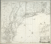
Island
& North River
note:
…
Atlantic
Seaboard.
… York
Island
& North
note:
… of Long
Island
from Eaton
m
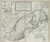
A chart of North and South Am…
note:
… and
islands
about Baffin
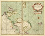
A chart of North and South Am…
note:
… with the countries and
islands
about
…
Island
to Port Royall.
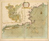
A chart of the coast of BARBA…
m
A chart of the harbour of Rhode
Island
… and Long
Island
from Cape
note:
…
Atlantic
Seaboard.
m
A cold morning after a snowfa…
abstract:
….
Atlantic
Avenue and Bond
A general map of the middle B…
note:
…
Atlantic
Seaboard.
A general map of the middle B…
note:
…
Atlantic
Seaboard.
… the sea coast and
Islands
… and Long
Island
; Boston
A map of East and West Florid…
note:
Corrected copy, "
Atlantic
Ocean
A map of New England, and Nov…
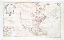
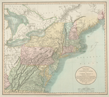
A map of North America : with…
note:
…
Atlantic
Seaboard.
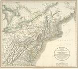
A map of North America with t…
note:
…
Atlantic
Seaboard.
A map of part of Rhode
Island
shewing
topic:
Rhode
Island
, Battle
of
, R.I., 1778
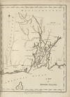
A map of Rhode
Island
.
note:
…
Atlantic
Seaboard.
…
islands
, 1794.
note:
…
Atlantic
Seaboard.
A map of that part of Pensylv…
note:
…
Atlantic
Seaboard.
…
Island
, & Long
Island
.
note:
…
Atlantic
Seaboard.
… of Connecticut and Rho[de
Islan
]d with pa[rt
of
] New-York
note:
Print contains insets:
Th[e
] city of New
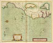
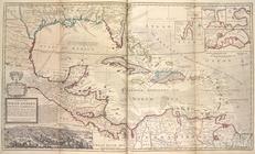
A map of the West-Indies or the
Islands
note:
…
Atlantic
Seaboard.
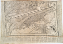
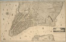
A new & accurate plan of the …
note:
Inset: A view of the city from Long
Island
.
… and
islands
within ye limits
note:
…
Atlantic
Seaboard.
m
… the shoals, channels,
islands
note:
…
Atlantic
Seaboard.
…, with their adjacent
islands
.
note:
Covers
Atlantic
Ocean between N 620
… with the West India
Islands
note:
… to the names of the
islands
… with the West India
Islands
note:
… & maps as an
island
.
… with the West India
Islands
:…
note:
…
Atlantic
Seaboard.
A new and exact map of the do…
note:
… Leeward
Islands
in America
m
A new and exact map of the do…
note:
… Leeward
Islands
in America
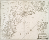
A new map of New England, New…
note:
… Jersey, Staten
Island
and part of Long
Island
]
A new map of New England, New…
note:
Covers Massachusetts, Rhode
Island
A new map of New England, New…
note:
Covers Massachusetts, Rhode
Island
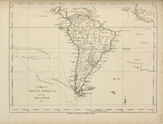
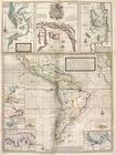
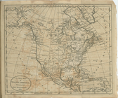
A new map of North America: w…
note:
… into the continent & the
islands
A new map of North America sh…
note:
…
Atlantic
Seaboard.
A new map of North America sh…
note:
Shows California as an
island
. …
… India
Islands
: divided
note:
…
Atlantic
Seaboard.
… India
Islands
: divided
note:
…
Atlantic
Seaboard.
… India
Islands
: divided
note:
…
Atlantic
Seaboard.
…, Connecticut, Rhode
Island
note:
…
Atlantic
Seaboard.
…, Connecticut, Rhode
Island
topic:
Middle
Atlantic
States
…, Connecticut, Rhode
Island
note:
…
Atlantic
Seaboard
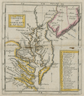
A new map of Virginia and Mar…
note:
…
Atlantic
Seaboard.
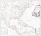
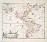
A new mapp of America: devid…
note:
…
Atlantic
Seaboard.
A new mapp of America Septent…
note:
…
Atlantic
Seaboard.
… the
islands
in the North Sea
note:
Also covers
Atlantic
coast of Virginia
…
Island
, part of Long
Island
&c : shewing
note:
…
Atlantic
Seaboard.
1
2
Previous
Next
1
2
Previous
Next