Click to visit the main New York Public Library Homepage
The New York Public Library
Digital Collections
About Digital Collections
Browse
Search only public domain materials
Items
Collections
Divisions
Home
Search
Browse
About
Search only public domain materials
Items
Collections
Divisions
Digital Collections
Using Images
Using Data
Search
Filtered search
Show filters
Hide filters
Show Only Public Domain
topic
Celestial charts
20
Constellations
20
Stars
20
Roads
16
Discovery and exploration
15
More
Less
name
Carey, Mathew, 1760-1839
69
Manning, Thomas S
44
Kruzenshtern, Ivan Fedorovich, 1770-1846
38
Bode, Johann Elert, 1747-1826
20
Jomard, M. (Edme-François), 1777-1862
19
More
Less
collection
Bancker plans
289
Maps of North America
51
Lawrence H. Slaughter Collection of English maps, charts, globes, books and atlases
49
Atlases, gazetteers, guidebooks and other books
44
Puteshestvie vokrug svieta v 1803, 4, 5 i 1806 godakh: po poveleniiu ego imperatorskago velichestva Aleksandra Pervago, nakorabliakh Nadezhde i Neve, pod nachalstvom... kapitana...Kruzenshterna
38
More
Less
place
United States
39
Egypt
24
Europe
23
Philadelphia (Pa.)
17
Switzerland
17
More
Less
genre
Maps
594
Surveys
289
land surveys
248
Prints
72
Documents
44
More
Less
publisher
M. Carey
59
V Morskoi Tipografii
38
Apud Autorem
20
Impr. impériale
19
Tip. Shnora
15
More
Less
division
Manuscripts and Archives Division
296
Map Division
188
General Research Division
43
Wallach Division: Art & Architecture Collection
38
Rare Book Division
21
More
Less
type
x
cartographic
text
46
still image
2
Date Range
to
600 results found
Filtering on:
x
Date
: 1801 - 1815
x
Type
: cartographic
Sort by:
Title
Date created
Date digitized
Sequence
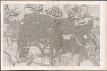
Plan of the town of Paramarib…
m
A New and Accurate Map of the…
Great Falls of Columbia River
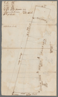
Plan of the town of York Haven
m
Carte d'une partie de l'Etat …
Map of the American Coast, fr…
Ancient Italy
Countries adjacent to the Med…
Environs du Kaire [Cairo]. Pl…
South Germany and Upper Italy…
France divided into one hundr…
m
Le Kaire: Plan particulier de…
m
United States of Nth. America
m
Map of the district of Maine,…
Plan of private claims in Mic…
m
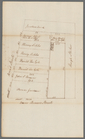
Hendrick's lot in Beaver Stre…
m
Beaver Street and Petticoat L…
m
Batavia Lane
m
Barclay, Robinson, Greenwich …
m
Bowery Lane
m
Bowery Lane between Stanton a…
m
Bowery Lane
m
Lots along Prince, Bowery and…
m
Plot on Bowery lane
m
Eight acres at Bloomingdale
m
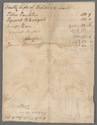
1801 December 21
m
John Hopper's at Bloomingdale
m
Bloomingdale
m
Bloomingdale - four mile stone
m
Bloomingdale Road to the Comm…
m
Augustus, Barley and George S…
m
Anthony Street
m
Lots near Amity Street, Broad…
m
Abbington and Fitzroy Roads
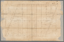
Plan of the siege of Charlest…
m
Pump, Eagle, Second, Third, F…
m
Pine Street from Pearl Street…
m
1810 January 8
m
1810 January 7
m
Ann and Nassau Streets
m
Between Lispenard and Leonard…
m
Kip's Bay
m
James Roosevelt at Harlem
m
Hellgate Road
m
Number 5 Hudson Street yard a…
m
Plan of a House at Number 5 H…
m
Hammond and Greenwich Street
m
Thomas B. Clark's ground at G…
m
Colonel Magregor's at Greenwi…
m
Greenwich Street between Dyes…
1
2
3
Previous
Next
1
2
3
Previous
Next