Click to visit the main New York Public Library Homepage
The New York Public Library
Digital Collections
About Digital Collections
Browse
Search only public domain materials
Items
Collections
Divisions
Home
Search
Browse
About
Search only public domain materials
Items
Collections
Divisions
Digital Collections
Using Images
Using Data
Search
Filtered search
Show filters
Hide filters
Show Only Public Domain
topic
Real property
1604
Administrative and political divisions
440
Business enterprises
395
Railroads
352
Landowners
321
More
Less
name
Beers, F. W. (Frederick W.)
534
Perris, William
308
United States Coast Survey
264
Everts, Ensign & Everts
231
Bache, A. D. (Alexander Dallas), 1806-1867
207
More
Less
collection
Atlases of the United States
1613
Maps of North America
1535
Maps of New York City and State
799
Atlases of New York City
734
Lawrence H. Slaughter Collection of English maps, charts, globes, books and atlases
110
More
Less
place
New York (State)
1925
New York
528
Manhattan (New York, N.Y.)
380
New York (N.Y.)
333
United States
274
More
Less
genre
Maps
4996
Atlases
1565
Cadastral maps
266
Nautical charts
187
Prints
182
More
Less
publisher
publisher not identified
227
William Perris
142
U.S. Coast Survey
133
Perris & Browne
124
Chapman and Hall
109
More
Less
division
Map Division
4762
General Research Division
83
George Arents Collection
51
Rare Book Division
35
Schomburg Jean Blackwell Hutson Research and Reference Division
18
More
Less
type
x
cartographic
still image
131
text
120
Date Range
to
5,126 results found
Filtering on:
x
Date
: 1842 - 1879
x
Type
: cartographic
Sort by:
Title
Date created
Date digitized
Sequence
Results 251 - 300
Johnson's Georgetown and the …
Portion of the Military depar…
Water shed of the Passaic Riv…
Colton's Georgetown and the c…
Topographical map of that por…
Phelps's national map of the …
m
A new map of the western rive…
Plan of Public Garden: showin…
Back Bay and Parker Hill park…
Plan of burnt district (by fi…
Plan of real estate at Harris…
Map of the water region: adja…
Plan of main ship channel in …
No. III, changes in the bed o…
Sketch of the Battle of Bunke…
Skeleton map of the overland …
Plan showing the redoubt, bre…
Map of Boston for 1878: Publi…
Plan of Charles River and War…
Plan of land on West Chester …
Map of Boston and the country…
Map of New England, with adja…
Map showing the New York and …
Map of Massachusetts, Vermont…
The northern route from Bosto…
Map showing route of marches …
Plan of extension of Devonshi…
Plan of extension of Devonshi…
Boston with Charlestown and R…
No. I, changes in the bed of …
Plan of South Bay: showing ch…
Map of the frontiers of the n…
Map of Boston and vicinity: e…
Plan for the occupation of th…
Map of free states, slave sta…
Map--S'emka Bolgarii mezhdu R…
S'emka Bolgarii mezhdu R. R. …
Geognosticheskaia karta bereg…
Karta rasprostraneniia dreves…
Plan chasti goroda Aiguna
Plan Albazinskago ukrepleniia…
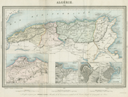
Algerie
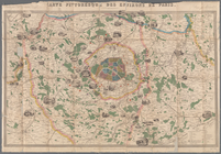
Carte pittoresque des environ…
Map of the port & vicinity of…
A chart of the world : exhibi…
New and improved map of the c…
McClung's map of Minnesota : …
State of Minnesota
Map of a part of the Village …
Plan of the city of Philadelp…
1
2
3
4
5
6
7
8
9
10
…
20
21
Previous
Next
1
2
3
4
5
6
7
8
9
10
…
20
21
Previous
Next